Enable Location

We need your location to show you interesting places around you

Discover nearby places

Find interesting locations and hidden gems around you

Precise directions

Get accurate directions and distances to places

Your location is never shared with other users. It's only used when you tap the location button.

Katima Mulilo Bridge

Log in to your account

Start exploring — it's free

Trusted by 63,084 travelers worldwide

Continue with Google
Continue with Apple
or

We will send you a code to connect

By continuing, you accept our Terms and Conditions and our Privacy Policy

Check your inbox

We've sent a pincode in your inbox. Please enter the code below.

Katima Mulilo Bridge
Discussion Reviews 1 Photos
5k Popularity

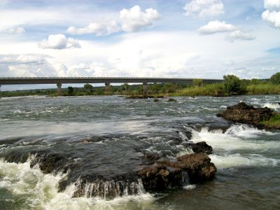
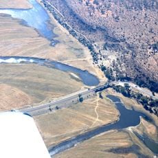
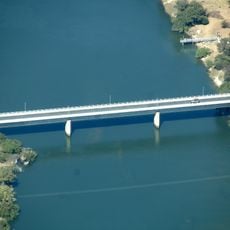
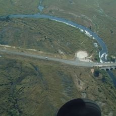
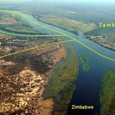
Katima Mulilo Bridge, International road bridge across Zambezi River between Katima Mulilo, Namibia and Sesheke, Zambia.

Katima Mulilo Bridge is an international road crossing over the Zambezi between Katima Mulilo in Namibia and Sesheke in Zambia. The structure spans approximately 900 meters across 19 sections, carrying both vehicle and foot traffic along the Trans-Caprivi Highway that connects the two countries.

Construction started in 2002 following decades of delays caused by political tensions, with the opening ceremony held on May 13, 2004 under Presidents Nujoma and Mwanawasa. The project finally resolved a long-standing barrier to regional connectivity between the two nations.

The structure links communities across the Zambezi, fostering interaction between residents on the Namibian and Zambian sides who share trade routes and family ties. Daily traffic shows how people use this crossing to maintain connections that would otherwise be broken by the river.

The crossing accommodates both vehicles and pedestrians, linking Namibia's Walvis Bay port to Zambia's mining regions and broader central African trade routes. You should be prepared for border formalities at both ends and have your travel documents ready for inspection.

The entire structure was built on Zambian territory to secure international funding, as Namibia's economic standing would have required repayment of development loans. This uncommon placement reveals how financial constraints shape the actual location of cross-border infrastructure.

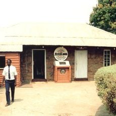
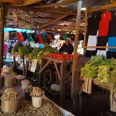
The community of curious travelers

AroundUs brings together thousands of curated places, local tips, and hidden gems, enriched daily by 60,000 contributors worldwide.

Start exploring
Inception
April 13, 2004
Part of
Namibia–Zambia border
GPS coordinates
-17.47208,24.24928
Latest update
December 10, 2025 20:00
Reviews
Share your experience

No review yet

Discussions
Start a discussion...

No discussion yet

« Katima Mulilo Bridge - International road bridge across Zambezi River between Katima Mulilo, Namibia and Sesheke, Zambia » is provided by Around Us (aroundus.com). Images and texts are derived from Wikimedia project under a Creative Commons license. You are allowed to copy, distribute, and modify copies of this page, under the conditions set by the license, as long as this note is clearly visible.

Discover hidden gems everywhere you go!

From secret cafés to breathtaking viewpoints, skip the crowded tourist spots and find places that match your style. Our app makes it easy with voice search, smart filtering, route optimization, and insider tips from travelers worldwide. Download now for the complete mobile experience.

Around Us App Screenshot

A unique approach to discovering new places

Le Figaro

All the places worth exploring

France Info

A tailor-made excursion in just a few clicks

20 Minutes

Around Us
Travel Guide & Maps
Download

Send to your phone

QR Code
1

Open the camera app on your mobile.

2

Point at the QR code with your camera. A notification will appear.

3

Tap the notification to open the link.