
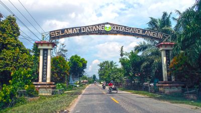
Sarolangun, district in Sarolangun Regency, Jambi Province, Indonesia
Location: Sarolangun
Elevation above the sea: 43 m
GPS coordinates: -2.32472,102.71972
Latest update: March 9, 2025 07:32

Mount Kerinci
176.3 km
Dempo
193.6 km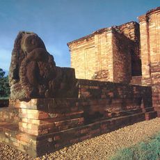
Muaro Jambi Temple Compounds
138.8 km
Kerinci Seblat National Park
137.9 km
Fort Marlborough
171 km
Bung Karno Seclusion House
171.9 km
Tropical Rainforest Heritage of Sumatra
137.1 km
Prasasti Karang Berahi
40.5 km
Bukit Tigapuluh National Park
149.5 km
Mount Kaba
133.5 km
Fatmawati's house
171.3 km
Bukit Duabelas National Park
53.4 km
Sembilang National Park
206.5 km
Gunung Masurai
91.4 km
Gentala Arasy Tower Museum
129.2 km
Thomas Parr Monument
171.1 km
Telun Berasap Falls
169.1 km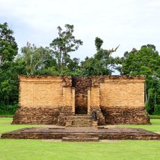
Candi Gumpung
141.5 km
Mount Kunyit
137.7 km
Serasan Sekate Stadium
139.2 km
Mount Tujuh
160.8 km
Belirang-Beriti
81.9 km
Ikhsaniyyah Mosque
128.1 km
Akbar At-Taqwa Grand Mosque
172 km
Mande Rubiah Museum
177.4 km
Masjid Tua Siguntur
199.3 km
Maung
199.9 km
Masjid Tuo Sitiung
191.4 kmReviews
Visited this place? Tap the stars to rate it and share your experience / photos with the community! Try now! You can cancel it anytime.
Discover hidden gems everywhere you go!
From secret cafés to breathtaking viewpoints, skip the crowded tourist spots and find places that match your style. Our app makes it easy with voice search, smart filtering, route optimization, and insider tips from travelers worldwide. Download now for the complete mobile experience.

A unique approach to discovering new places❞
— Le Figaro
All the places worth exploring❞
— France Info
A tailor-made excursion in just a few clicks❞
— 20 Minutes