Chest opened
+${chestReward.xp} XP
Explorer
NOUVEAU ×${chestReward.collectible.quantity}
tapez pour fermer
Chest locked

Open chests in the app

Around Us is built for your phone — chests unlock when you walk, explore and capture nearby places.

Enable Location

We need your location to show you interesting places around you

Discover nearby places

Find interesting locations and hidden gems around you

Precise directions

Get accurate directions and distances to places

Your location is never shared with other users. It's only used when you tap the location button.

Jabiru

Log in to your account

Start exploring — it's free

Trusted by 72,879 travelers worldwide

Continue with Google
Continue with Apple
or

We will send you a code to connect

By continuing, you accept our Terms and Conditions and our Privacy Policy

Check your inbox

We've sent a pincode in your inbox. Please enter the code below.

Discussion Reviews 1 Photos
17.3k Popularity

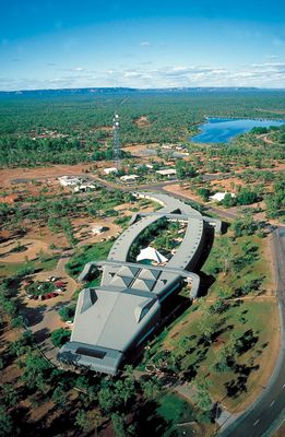
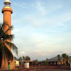
Jabiru, Administrative division in West Arnhem Region, Australia.

Jabiru is an administrative division in West Arnhem Region that covers a large area of Northern Territory with multiple Aboriginal communities scattered throughout. The area is managed by the West Arnhem Regional Council, which provides services and oversees infrastructure for settlements across these landscapes.

This administrative structure came into being in the early 1980s following the opening of the Ranger Uranium Mine, which required organized governance across the region. The mining development became a driving force behind the formation of regional administration and local infrastructure.

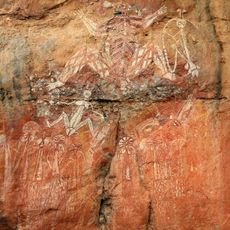
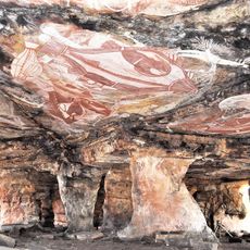
The administration works closely with Aboriginal communities to ensure their voices shape decisions that affect the region. This cooperation appears in how services and infrastructure projects are planned to respect local knowledge and traditions.

The region is spread out over a large distance, so traveling between communities requires planning and understanding of available routes. Visitors should check conditions and prepare for travel across rural areas before visiting remote settlements.

The administrative system links several isolated communities such as Gunbalanya, Maningrida, Minjilang, and Warruwi into a coordinated network. This arrangement allows these distant settlements to share resources and services despite being separated by large expanses of land.

The community of curious travelers

AroundUs brings together thousands of curated places, local tips, and hidden gems, enriched daily by 60,000 contributors worldwide.

Start exploring
GPS coordinates
-12.67383,132.83659
Latest update
December 7, 2025 19:25
Reviews
Share your experience

No review yet

Discussions
Start a discussion...

No discussion yet

« Jabiru - Administrative division in West Arnhem Region, Australia » is provided by Around Us (aroundus.com). Images and texts are derived from Wikimedia project under a Creative Commons license. You are allowed to copy, distribute, and modify copies of this page, under the conditions set by the license, as long as this note is clearly visible.

Discover hidden gems everywhere you go!

From secret cafés to breathtaking viewpoints, skip the crowded tourist spots and find places that match your style. Our app makes it easy with voice search, smart filtering, route optimization, and insider tips from travelers worldwide. Download now for the complete mobile experience.

Around Us App Screenshot

A unique approach to discovering new places

Le Figaro

All the places worth exploring

France Info

A tailor-made excursion in just a few clicks

20 Minutes

Around Us
Travel Guide & Maps
Download

Send to your phone

QR Code
1

Open the camera app on your mobile.

2

Point at the QR code with your camera. A notification will appear.

3

Tap the notification to open the link.