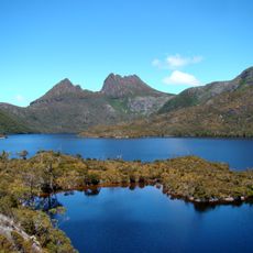
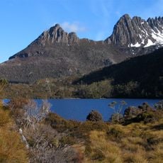
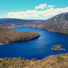
Dove Lake, Alpine lake in Cradle Mountain National Park, Tasmania, Australia
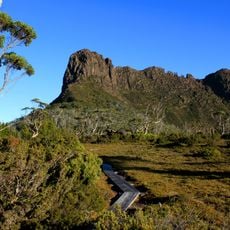
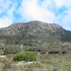
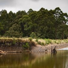
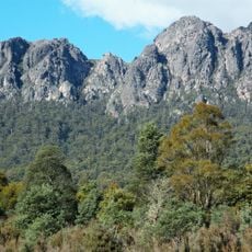
Dove Lake is an oval-shaped alpine water body in Cradle Mountain National Park, positioned at roughly 1200 meters elevation and ringed by rocky peaks. The water mirrors the surrounding mountains and covers an area of about 86 hectares.
The alpine water body was named during colonial times when Gustav Weindorfer explored the region while connected to the Van Diemen's Land Company. Its formation traces back to glacial movements from earlier geological periods.
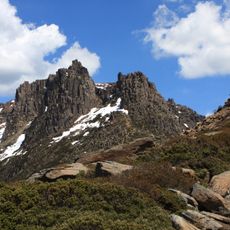
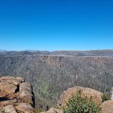
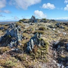
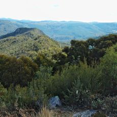
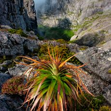
The walking path crosses through different Tasmanian plant communities, from swamp grass to ancient King Billy pines that shape the landscape. These species represent the natural zone typical of mountainous areas at this elevation.
A loop track around the water body covers about 6 kilometers and typically takes 2 to 3 hours, with a parking area and shelter at the starting point. The path crosses varied terrain, so sturdy footwear is recommended.
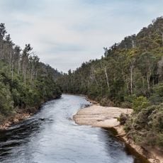
The water body reaches depths of about 157 meters, making it one of the deepest natural lakes in Tasmania. The Dove River plays a key role in maintaining its water level and demonstrates how natural systems work together.
Location: Tasmania
Elevation above the sea: 1,223 m
Address: Dove Lake, Cradle Mountain TAS 7306, Australia
GPS coordinates: -41.65806,145.96194
Latest update: December 6, 2025 17:40
Tasmania draws visitors who want to experience both raw nature and deep history. This Australian island rewards exploration at every turn: gorges sculpted by water, beaches with white sand, mountains that rise into the clouds, and forests that look ancient and untouched. Mountain lakes and rivers...
Cradle Mountain
3.1 km
Mount Ossa
24.4 km
Cradle-Mountain-Lake-St.-Clair-Nationalpark
23.3 km
Walls of Jerusalem National Park
34 km
Mount Roland Conservation Area
35 km
Mount Pelion West
19.4 km
Mole Creek Karst National Park
30.8 km
Mount Pelion East
23.8 km
The Acropolis
31.9 km
Cathedral Mountain
28.3 km
Gunns Plains Cave
40.5 km
Devils@cradle
8 km
Ironstone Mountain
43.2 km
Artillery Knob
2 km
Devil Gullets Lookout
30.1 km
Wee Georgie Wood Steam Railway
29.2 km
Mount Ramsay
43.1 km
Butlers Beach
35.8 km
Brewery Knob
4.3 km
Round Mountain lookout
25.7 km
Old bluestone reservoir
41.1 km
Mount Roland
33.5 km
Drainage adit
28.8 km
Waratah Museum
43.1 km
Mount Murchison Regional Reserve
33.1 km
Forth River, Tasmania
25.4 km
Sheffield church, Tasmania
43.3 km
Waratah Falls
43.5 kmVisited this place? Tap the stars to rate it and share your experience / photos with the community! Try now! You can cancel it anytime.
Discover hidden gems everywhere you go!
From secret cafés to breathtaking viewpoints, skip the crowded tourist spots and find places that match your style. Our app makes it easy with voice search, smart filtering, route optimization, and insider tips from travelers worldwide. Download now for the complete mobile experience.
A unique approach to discovering new places❞
— Le Figaro
All the places worth exploring❞
— France Info
A tailor-made excursion in just a few clicks❞
— 20 Minutes