Chest opened
+${chestReward.xp} XP
Explorer
NOUVEAU ×${chestReward.collectible.quantity}
tapez pour fermer

See the monuments around you in AR Open chests in the app

Around Us is built for your phone — point your camera at the streets and discover the monuments and places around you in augmented reality. Around Us is built for your phone — chests unlock when you walk, explore and capture nearby places.

•

Enable Location

We need your location to show you interesting places around you

Discover nearby places

Find interesting locations and hidden gems around you

Precise directions

Get accurate directions and distances to places

Your location is never shared with other users. It's only used when you tap the location button.

Hefferan Park Air Raid Shelter

Log in to your account

Start exploring — it's free

Trusted by 93,026 travelers worldwide

Continue with Google
Continue with Apple
or

We will send you a code to connect

By continuing, you accept our Terms and Conditions and our Privacy Policy

Check your inbox

We've sent a pincode in your inbox. Please enter the code below.

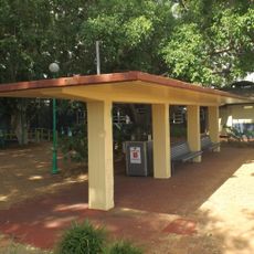
Hefferan Park Air Raid Shelter, World War II air raid shelter in Annerley, Australia.

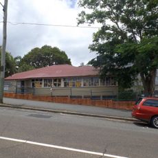
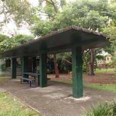
Hefferan Park Air Raid Shelter is a rectangular concrete structure at 260 Annerley Road with a flat green roof, red and white painted piers, and diagonal patterned flooring. The building sits next to a playground beneath fig trees and maintains its original structural form.

The structure was built in 1942 by Brisbane City Council as part of 235 public protective structures during World War II against Japanese attacks on Australia. It formed part of the broad defense measures protecting the city and its residents.

Hefferan Park is named after William Vincent Hefferan, a Brisbane City Council alderman, on the suggestion of the Labor Party. Of the 235 public surface shelters built in Brisbane, only 21 survive and remain in council ownership, this being one of them.

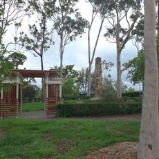
The structure is easily accessible in a public park and can be viewed at any time. The setting offers plenty of space for exploring and photography, especially since the park is equipped with trees and a recreation area.

Of the 235 public surface shelters Brisbane City Council built, only 21 survive and remain council-owned; this is one of them. The programme was ordered by Premier William Forgan Smith in the Protection of Persons and Property Order No.1, gazetted on 23 December 1941, and was about 90% complete by June 1942.

The community of curious travelers

AroundUs brings together thousands of curated places, local tips, and hidden gems, enriched daily by 93,026 contributors worldwide.

Start exploring
Location
GPS coordinates
-27.50040,153.02900
Latest update
October 25, 2026 05:33
Reviews
Share your experience

No review yet

Discussions
Start a discussion...

No discussion yet

« Hefferan Park Air Raid Shelter - World War II air raid shelter in Annerley, Australia » is provided by Around Us (aroundus.com). Images and texts are derived from Wikimedia project under a Creative Commons license. You are allowed to copy, distribute, and modify copies of this page, under the conditions set by the license, as long as this note is clearly visible.

Discover hidden gems everywhere you go!

From secret cafés to breathtaking viewpoints, skip the crowded tourist spots and find places that match your style. Our app makes it easy with voice search, smart filtering, route optimization, and insider tips from travelers worldwide. Download now for the complete mobile experience.
Around Us App Screenshot
❝

A unique approach to discovering new places❞

— Le Figaro

❝

All the places worth exploring❞

— France Info

❝

A tailor-made excursion in just a few clicks❞

— 20 Minutes

Around Us
Travel Guide & Maps
Download

Send to your phone

QR Code
1

Open the camera app on your mobile.

2

Point at the QR code with your camera. A notification will appear.

3

Tap the notification to open the link.