Chest opened
+${chestReward.xp} XP
Explorer
NOUVEAU ×${chestReward.collectible.quantity}
tapez pour fermer

See the monuments around you in AR Open chests in the app

Around Us is built for your phone — point your camera at the streets and discover the monuments and places around you in augmented reality. Around Us is built for your phone — chests unlock when you walk, explore and capture nearby places.

•

Enable Location

We need your location to show you interesting places around you

Discover nearby places

Find interesting locations and hidden gems around you

Precise directions

Get accurate directions and distances to places

Your location is never shared with other users. It's only used when you tap the location button.

Maro Reef

Log in to your account

Start exploring — it's free

Trusted by 92,380 travelers worldwide

Continue with Google
Continue with Apple
or

We will send you a code to connect

By continuing, you accept our Terms and Conditions and our Privacy Policy

Check your inbox

We've sent a pincode in your inbox. Please enter the code below.

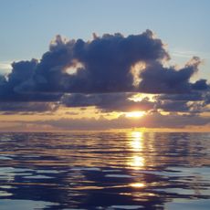
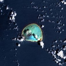
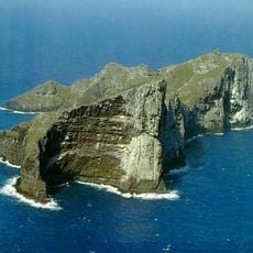
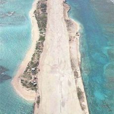
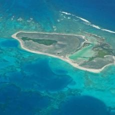
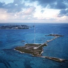
Maro Reef, Coral reef in Northwestern Hawaiian Islands, United States

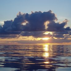
Maro Reef is a coral reef system in the Northwestern Hawaiian Islands that spreads outward from its center in a wheel-like formation. The structure creates an expansive underwater landscape that shifts in appearance depending on tidal conditions.

American Captain Joseph Allen discovered this reef formation in 1820 while commanding a vessel named Maro across the Pacific Ocean. The reef took its name from the ship that first charted it, linking the place to early maritime exploration.

The reef carries the Hawaiian name Nalukākala and holds significance in the traditional navigation and fishing practices of Native Hawaiians. Visitors can sense this cultural connection to ancestral maritime knowledge, even though the place remains untouched by settlement.

Access to this protected reef requires special scientific permits and authorization due to its conservation status. The location is remote and sits far from shore, making it inaccessible to most casual visitors.

The reef harbors multiple species of stony and soft corals that have established themselves in this remote ecosystem. At high tide, much of the visible reef structure becomes submerged beneath the ocean surface.

The community of curious travelers

AroundUs brings together thousands of curated places, local tips, and hidden gems, enriched daily by 92,380 contributors worldwide.

Start exploring
Location
Part of
Northwestern Hawaiian Islands
GPS coordinates
25.41667,-170.58333
Latest update
October 8, 2026 16:30
Around this place
Papahānaumokuākea Marine National Monument
United States of America

Papahānaumokuākea Marine National Monument

8927 mi
Papahānaumokuākea Marine National Monument
United States of America

Papahānaumokuākea Marine National Monument

74.4 mi
French Frigate Shoals
United States of America

French Frigate Shoals

298.8 mi
Kure Atoll
United States of America

Kure Atoll

520.9 mi
Nā Pali Coast State Park
United States of America

Nā Pali Coast State Park

726.6 mi
Kalalau Trail
United States of America

Kalalau Trail

728.5 mi
Nihoa
United States of America

Nihoa

570 mi
United States of America

Necker Island

391.6 mi
Tern Island
United States of America

Tern Island

290.7 mi
WWVH
United States of America

WWVH

724.9 mi
Pearl and Hermes Atoll
United States of America

Pearl and Hermes Atoll

365 mi
Polihale State Park
United States of America

Polihale State Park

722.7 mi
Kalalau Beach
United States of America

Kalalau Beach

726.6 mi
Midway Atoll National Wildlife Refuge
United States of America

Midway Atoll National Wildlife Refuge

461.8 mi
World War II Facilities at Midway
United States of America

World War II Facilities at Midway

459.9 mi
Koke'e State Park
United States of America

Koke'e State Park

728.5 mi
Civilian Conservation Corps Camp in Koke'e State Park
United States of America

Civilian Conservation Corps Camp in Koke'e State Park

727.4 mi
Camp Sloggett
United States of America

Camp Sloggett

728.1 mi
Tanager Peak
United States of America

Tanager Peak

570.3 mi
Nualolo Kai Beach
United States of America

Nualolo Kai Beach

724.4 mi
Sand Island
United States of America

Sand Island

603.8 mi
Kalaoa Beach
United States of America

Kalaoa Beach

706 mi
Kamalino Beach
United States of America

Kamalino Beach

700.1 mi
Puʻuwai Beach
United States of America

Puʻuwai Beach

700.6 mi
Honopu Beach
United States of America

Honopu Beach

726.2 mi
Miloliʻi Beach
United States of America

Miloliʻi Beach

723.6 mi
Keamano Beach
United States of America

Keamano Beach

705.7 mi
Sand Island Light
United States of America

Sand Island Light

461.7 mi
Show the full map
Reviews
Share your experience

No review yet

Discussions
Start a discussion...

No discussion yet

« Maro Reef - Coral reef in Northwestern Hawaiian Islands, United States » is provided by Around Us (aroundus.com). Images and texts are derived from Wikimedia project under a Creative Commons license. You are allowed to copy, distribute, and modify copies of this page, under the conditions set by the license, as long as this note is clearly visible.

Discover hidden gems everywhere you go!

From secret cafés to breathtaking viewpoints, skip the crowded tourist spots and find places that match your style. Our app makes it easy with voice search, smart filtering, route optimization, and insider tips from travelers worldwide. Download now for the complete mobile experience.
Around Us App Screenshot
❝

A unique approach to discovering new places❞

— Le Figaro

❝

All the places worth exploring❞

— France Info

❝

A tailor-made excursion in just a few clicks❞

— 20 Minutes

Around Us
Travel Guide & Maps
Download

Send to your phone

QR Code
1

Open the camera app on your mobile.

2

Point at the QR code with your camera. A notification will appear.

3

Tap the notification to open the link.