Enable Location

We need your location to show you interesting places around you

Discover nearby places

Find interesting locations and hidden gems around you

Precise directions

Get accurate directions and distances to places

Your location is never shared with other users. It's only used when you tap the location button.

Lānaihale

Log in to your account

Start exploring — it's free

Trusted by 62,178 travelers worldwide

Continue with Google
Continue with Apple
or

We will send you a code to connect

By continuing, you accept our Terms and Conditions and our Privacy Policy

Check your inbox

We've sent a pincode in your inbox. Please enter the code below.

Lānaihale

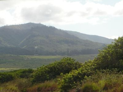
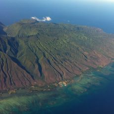
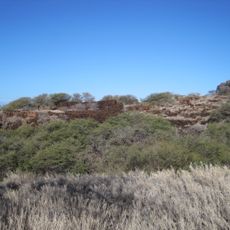
Lānaihale, Mountain summit in Maui County, United States.

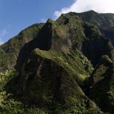
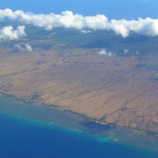
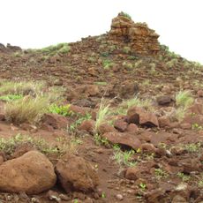
Lānaihale is the highest point on Lanai island, rising to about 1,030 meters (3,380 feet) above sea level. From the summit, visitors can look out toward neighboring Hawaiian islands and see across the surrounding landscape.

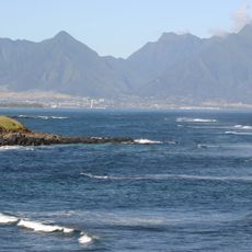
The mountain served early Polynesian sailors as an essential navigation landmark, with its distinctive shape helping them locate Lanai island during ocean voyages. This kind of navigation using notable landforms was crucial to early settlement patterns across the Pacific.

The mountain holds deep meaning for Native Hawaiian people and remains a place where traditional practices take place today. People come here to gather native plants that play a role in local healing practices.

The roads to the summit require four-wheel drive vehicles and can be challenging to navigate. Visitors should check weather conditions before attempting the climb, as conditions can shift quickly and visibility on the mountain can be limited.

The summit has its own microclimate where rare plant species grow that exist only at this elevation. These special conditions make it a notable spot for those interested in studying plants that thrive in few other places.

The community of curious travelers

AroundUs brings together thousands of curated places, local tips, and hidden gems, enriched daily by 60,000 contributors worldwide.

Start exploring
Location
Elevation above the sea
1,030 m
GPS coordinates
20.81221,-156.87317
Latest update
December 14, 2025 18:41
Around this place
Banyan tree in Lahaina
United States of America

Banyan tree in Lahaina

21.4 km
Iao Valley
United States of America

Iao Valley

35 km
United States of America

Sentry Tournament of Champions

32.5 km
Lahaina Lighthouse
United States of America

Lahaina Lighthouse

21.3 km
West Maui Mountains
United States of America

West Maui Mountains

30.9 km
Lahaina Banyan Court Park
United States of America

Lahaina Banyan Court Park

21.4 km
Kapalua Resort
United States of America

Kapalua Resort

31 km
Maui Ocean Center
United States of America

Maui Ocean Center

37.7 km
East Molokai Volcano
United States of America

East Molokai Volcano

33.3 km
King Kamehameha Golf Course Clubhouse
United States of America

King Kamehameha Golf Course Clubhouse

37 km
Kamakou
United States of America

Kamakou

32.8 km
Puu Kukui
United States of America

Puu Kukui

31.1 km
Bailey House Museum
United States of America

Bailey House Museum

39 km
Hawaiian Islands Humpback Whale National Marine Sanctuary
United States of America

Hawaiian Islands Humpback Whale National Marine Sanctuary

17.5 km
Mokuʻula
United States of America

Mokuʻula

21.5 km
Lahaina Historic District
United States of America

Lahaina Historic District

21.4 km
D.T. Fleming Beach
United States of America

D.T. Fleming Beach

31.5 km
Waiola Church
United States of America

Waiola Church

21.8 km
Slaughterhouse Beach
United States of America

Slaughterhouse Beach

32.7 km
Kaunolu Village Site
United States of America

Kaunolu Village Site

12.8 km
Chee Kung Tong Society Building
United States of America

Chee Kung Tong Society Building

39 km
Tropical Gardens of Maui
United States of America

Tropical Gardens of Maui

36.1 km
Pu'upehe Platform
United States of America

Pu'upehe Platform

8.9 km
Wailuku School
United States of America

Wailuku School

38.9 km
Dragon's Teeth, Maui
United States of America

Dragon's Teeth, Maui

31.4 km
St. Joseph's Church Kamalo, Hawaii
United States of America

St. Joseph's Church Kamalo, Hawaii

26.8 km
Our Lady of Seven Sorrows Catholic Church
United States of America

Our Lady of Seven Sorrows Catholic Church

29 km
Keahiakawelo
United States of America

Keahiakawelo

14.8 km
Show the full map
« Lānaihale - Mountain summit in Maui County, United States » is provided by Around Us (aroundus.com). Images and texts are derived from Wikimedia project under a Creative Commons license. You are allowed to copy, distribute, and modify copies of this page, under the conditions set by the license, as long as this note is clearly visible.

Discover hidden gems everywhere you go!

From secret cafés to breathtaking viewpoints, skip the crowded tourist spots and find places that match your style. Our app makes it easy with voice search, smart filtering, route optimization, and insider tips from travelers worldwide. Download now for the complete mobile experience.

Around Us App Screenshot

A unique approach to discovering new places

Le Figaro

All the places worth exploring

France Info

A tailor-made excursion in just a few clicks

20 Minutes

Around Us
Travel Guide & Maps
Download

Send to your phone

QR Code
1

Open the camera app on your mobile.

2

Point at the QR code with your camera. A notification will appear.

3

Tap the notification to open the link.