Chest opened
+${chestReward.xp} XP
Explorer
NOUVEAU ×${chestReward.collectible.quantity}
tapez pour fermer

See the monuments around you in AR Open chests in the app

Around Us is built for your phone — point your camera at the streets and discover the monuments and places around you in augmented reality. Around Us is built for your phone — chests unlock when you walk, explore and capture nearby places.

•

Enable Location

We need your location to show you interesting places around you

Discover nearby places

Find interesting locations and hidden gems around you

Precise directions

Get accurate directions and distances to places

Your location is never shared with other users. It's only used when you tap the location button.

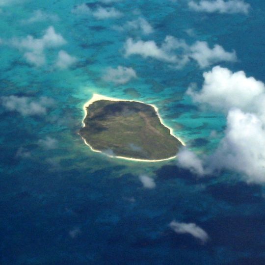
Lisianski Island

Log in to your account

Start exploring — it's free

Trusted by 90,835 travelers worldwide

Continue with Google
Continue with Apple
or

We will send you a code to connect

By continuing, you accept our Terms and Conditions and our Privacy Policy

Check your inbox

We've sent a pincode in your inbox. Please enter the code below.

Lisianski Island

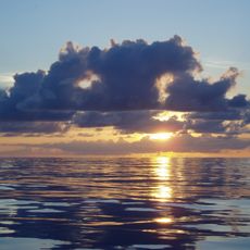
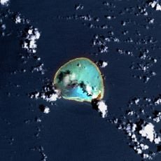
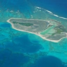
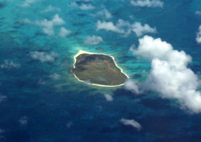
Lisianski Island, Pacific wildlife refuge in Northwestern Hawaiian Islands, United States

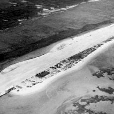
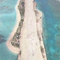
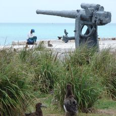
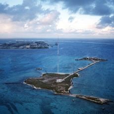
Lisianski Island is a flat landmass in the Northwestern Hawaiian Islands with a maximum elevation of about 40 feet above sea level. The terrain consists of sand and coral, and the island serves as a nesting and resting ground for sea turtles, seabirds, and monk seals.

The island was discovered in 1805 by Russian explorer Yuri Lisyansky during his Pacific voyage aboard the sloop Neva. It later became part of the Hawaiian Kingdom and remains an important wildlife sanctuary today.

King Kamehameha IV incorporated this territory into the Kingdom of Hawaii in 1857, marking its integration into Hawaiian sovereignty.

Access requires permits from the U.S. Fish and Wildlife Service due to its protected status as a wildlife refuge. Visits are limited to authorized tours or research expeditions, reached by helicopter or boat.

Beneath the sandy surface lie limestone formations that rest on an extinct shield volcano that last erupted roughly 20 million years ago. This geological layer reveals the ancient volcanic history underlying the Hawaiian island chain.

The community of curious travelers

AroundUs brings together thousands of curated places, local tips, and hidden gems, enriched daily by 90,835 contributors worldwide.
Start exploring
Location
Part of
Northwestern Hawaiian Islands
GPS coordinates
26.06417,-173.96556
Latest update
October 8, 2026 16:30
Around this place
Papahānaumokuākea Marine National Monument
United States of America

Papahānaumokuākea Marine National Monument

8879.3 mi
Papahānaumokuākea Marine National Monument
United States of America

Papahānaumokuākea Marine National Monument

141.2 mi
French Frigate Shoals
United States of America

French Frigate Shoals

512.6 mi
Kure Atoll
United States of America

Kure Atoll

314 mi
Nā Pali Coast State Park
United States of America

Nā Pali Coast State Park

942.6 mi
Kalalau Trail
United States of America

Kalalau Trail

943.8 mi
Nihoa
United States of America

Nihoa

785.3 mi
United States of America

Necker Island

606.5 mi
Tern Island
United States of America

Tern Island

504.9 mi
WWVH
United States of America

WWVH

939.9 mi
Pearl and Hermes Atoll
United States of America

Pearl and Hermes Atoll

167.1 mi
Polihale State Park
United States of America

Polihale State Park

938.2 mi
Kalalau Beach
United States of America

Kalalau Beach

941.8 mi
Midway Atoll National Wildlife Refuge
United States of America

Midway Atoll National Wildlife Refuge

257.6 mi
World War II Facilities at Midway
United States of America

World War II Facilities at Midway

255.4 mi
Koke'e State Park
United States of America

Koke'e State Park

943.7 mi
Civilian Conservation Corps Camp in Koke'e State Park
United States of America

Civilian Conservation Corps Camp in Koke'e State Park

942.5 mi
Camp Sloggett
United States of America

Camp Sloggett

943.2 mi
Tanager Peak
United States of America

Tanager Peak

785.6 mi
Nualolo Kai Beach
United States of America

Nualolo Kai Beach

939.6 mi
Sand Island
United States of America

Sand Island

705.3 mi
Kalaoa Beach
United States of America

Kalaoa Beach

920.7 mi
Kamalino Beach
United States of America

Kamalino Beach

914.7 mi
Puʻuwai Beach
United States of America

Puʻuwai Beach

915.4 mi
Honopu Beach
United States of America

Honopu Beach

941.4 mi
Miloliʻi Beach
United States of America

Miloliʻi Beach

938.7 mi
Keamano Beach
United States of America

Keamano Beach

920.5 mi
Sand Island Light
United States of America

Sand Island Light

257.2 mi
Show the full map
Reviews
Share your experience

No review yet

Discussions
Start a discussion...

No discussion yet

« Lisianski Island - Pacific wildlife refuge in Northwestern Hawaiian Islands, United States » is provided by Around Us (aroundus.com). Images and texts are derived from Wikimedia project under a Creative Commons license. You are allowed to copy, distribute, and modify copies of this page, under the conditions set by the license, as long as this note is clearly visible.

Discover hidden gems everywhere you go!

From secret cafés to breathtaking viewpoints, skip the crowded tourist spots and find places that match your style. Our app makes it easy with voice search, smart filtering, route optimization, and insider tips from travelers worldwide. Download now for the complete mobile experience.
Around Us App Screenshot
❝

A unique approach to discovering new places❞

— Le Figaro

❝

All the places worth exploring❞

— France Info

❝

A tailor-made excursion in just a few clicks❞

— 20 Minutes

Around Us
Travel Guide & Maps
Download

Send to your phone

QR Code
1

Open the camera app on your mobile.

2

Point at the QR code with your camera. A notification will appear.

3

Tap the notification to open the link.