Chest opened
+${chestReward.xp} XP
Explorer
NOUVEAU ×${chestReward.collectible.quantity}
tapez pour fermer
Chest locked

Open chests in the app

Around Us is built for your phone — chests unlock when you walk, explore and capture nearby places.

Enable Location

We need your location to show you interesting places around you

Discover nearby places

Find interesting locations and hidden gems around you

Precise directions

Get accurate directions and distances to places

Your location is never shared with other users. It's only used when you tap the location button.

Log in to your account

Start exploring — it's free

Trusted by 72,934 travelers worldwide

Continue with Google
Continue with Apple
or

We will send you a code to connect

By continuing, you accept our Terms and Conditions and our Privacy Policy

Check your inbox

We've sent a pincode in your inbox. Please enter the code below.

West Molokai Volcano
Discussion Reviews Photo
3.9k Popularity

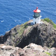
West Molokai Volcano, Shield volcano in Maui County, United States

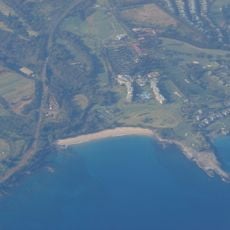
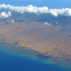
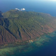
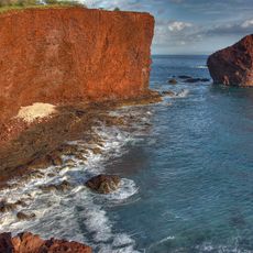
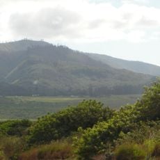
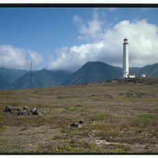
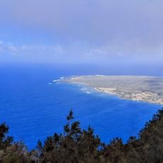
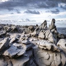
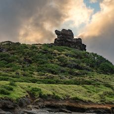
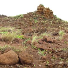
West Molokai Volcano forms the western portion of Molokai island, rising roughly 420 meters above sea level with the broad, gently sloping shape typical of shield volcanoes. The volcanic landscape dominates the terrain in this remote area of the Hawaiian archipelago.

The volcanic formation developed in two phases, with the first stage occurring roughly 1.9 million years ago. A second phase followed approximately 1.76 million years later, completing the structure of the volcano as it exists today.

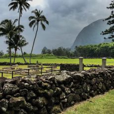
Native Hawaiian communities integrate the volcanic landscape into their traditional practices of navigation and environmental stewardship across the western Molokai region.

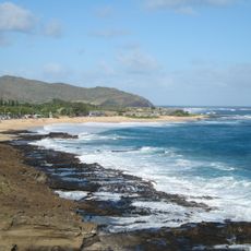
Reaching this remote location requires advance planning since transportation options are limited and guided tours must be arranged beforehand. Visit during drier months when conditions are more favorable for traveling across the rugged terrain.

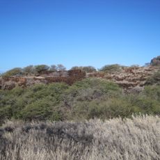
The volcano features multiple rift zones that create a v-shaped pattern across its western slope. A third zone extends toward the neighboring East Molokai Volcano, showing how the two volcanic structures relate to each other.

The community of curious travelers

AroundUs brings together thousands of curated places, local tips, and hidden gems, enriched daily by 60,000 contributors worldwide.

Start exploring
Location
Elevation above the sea
421 m
Part of
Hawaiian Islands
GPS coordinates
21.13000,-157.20000
Latest update
December 11, 2025 18:05
Around this place
Kapalua Resort
United States of America

Kapalua Resort

58.5 km
East Molokai Volcano
United States of America

East Molokai Volcano

37.4 km
Sandy Beach
United States of America

Sandy Beach

51.9 km
Kalaupapa Leprosy Settlement and National Historical Park
United States of America

Kalaupapa Leprosy Settlement and National Historical Park

25.5 km
Kamakou
United States of America

Kamakou

34.5 km
Koko Crater
United States of America

Koko Crater

53.1 km
Kauhakō Crater
United States of America

Kauhakō Crater

25.2 km
Hawaiian Islands Humpback Whale National Marine Sanctuary
United States of America

Hawaiian Islands Humpback Whale National Marine Sanctuary

49.6 km
Oloʻupena Falls
United States of America

Oloʻupena Falls

35.6 km
Koko Crater Botanical Garden
United States of America

Koko Crater Botanical Garden

52.9 km
Makapuu Point Light
United States of America

Makapuu Point Light

51.3 km
Kaunolu Village Site
United States of America

Kaunolu Village Site

50.4 km
Bellows Field Beach Park
United States of America

Bellows Field Beach Park

58.6 km
Pu'upehe Platform
United States of America

Pu'upehe Platform

54.6 km
Holy Trinity Catholic Church
United States of America

Holy Trinity Catholic Church

57.5 km
Lānaihale
United States of America

Lānaihale

49 km
Moloka'i Light
United States of America

Moloka'i Light

25.5 km
Kaulaupapa Lookout
United States of America

Kaulaupapa Lookout

20.9 km
Dragon's Teeth, Maui
United States of America

Dragon's Teeth, Maui

58.2 km
Pele's Chair
United States of America

Pele's Chair

50.7 km
Island Sound Studios
United States of America

Island Sound Studios

55.5 km
St. Joseph's Church Kamalo, Hawaii
United States of America

St. Joseph's Church Kamalo, Hawaii

35.1 km
St. Francis Catholic Church
United States of America

St. Francis Catholic Church

23.4 km
Our Lady of Seven Sorrows Catholic Church
United States of America

Our Lady of Seven Sorrows Catholic Church

40.4 km
Keahiakawelo
United States of America

Keahiakawelo

35 km
Makapuʻu Point Lighthouse Trail
United States of America

Makapuʻu Point Lighthouse Trail

50.8 km
Pāpōhaku Beach
United States of America

Pāpōhaku Beach

7.5 km
Makapuʻu Lookout
United States of America

Makapuʻu Lookout

51.4 km
Show the full map
Reviews
Share your experience

No review yet

Discussions
Start a discussion...

No discussion yet

« West Molokai Volcano - Shield volcano in Maui County, United States » is provided by Around Us (aroundus.com). Images and texts are derived from Wikimedia project under a Creative Commons license. You are allowed to copy, distribute, and modify copies of this page, under the conditions set by the license, as long as this note is clearly visible.

Discover hidden gems everywhere you go!

From secret cafés to breathtaking viewpoints, skip the crowded tourist spots and find places that match your style. Our app makes it easy with voice search, smart filtering, route optimization, and insider tips from travelers worldwide. Download now for the complete mobile experience.

Around Us App Screenshot

A unique approach to discovering new places

Le Figaro

All the places worth exploring

France Info

A tailor-made excursion in just a few clicks

20 Minutes

Around Us
Travel Guide & Maps
Download

Send to your phone

QR Code
1

Open the camera app on your mobile.

2

Point at the QR code with your camera. A notification will appear.

3

Tap the notification to open the link.