Kaulaupapa Lookout

Log in to your account

AroundUs is a community-driven map of interesting places, built by curious explorers like you. It grows with every review, story, and photo you share.
Connect to save your favorite spots, contribute locations, and create personalized routes.
Continue with Google
Continue with Apple
Continue with X
Continue with Facebook
Continue with email
By continuing, you accept our Terms and Conditions and our Privacy Policy
Create an account
Add to collection
Map
Suggest a change
Share

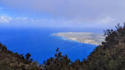
Kaulaupapa Lookout, Scenic overlook in Kalawao County, United States.

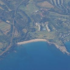
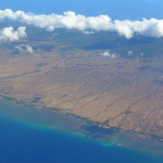
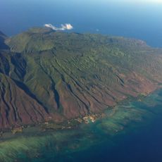
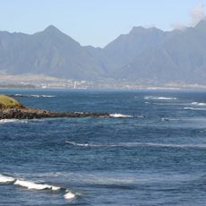
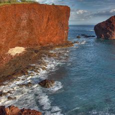
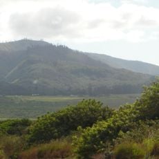
Kaulaupapa Lookout is a scenic viewpoint situated atop steep cliffs on Molokai island, with views extending across to the Kalaupapa Peninsula and the Pacific Ocean. The vantage point provides an unobstructed perspective of the landscape below, where the terrain drops sharply to the water.

The peninsula visible from this point was established as an isolation settlement in 1866 for people with Hansen's disease. The site housed thousands of patients over many decades until medical advances made the condition treatable and isolation unnecessary.

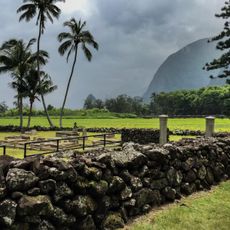
The peninsula below holds deep meaning for Native Hawaiians as a place of ancestral presence and sacred ground that has been honored for centuries. Visitors can sense this spiritual dimension when looking across the water toward the landscape below.

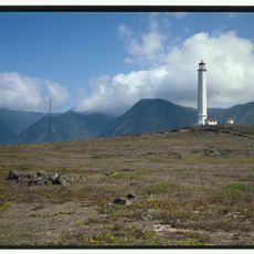
The viewpoint offers the clearest views during morning hours before afternoon clouds typically move in across the landscape. The site remains open and exposed, so bringing sun protection and sturdy footwear is advisable for a comfortable visit.

The view takes in three distinct districts of the peninsula below, each representing different chapters of the settlement's past. These divisions remain visible in how the landscape is organized from this vantage point.

Location: Kalawao County

Address: Pala'au State Park, Highway 47, Ho'olehua, HI 96729, USA

Opening Hours: Monday-Sunday 07:00-19:00

Phone: +18085870286

Website: http://dlnr.hawaii.gov

GPS coordinates: 21.17695,-157.00513

Latest update: December 14, 2025 20:21

Photos
Around this place
Banyan tree in Lahaina
United States of America

Banyan tree in Lahaina

48.1 km
United States of America

Sentry Tournament of Champions

42.4 km
Lahaina Lighthouse
United States of America

Lahaina Lighthouse

48 km
West Maui Mountains
United States of America

West Maui Mountains

53.5 km
Lahaina Banyan Court Park
United States of America

Lahaina Banyan Court Park

48.1 km
Kapalua Resort
United States of America

Kapalua Resort

41.4 km
East Molokai Volcano
United States of America

East Molokai Volcano

18.7 km
Kalaupapa Leprosy Settlement and National Historical Park
United States of America

Kalaupapa Leprosy Settlement and National Historical Park

4.7 km
Kamakou
United States of America

Kamakou

16.2 km
Puu Kukui
United States of America

Puu Kukui

54 km
Kauhakō Crater
United States of America

Kauhakō Crater

4.3 km
Hawaiian Islands Humpback Whale National Marine Sanctuary
United States of America

Hawaiian Islands Humpback Whale National Marine Sanctuary

36.3 km
Oloʻupena Falls
United States of America

Oloʻupena Falls

15.2 km
Mokuʻula
United States of America

Mokuʻula

48 km
Lahaina Historic District
United States of America

Lahaina Historic District

47.9 km
D.T. Fleming Beach
United States of America

D.T. Fleming Beach

41.5 km
Waiola Church
United States of America

Waiola Church

48.6 km
Slaughterhouse Beach
United States of America

Slaughterhouse Beach

42 km
Kaunolu Village Site
United States of America

Kaunolu Village Site

49.5 km
Pu'upehe Platform
United States of America

Pu'upehe Platform

50.8 km
Lānaihale
United States of America

Lānaihale

42.9 km
Moloka'i Light
United States of America

Moloka'i Light

5.2 km
Dragon's Teeth, Maui
United States of America

Dragon's Teeth, Maui

40.9 km
St. Joseph's Church Kamalo, Hawaii
United States of America

St. Joseph's Church Kamalo, Hawaii

19.5 km
St. Francis Catholic Church
United States of America

St. Francis Catholic Church

2.7 km
Our Lady of Seven Sorrows Catholic Church
United States of America

Our Lady of Seven Sorrows Catholic Church

23 km
Keahiakawelo
United States of America

Keahiakawelo

33.2 km
Pāpōhaku Beach
United States of America

Pāpōhaku Beach

26.5 km
Show the full map
Reviews

Visited this place? Tap the stars to rate it and share your experience / photos with the community! Try now! You can cancel it anytime.

« Kaulaupapa Lookout - Scenic overlook in Kalawao County, United States » is provided by Around Us (aroundus.com). Images and texts are derived from Wikimedia project under a Creative Commons license. You are allowed to copy, distribute, and modify copies of this page, under the conditions set by the license, as long as this note is clearly visible.

Discover hidden gems everywhere you go!

From secret cafés to breathtaking viewpoints, skip the crowded tourist spots and find places that match your style. Our app makes it easy with voice search, smart filtering, route optimization, and insider tips from travelers worldwide. Download now for the complete mobile experience.

Around Us App Screenshot

A unique approach to discovering new places

Le Figaro

All the places worth exploring

France Info

A tailor-made excursion in just a few clicks

20 Minutes