Chest opened
+${chestReward.xp} XP
Explorer
NOUVEAU ×${chestReward.collectible.quantity}
tapez pour fermer
Chest locked

Open chests in the app

Around Us is built for your phone — chests unlock when you walk, explore and capture nearby places.

Enable Location

We need your location to show you interesting places around you

Discover nearby places

Find interesting locations and hidden gems around you

Precise directions

Get accurate directions and distances to places

Your location is never shared with other users. It's only used when you tap the location button.

Bering Sea

Log in to your account

Start exploring — it's free

Trusted by 72,885 travelers worldwide

Continue with Google
Continue with Apple
or

We will send you a code to connect

By continuing, you accept our Terms and Conditions and our Privacy Policy

Check your inbox

We've sent a pincode in your inbox. Please enter the code below.

Discussion Reviews 2 Photos
173k Popularity

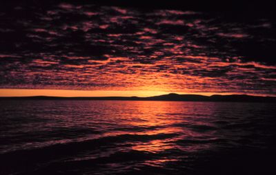
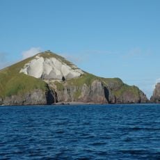
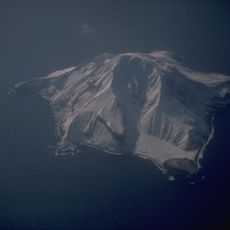
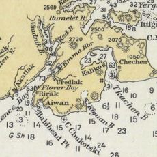
Bering Sea, Northern marginal sea between Alaska, US and Russia.

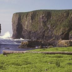
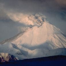
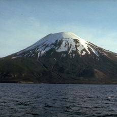
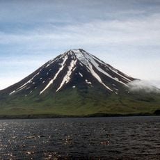
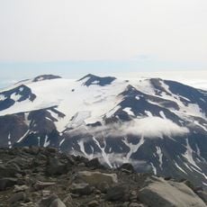
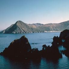
The Bering Sea is a marginal sea of the Pacific Ocean lying between the Russian peninsula of Kamchatka and the American state of Alaska, covering more than 2 million square kilometers (772,000 square miles). Deep basins alternate with shallow shelf zones that form extensive fishing grounds, particularly in the southern and western portions.

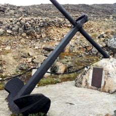
The sea received its name from the Danish navigator Vitus Bering, who explored the strait between Asia and America in 1728 under commission from the Russian tsar. During the last ice age, a land bridge formed here, allowing animals and later humans to pass between the continents.

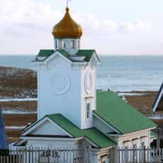
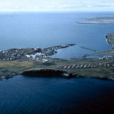
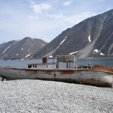
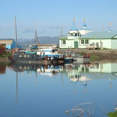
Coastal communities on both sides depend on salmon, crab and halibut, preserving fish through smoking and drying techniques passed down over generations. Villages celebrate the return of migrating species with ceremonies that honor the animals and mark the rhythm of the seasons.

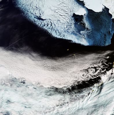
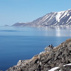
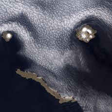
In winter, the northern portion develops thick ice cover, while the southern waters remain open for navigation throughout the year. Boats and fishing vessels operate mainly from May through October, when weather conditions are more stable and visibility improves.

On December 18, 2018, a meteor exploded above the waters, releasing energy equivalent to about 49 kilotons, more than three times the Hiroshima bomb. Scientists discovered the event only months later through data analysis, as it occurred in a remote region with no direct witnesses.

The community of curious travelers

AroundUs brings together thousands of curated places, local tips, and hidden gems, enriched daily by 60,000 contributors worldwide.

Start exploring
Part of
Pacific Ocean
Shares border with
Aleutians West Census Area
GPS coordinates
58.00000,-178.00000
Latest update
December 12, 2025 20:52
Around this place
Mount Cleveland
United States of America

Mount Cleveland

768 km
COBRA DANE
United States of America

COBRA DANE

769.4 km
Atka B-24D Liberator
United States of America

Atka B-24D Liberator

689 km
Alaska Maritime National Wildlife Refuge
United States of America

Alaska Maritime National Wildlife Refuge

714.8 km
Japanese Occupation Site, Kiska Island
United States of America

Japanese Occupation Site, Kiska Island

727.6 km
Beringia National Park
Russian Federation

Beringia National Park

751.8 km
Mount Adagdak
United States of America

Mount Adagdak

675.3 km
Gareloi Volcano
United States of America

Gareloi Volcano

693.6 km
Kanaga Volcano
United States of America

Kanaga Volcano

678.5 km
Mount Amukta
United States of America

Mount Amukta

746.7 km
Mount Carlisle
United States of America

Mount Carlisle

757.2 km
Sts. Peter and Paul Church
United States of America

Sts. Peter and Paul Church

470.9 km
Khatyrka meteorite
Russian Federation

Khatyrka meteorite

661.8 km
Davidof Volcano
United States of America

Davidof Volcano

712.5 km
Bogoslof Wilderness
United States of America

Bogoslof Wilderness

766.8 km
Seal Island Historic District
United States of America

Seal Island Historic District

491.6 km
Bobrof Volcano
United States of America

Bobrof Volcano

679.1 km
Mount Takawangha
United States of America

Mount Takawangha

682.5 km
Slavyanka Cove
Russian Federation

Slavyanka Cove

751 km
Историко-культурный комплекс Пловер
Russian Federation

Историко-культурный комплекс Пловер

750.2 km
Богослов (вулкан)
United States of America

Богослов (вулкан)

678.9 km
Памятный знак в честь 250-летия Первой Камчатской экспедиции (Провидения)
Russian Federation

Памятный знак в честь 250-летия Первой Камчатской экспедиции (Провидения)

758 km
Koniuji
United States of America

Koniuji

668.7 km
Little Sitkin volcano
United States of America

Little Sitkin volcano

708.5 km
Takawangha
United States of America

Takawangha

682.1 km
Дворец Пионеров (Анадырь)
Russian Federation

Дворец Пионеров (Анадырь)

786 km
Историко-этнографический памятник «Коса Святого Александра» (Анадырь)
Russian Federation

Историко-этнографический памятник «Коса Святого Александра» (Анадырь)

786.2 km
Памятник В. И. Ленину (Анадырь)
Russian Federation

Памятник В. И. Ленину (Анадырь)

786.1 km
Show the full map
Reviews
Share your experience

No review yet

Discussions
Start a discussion...

No discussion yet

« Bering Sea - Northern marginal sea between Alaska, US and Russia » is provided by Around Us (aroundus.com). Images and texts are derived from Wikimedia project under a Creative Commons license. You are allowed to copy, distribute, and modify copies of this page, under the conditions set by the license, as long as this note is clearly visible.

Discover hidden gems everywhere you go!

From secret cafés to breathtaking viewpoints, skip the crowded tourist spots and find places that match your style. Our app makes it easy with voice search, smart filtering, route optimization, and insider tips from travelers worldwide. Download now for the complete mobile experience.

Around Us App Screenshot

A unique approach to discovering new places

Le Figaro

All the places worth exploring

France Info

A tailor-made excursion in just a few clicks

20 Minutes

Around Us
Travel Guide & Maps
Download

Send to your phone

QR Code
1

Open the camera app on your mobile.

2

Point at the QR code with your camera. A notification will appear.

3

Tap the notification to open the link.