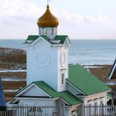
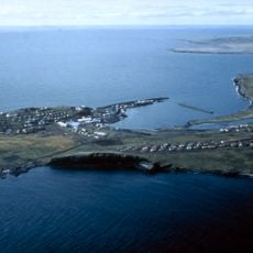
Chest opened
+${chestReward.xp} XP
Explorer
NOUVEAU ×${chestReward.collectible.quantity}
tapez pour fermer
Chest locked

Open chests in the app

Around Us is built for your phone — chests unlock when you walk, explore and capture nearby places.

Enable Location

We need your location to show you interesting places around you

Discover nearby places

Find interesting locations and hidden gems around you

Precise directions

Get accurate directions and distances to places

Your location is never shared with other users. It's only used when you tap the location button.

Log in to your account

Start exploring — it's free

Trusted by 72,983 travelers worldwide

Continue with Google
Continue with Apple
or

We will send you a code to connect

By continuing, you accept our Terms and Conditions and our Privacy Policy

Check your inbox

We've sent a pincode in your inbox. Please enter the code below.

Discussion Reviews Photo
20.5k Popularity

Nightmute, city

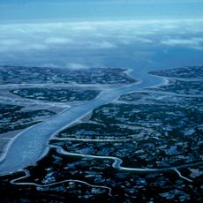
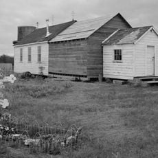
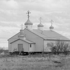
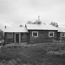
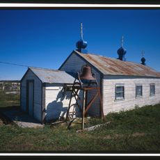
Nightmute is a small city on Nelson Island in the Bethel Census Area in Alaska, set within a flat landscape of wetlands and tundra. Buildings are mostly simple homes designed to handle the extreme cold and the frozen ground beneath them.

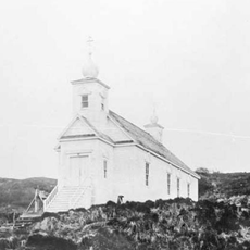
The Yup'ik have lived on Nelson Island for well over a thousand years, and Nightmute is one of the oldest continuously settled spots in the area. It was first recorded in a census in 1940 as a Native village, then officially incorporated as a city in 1974.

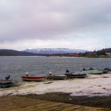
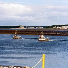
Most residents of Nightmute are Yup'ik, and their language is still spoken in everyday life. Traditional fishing, hunting, and handmade crafts remain part of daily routines and are passed down within families.

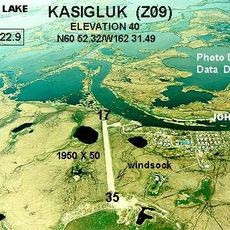
Nightmute can only be reached by small plane or boat, as no roads connect it to larger towns. In winter, snowmobile trails and ice roads offer additional options, but conditions can change quickly and sometimes make travel impossible.

The name Nightmute comes from the Yup'ik language and means something close to 'people of the pressed-down place', a direct reference to the soft, sinking ground of the island. This meaning becomes easy to understand when you notice how buildings are raised on stilts or platforms to stay level above the shifting soil.

The community of curious travelers

AroundUs brings together thousands of curated places, local tips, and hidden gems, enriched daily by 60,000 contributors worldwide.

Start exploring
Inception
April 30, 1974
Elevation above the sea
23 m
GPS coordinates
60.49140,-164.82600
Latest update
March 3, 2026 08:22
Around this place
Yukon Delta National Wildlife Refuge
United States of America

Yukon Delta National Wildlife Refuge

114.3 km
Wood-Tikchik State Park
United States of America

Wood-Tikchik State Park

342.5 km
Togiak National Wildlife Refuge
United States of America

Togiak National Wildlife Refuge

285.9 km
Naknek River
United States of America

Naknek River

499.5 km
Innoko National Wildlife Refuge
United States of America

Innoko National Wildlife Refuge

461 km
Sts. Peter and Paul Church
United States of America

Sts. Peter and Paul Church

489.3 km
Togiak Wilderness
United States of America

Togiak Wilderness

274 km
Innoko Wilderness
United States of America

Innoko Wilderness

446.8 km
Pilgrim Hot Springs
United States of America

Pilgrim Hot Springs

512.2 km
Cape Nome Mining District Discovery Sites
United States of America

Cape Nome Mining District Discovery Sites

454.2 km
Unalakleet River
United States of America

Unalakleet River

464.3 km
Seal Island Historic District
United States of America

Seal Island Historic District

499.8 km
Old St. Joseph's Catholic Church
United States of America

Old St. Joseph's Catholic Church

447.2 km
Nome River
United States of America

Nome River

462.9 km
Snake River
United States of America

Snake River

462.6 km
Christ Church Mission
United States of America

Christ Church Mission

343.4 km
Swanberg Dredge
United States of America

Swanberg Dredge

446.3 km
Solomon Roadhouse
United States of America

Solomon Roadhouse

453.3 km
Elevation of Holy Cross Church
United States of America

Elevation of Holy Cross Church

482.6 km
Niukluk River
United States of America

Niukluk River

496.8 km
Iyatayet Site
United States of America

Iyatayet Site

468.1 km
St. Jacob's Church
United States of America

St. Jacob's Church

169.1 km
St. Seraphim Chapel
United States of America

St. Seraphim Chapel

266.5 km
St. John the Baptist Chapel
United States of America

St. John the Baptist Chapel

481.6 km
Transfiguration of Our Lord Chapel
United States of America

Transfiguration of Our Lord Chapel

394.8 km
Bureau of Indian Affairs Unalakleet School
United States of America

Bureau of Indian Affairs Unalakleet School

430.7 km
Johnson River
United States of America

Johnson River

196 km
Kemuk River
United States of America

Kemuk River

294.5 km
Show the full map
Reviews
Share your experience

No review yet

Discussions
Start a discussion...

No discussion yet

« Nightmute - city » is provided by Around Us (aroundus.com). Images and texts are derived from Wikimedia project under a Creative Commons license. You are allowed to copy, distribute, and modify copies of this page, under the conditions set by the license, as long as this note is clearly visible.

Discover hidden gems everywhere you go!

From secret cafés to breathtaking viewpoints, skip the crowded tourist spots and find places that match your style. Our app makes it easy with voice search, smart filtering, route optimization, and insider tips from travelers worldwide. Download now for the complete mobile experience.

Around Us App Screenshot

A unique approach to discovering new places

Le Figaro

All the places worth exploring

France Info

A tailor-made excursion in just a few clicks

20 Minutes

Around Us
Travel Guide & Maps
Download

Send to your phone

QR Code
1

Open the camera app on your mobile.

2

Point at the QR code with your camera. A notification will appear.

3

Tap the notification to open the link.