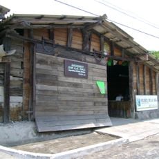
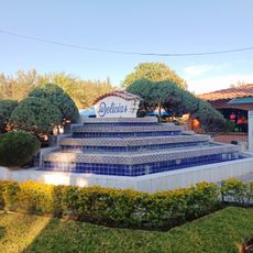
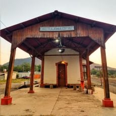
Ciudad Guzmán, Commercial center in Jalisco, Mexico
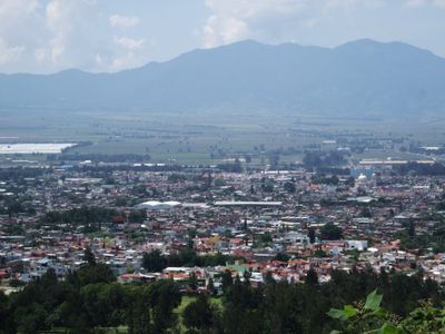
Ciudad Guzmán is a city in Jalisco situated between the Sierra Tapalpa and Cerro del Tigre mountains at about 1,500 meters elevation. It functions as a commercial hub for the region with local markets and trade facilities positioned near Lake Zapotlán.
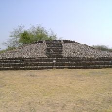
Spanish conquistadors took control of the area in 1526, transforming the pre-Columbian kingdom of Zapotlán into a colonial settlement. This transformation set the foundation for later development as a trade center.
The city earned the nickname Athens of Jalisco because it produced renowned artists and musicians who shaped Mexican culture. This artistic legacy remains a source of pride for local residents today.
The city sits on main highways connecting Guadalajara to the north and Colima to the south, making regional travel straightforward. The elevation keeps the climate cool and mild throughout the year.
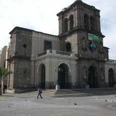
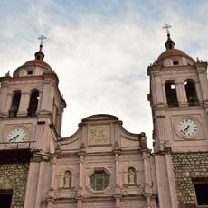
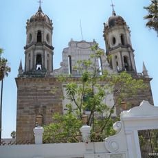
The Cathedral of San José shows visible traces of rebuilding after the 1985 earthquake, with its towers reconstructed at a lower height. This change remains clearly visible to visitors and tells the story of how the city recovered from this natural disaster.
Location: Zapotlán El Grande Municipality
Inception: 1533
Elevation above the sea: 1,535 m
Website: http://ciudadguzman.gob.mx
GPS coordinates: 19.70016,-103.46394
Latest update: December 6, 2025 21:20
La Primavera Biosphere Reserve
104.7 km
Puente Matute Remus
107.6 km
Nevado de Colima National Park
27.5 km
La Campana
55.4 km
Lake Cajititlan, Jalisco
81.9 km
Agave Landscape and Ancient Industrial Facilities of Tequila
108.2 km
Arcos del Milenio
107.1 km
Roundabout of the disappeared
108.1 km
Estadio Olímpico Universitario de Colima
56.4 km
St. Joseph Cathedral, Ciudad Guzmán
395 m
Plaza de toros Alberto Balderas
94.5 km
Cathedral Basilica of Our Lady of Guadalupe
57.9 km
Guadalajara México Temple
107.1 km
Museo Regional de la Ceramica, Tlaquepaque
105.7 km
Holy Trinity Cathedral, Autlán
94.7 km
Trióvalo Bernardo Obregón
85.5 km
Estadio Colima
59.5 km
Museo Universitario de Artes Populares María Teresa Pomar
57.1 km
Museo Regional de Historia de Colima
58 km
Parroquia de San Pedro Apóstol
105.9 km
Santuario de Nuestra Señora de la Soledad
105.8 km
Centro Cultural González Gallo
72.2 km
Chapala
72.6 km
Museo Comunitario de la Sal
108.2 km
Las Delicias
82.4 km
Antigua Estación de Ferrocarril Tlajomulco
85.3 km
Puente del Diablo, Buenavista
106.3 km
Dr. Jorge Villalobos Padilla, SJ library
101 kmVisited this place? Tap the stars to rate it and share your experience / photos with the community! Try now! You can cancel it anytime.
Discover hidden gems everywhere you go!
From secret cafés to breathtaking viewpoints, skip the crowded tourist spots and find places that match your style. Our app makes it easy with voice search, smart filtering, route optimization, and insider tips from travelers worldwide. Download now for the complete mobile experience.
A unique approach to discovering new places❞
— Le Figaro
All the places worth exploring❞
— France Info
A tailor-made excursion in just a few clicks❞
— 20 Minutes