Zapopan

Log in to your account

AroundUs is a community-driven map of interesting places, built by curious explorers like you. It grows with every review, story, and photo you share.
Connect to save your favorite spots, contribute locations, and create personalized routes.
Continue with Google
Continue with Apple
Continue with X
Continue with Facebook
Continue with email
By continuing, you accept our Terms and Conditions and our Privacy Policy
Create an account
Add to collection
Map
Suggest a change
Share

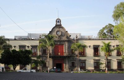
Zapopan, Administrative center in Guadalajara metropolitan area, Mexico

Zapopan is a city in central Jalisco that spans a wide area and forms part of the country's second-largest metropolitan region. The elevation of 1,571 meters (5,154 feet) creates a moderate climate, while residential, commercial, and industrial districts spread across the territory.

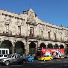
Spanish settlers founded the town in 1541 on the land of an indigenous community that had farmed for centuries. Over time, the city grew and shifted from a rural center to a major hub for technology and industry in the western region.

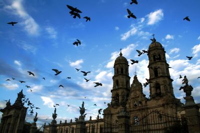
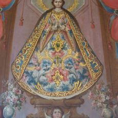
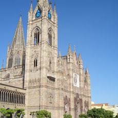
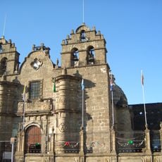
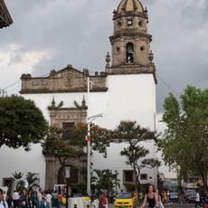
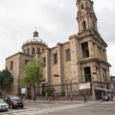
The basilica houses an image of Mary that has drawn pilgrims from all regions for centuries. Every October, believers walk through the streets carrying the statue back from the main cathedral in a procession that lasts several hours.

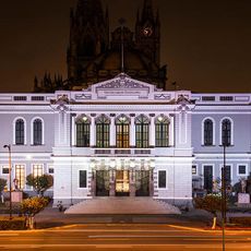
Companies from different sectors have offices here, making it an economically active area. Educational institutions also offer courses and programs in technology and management that are open to locals and students from other regions.

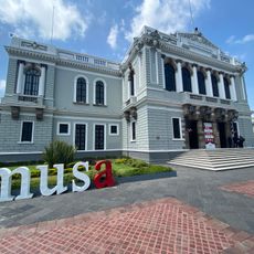
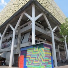
The university cultural complex includes several buildings and halls, among them a large auditorium for concerts and events. Visitors also find exhibition spaces and libraries open to the public that regularly host cultural programs.

Location: Zapopan Municipality

Inception: 1541

Elevation above the sea: 1,571 m

Part of: Guadalajara metropolitan area

Shares border with: Guadalajara, Tequila, San Cristóbal de la Barranca Municipality, Amatitán, El Arenal, Tala, Ixtlahuacán del Río, Tlajomulco de Zuñiga, Tlaquepaque Municipality

Website: https://zapopan.gob.mx

GPS coordinates: 20.72028,-103.39194

Latest update: December 12, 2025 23:18

Photos
Reviews

Visited this place? Tap the stars to rate it and share your experience / photos with the community! Try now! You can cancel it anytime.

« Zapopan - Administrative center in Guadalajara metropolitan area, Mexico » is provided by Around Us (aroundus.com). Images and texts are derived from Wikimedia project under a Creative Commons license. You are allowed to copy, distribute, and modify copies of this page, under the conditions set by the license, as long as this note is clearly visible.

Discover hidden gems everywhere you go!

From secret cafés to breathtaking viewpoints, skip the crowded tourist spots and find places that match your style. Our app makes it easy with voice search, smart filtering, route optimization, and insider tips from travelers worldwide. Download now for the complete mobile experience.

Around Us App Screenshot

A unique approach to discovering new places

Le Figaro

All the places worth exploring

France Info

A tailor-made excursion in just a few clicks

20 Minutes