Chest opened
+${chestReward.xp} XP
Explorer
NOUVEAU ×${chestReward.collectible.quantity}
tapez pour fermer
Chest locked

Open chests in the app

Around Us is built for your phone — chests unlock when you walk, explore and capture nearby places.

Enable Location

We need your location to show you interesting places around you

Discover nearby places

Find interesting locations and hidden gems around you

Precise directions

Get accurate directions and distances to places

Your location is never shared with other users. It's only used when you tap the location button.

Panorama City

Log in to your account

Start exploring — it's free

Trusted by 72,932 travelers worldwide

Continue with Google
Continue with Apple
or

We will send you a code to connect

By continuing, you accept our Terms and Conditions and our Privacy Policy

Check your inbox

We've sent a pincode in your inbox. Please enter the code below.

Discussion Reviews 2 Photos
67.6k Popularity

Panorama City, Residential neighborhood in San Fernando Valley, Los Angeles, United States.

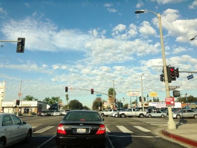
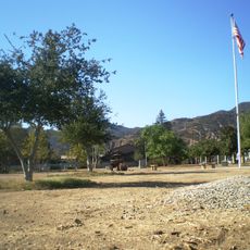
Panorama City is a residential neighborhood in the San Fernando Valley in the northern part of Los Angeles County. The area is crisscrossed by wide streets and feels rather flat, with low-rise buildings and parking lots scattered between houses.

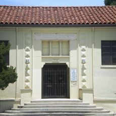
Fritz B. Burns and Henry J. Kaiser founded this community in 1948 as the first planned neighborhood in the San Fernando Valley after the war. Architects Wurdeman and Becket drew up the original concept following federal housing guidelines.

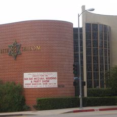
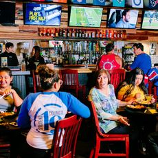
Local businesses and restaurants reflect the everyday life of the many families who settled here over the decades. Spanish and Tagalog mix with English on storefronts, and markets sell products from Mexico, El Salvador and the Philippines alongside mainstream goods.

The area is easiest to reach by car, as public transit options are limited and main streets often see heavy traffic. Walking visitors should be ready for longer distances, as many corners are spread out.

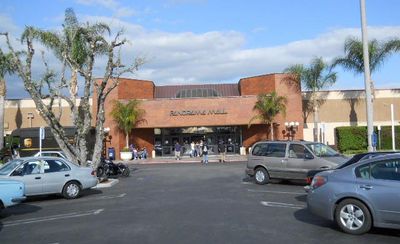
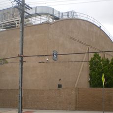
Part of the original master plan included a central shopping center, which survives today as the Panorama Mall. The design followed federal recommendations to create housing for returning soldiers.

The community of curious travelers

AroundUs brings together thousands of curated places, local tips, and hidden gems, enriched daily by 60,000 contributors worldwide.

Start exploring
Location
Shares border with
Arleta
GPS coordinates
34.22429,-118.44537
Latest update
March 5, 2026 21:06
Around this place
Mission San Fernando Rey de España
United States of America

Mission San Fernando Rey de España

5.6 km
Sepulveda Dam
United States of America

Sepulveda Dam

6.9 km
Radford Studio Center
United States of America

Radford Studio Center

10.2 km
Nethercutt Collection
United States of America

Nethercutt Collection

9.3 km
The Great Wall of Los Angeles
United States of America

The Great Wall of Los Angeles

5.8 km
The Japanese Garden
United States of America

The Japanese Garden

5.6 km
Portal of the Folded Wings Shrine to Aviation
United States of America

Portal of the Folded Wings Shrine to Aviation

8.7 km
17 Hertz Studio
United States of America

17 Hertz Studio

9.1 km
Los Encinos State Historic Park
United States of America

Los Encinos State Historic Park

8.7 km
Matadome
United States of America

Matadome

7.7 km
Rómulo Pico Adobe
United States of America

Rómulo Pico Adobe

5.4 km
United States of America

Van Nuys City Hall

4.4 km
Convento Building
United States of America

Convento Building

5.6 km
Valley Beth Shalom
United States of America

Valley Beth Shalom

8.2 km
Sylmar Converter Station
United States of America

Sylmar Converter Station

10.3 km
California State University Northridge Botanic Garden
United States of America

California State University Northridge Botanic Garden

7.7 km
Lopez Adobe
United States of America

Lopez Adobe

6.4 km
Oviatt Library
United States of America

Oviatt Library

7.9 km
San Fernando Pioneer Memorial Cemetery
United States of America

San Fernando Pioneer Memorial Cemetery

10.7 km
Cathedral of St. Mary Byzantine Catholic Church
United States of America

Cathedral of St. Mary Byzantine Catholic Church

6.6 km
North Hollywood Amelia Earhart Regional Library
United States of America

North Hollywood Amelia Earhart Regional Library

8.9 km
Saint Saviour's Chapel
United States of America

Saint Saviour's Chapel

9.8 km
Van Nuys Branch
United States of America

Van Nuys Branch

4.4 km
Brunswick Matador Bowl
United States of America

Brunswick Matador Bowl

5.3 km
St. Leon Cathedral
United States of America

St. Leon Cathedral

9.8 km
Valley Relics Museum
United States of America

Valley Relics Museum

5.2 km
El Portal Theatre
United States of America

El Portal Theatre

9 km
Playtime Co.
United States of America

Playtime Co.

4 km
Show the full map
Reviews
Share your experience

No review yet

Discussions
Start a discussion...

No discussion yet

« Panorama City - Residential neighborhood in San Fernando Valley, Los Angeles, United States » is provided by Around Us (aroundus.com). Images and texts are derived from Wikimedia project under a Creative Commons license. You are allowed to copy, distribute, and modify copies of this page, under the conditions set by the license, as long as this note is clearly visible.

Discover hidden gems everywhere you go!

From secret cafés to breathtaking viewpoints, skip the crowded tourist spots and find places that match your style. Our app makes it easy with voice search, smart filtering, route optimization, and insider tips from travelers worldwide. Download now for the complete mobile experience.

Around Us App Screenshot

A unique approach to discovering new places

Le Figaro

All the places worth exploring

France Info

A tailor-made excursion in just a few clicks

20 Minutes

Around Us
Travel Guide & Maps
Download

Send to your phone

QR Code
1

Open the camera app on your mobile.

2

Point at the QR code with your camera. A notification will appear.

3

Tap the notification to open the link.