Chest opened
+${chestReward.xp} XP
Explorer
NOUVEAU ×${chestReward.collectible.quantity}
tapez pour fermer
Chest locked

Open chests in the app

Around Us is built for your phone — chests unlock when you walk, explore and capture nearby places.

Enable Location

We need your location to show you interesting places around you

Discover nearby places

Find interesting locations and hidden gems around you

Precise directions

Get accurate directions and distances to places

Your location is never shared with other users. It's only used when you tap the location button.

Log in to your account

Start exploring — it's free

Trusted by 72,891 travelers worldwide

Continue with Google
Continue with Apple
or

We will send you a code to connect

By continuing, you accept our Terms and Conditions and our Privacy Policy

Check your inbox

We've sent a pincode in your inbox. Please enter the code below.

Temecula Massacre
Discussion Reviews Photo
4.4k Popularity

Temecula Massacre, Military conflict site in Temecula Valley, California, United States.

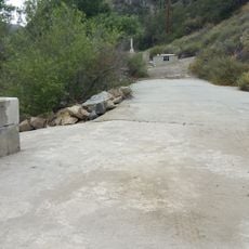
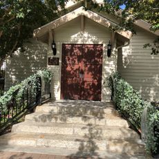
The Temecula Massacre was an armed conflict that occurred in a canyon east of present-day Temecula in December 1846. The location is now marked by a memorial at the Old Temecula Village Cemetery, where visitors can learn about the events of that day.

In December 1846, Mexican forces and Cahuilla allies attacked Luiseño Indians, with over 100 people killed during the Mexican-American War. This event shifted the balance of power in the region.

The event marked a turning point in relations between Mexican authorities, Native American tribes, and the emerging United States presence in California.

The site can be visited through the memorial at the Old Temecula Village Cemetery, where informational displays provide historical context. Allow time to explore the surrounding area and reflect on the significance of this location.

After the attack, members of the Mormon Battalion helped survivors bury and protect their deceased from further violence. Their presence during this time prevented additional bloodshed in the days that followed.

The community of curious travelers

AroundUs brings together thousands of curated places, local tips, and hidden gems, enriched daily by 60,000 contributors worldwide.

Start exploring
Location
GPS coordinates
33.48170,-117.09100
Latest update
December 11, 2025 11:01
Around this place
Palomar Mountain Observatory
United States of America

Palomar Mountain Observatory

25.2 km
Palomar Mountain
United States of America

Palomar Mountain

27.1 km
Hale Telescope
United States of America

Hale Telescope

25.2 km
Diamond Valley Lake
United States of America

Diamond Valley Lake

23 km
Harrah's Resort Southern California
United States of America

Harrah's Resort Southern California

27 km
Otay Mountain Wilderness
United States of America

Otay Mountain Wilderness

26 km
San Diego Aqueduct
United States of America

San Diego Aqueduct

20.5 km
Agua Tibia Wilderness
United States of America

Agua Tibia Wilderness

10.1 km
Temecula Valley
United States of America

Temecula Valley

4.7 km
Lilac Road Bridge
United States of America

Lilac Road Bridge

20.9 km
Skinner Reservoir
United States of America

Skinner Reservoir

12.3 km
Samuel Oschin telescope
United States of America

Samuel Oschin telescope

25.6 km
Canyon Lake
United States of America

Canyon Lake

28.2 km
Western Science Center
United States of America

Western Science Center

26.6 km
Oak Grove Butterfield Stage Station
United States of America

Oak Grove Butterfield Stage Station

29.4 km
Redonda Mesa
United States of America

Redonda Mesa

23.7 km
Margarita Peak
United States of America

Margarita Peak

28.1 km
Palomar Testbed Interferometer
United States of America

Palomar Testbed Interferometer

25.2 km
United States of America

Railroad Canyon

28.2 km
United States of America

Double Butte

27.1 km
Temecula's Chapel of Memories
United States of America

Temecula's Chapel of Memories

5.9 km
Bell Mountain
United States of America

Bell Mountain

20.5 km
Rome Hill
United States of America

Rome Hill

27.1 km
Motte Historical Car Museum
United States of America

Motte Historical Car Museum

29.9 km
Finca y jardines Grand Tradition
United States of America

Finca y jardines Grand Tradition

18.2 km
South Coast Winery
United States of America

South Coast Winery

6.8 km
Deer Park Winery & Auto Museum
United States of America

Deer Park Winery & Auto Museum

27.4 km
Ramona Bowl Amphitheatre
United States of America

Ramona Bowl Amphitheatre

29.6 km
Show the full map
Reviews
Share your experience

No review yet

Discussions
Start a discussion...

No discussion yet

« Temecula Massacre - Military conflict site in Temecula Valley, California, United States » is provided by Around Us (aroundus.com). Images and texts are derived from Wikimedia project under a Creative Commons license. You are allowed to copy, distribute, and modify copies of this page, under the conditions set by the license, as long as this note is clearly visible.

Discover hidden gems everywhere you go!

From secret cafés to breathtaking viewpoints, skip the crowded tourist spots and find places that match your style. Our app makes it easy with voice search, smart filtering, route optimization, and insider tips from travelers worldwide. Download now for the complete mobile experience.

Around Us App Screenshot

A unique approach to discovering new places

Le Figaro

All the places worth exploring

France Info

A tailor-made excursion in just a few clicks

20 Minutes

Around Us
Travel Guide & Maps
Download

Send to your phone

QR Code
1

Open the camera app on your mobile.

2

Point at the QR code with your camera. A notification will appear.

3

Tap the notification to open the link.