Chest opened
+${chestReward.xp} XP
Explorer
NOUVEAU ×${chestReward.collectible.quantity}
tapez pour fermer
Chest locked

Open chests in the app

Around Us is built for your phone — chests unlock when you walk, explore and capture nearby places.

Enable Location

We need your location to show you interesting places around you

Discover nearby places

Find interesting locations and hidden gems around you

Precise directions

Get accurate directions and distances to places

Your location is never shared with other users. It's only used when you tap the location button.

Santa Rosa Mountains

Log in to your account

Start exploring — it's free

Trusted by 72,883 travelers worldwide

Continue with Google
Continue with Apple
or

We will send you a code to connect

By continuing, you accept our Terms and Conditions and our Privacy Policy

Check your inbox

We've sent a pincode in your inbox. Please enter the code below.

Santa Rosa Mountains
Discussion Reviews 1 Photos
12.8k Popularity

Santa Rosa Mountains, Mountain range in Riverside County, California

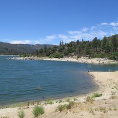
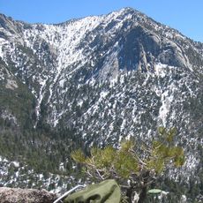
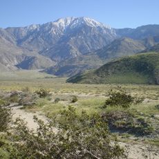
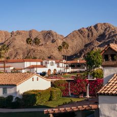
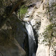
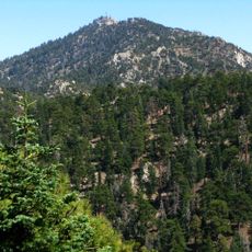
The Santa Rosa Mountains are a mountain range stretching roughly 48 kilometers through Southern California, with Toro Peak rising to about 2,657 meters as the highest point. Today, much of the range is protected as a National Monument with multiple trails and visitor facilities that allow access to its varied landscapes.

Spanish explorer Juan Bautista de Anza first mapped the southeastern sections during his 1774 expedition through the colonial landscape. Since European contact, the mountains have evolved into a protected region with growing recognition of their ecological and historical importance.

The Cahuilla people made these mountains their home for thousands of years, and their presence remains woven into the landscape and local identity today. Walking through this terrain, you can sense the deep connection between the communities and the land they have inhabited.

Most visitors find multiple trail access points on both sides of the range, with the western side generally easier to reach. Coming prepared with plenty of water and sun protection is wise, as the elevation gain and exposure can be demanding.

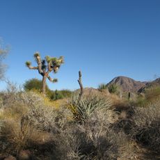
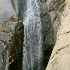
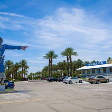
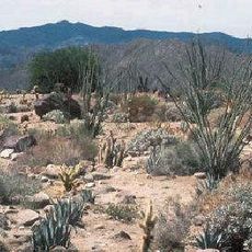
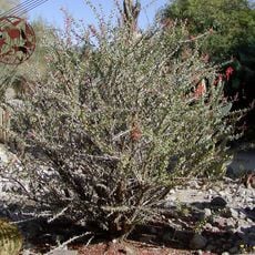
Along the eastern oases, California fan palms grow naturally, the only palm species native to the state in the wild. These hidden pockets of water and lush growth support animal and plant species found nowhere else in the surrounding region.

The community of curious travelers

AroundUs brings together thousands of curated places, local tips, and hidden gems, enriched daily by 60,000 contributors worldwide.

Start exploring
Location
GPS coordinates
33.52300,-116.42600
Latest update
December 7, 2025 20:43
Around this place
United States of America

Humana Challenge

20.6 km
Sunnylands
United States of America

Sunnylands

28.3 km
Lake Hemet
United States of America

Lake Hemet

29.6 km
Living Desert Zoo and Gardens
United States of America

Living Desert Zoo and Gardens

20.5 km
Wet'n'Wild Palm Springs
United States of America

Wet'n'Wild Palm Springs

31.9 km
Tahquitz Peak
United States of America

Tahquitz Peak

34.8 km
Santa Rosa and San Jacinto Mountains National Monument
United States of America

Santa Rosa and San Jacinto Mountains National Monument

18.3 km
Tahquitz Canyon
United States of America

Tahquitz Canyon

11.2 km
La Quinta Resort and Club
United States of America

La Quinta Resort and Club

21.7 km
Galleta Meadows Estate
United States of America

Galleta Meadows Estate

26.6 km
Coachella Valley National Wildlife Refuge
United States of America

Coachella Valley National Wildlife Refuge

32.2 km
Shields Date Gardens
United States of America

Shields Date Gardens

25.2 km
Tahquitz Falls
United States of America

Tahquitz Falls

33.7 km
Santa Rosa Wilderness
United States of America

Santa Rosa Wilderness

10.7 km
Moorten Botanical Garden and Cactarium
United States of America

Moorten Botanical Garden and Cactarium

32.8 km
Toro Peak
United States of America

Toro Peak

57 m
Cornelia White House
United States of America

Cornelia White House

35 km
Yokoji Zen Mountain Center
United States of America

Yokoji Zen Mountain Center

29.1 km
Koerner House
United States of America

Koerner House

33 km
Kenaston House
United States of America

Kenaston House

26.3 km
Coachella Valley Savings No. 2
United States of America

Coachella Valley Savings No. 2

34.5 km
Boomers
United States of America

Boomers

30.2 km
Martinez Canyon Rockhouse
United States of America

Martinez Canyon Rockhouse

9.5 km
Sunnylands Center & Gardens
United States of America

Sunnylands Center & Gardens

28.7 km
Palm Springs Unified School District Educational Administrative Center
United States of America

Palm Springs Unified School District Educational Administrative Center

34 km
College of the Desert Arboretum
United States of America

College of the Desert Arboretum

23.7 km
Museum of Ancient Wonders
United States of America

Museum of Ancient Wonders

28.7 km
Jack Nicklaus Resort Golf Course
United States of America

Jack Nicklaus Resort Golf Course

20.8 km
Show the full map
Reviews
Share your experience

No review yet

Discussions
Start a discussion...

No discussion yet

« Santa Rosa Mountains - Mountain range in Riverside County, California » is provided by Around Us (aroundus.com). Images and texts are derived from Wikimedia project under a Creative Commons license. You are allowed to copy, distribute, and modify copies of this page, under the conditions set by the license, as long as this note is clearly visible.

Discover hidden gems everywhere you go!

From secret cafés to breathtaking viewpoints, skip the crowded tourist spots and find places that match your style. Our app makes it easy with voice search, smart filtering, route optimization, and insider tips from travelers worldwide. Download now for the complete mobile experience.

Around Us App Screenshot

A unique approach to discovering new places

Le Figaro

All the places worth exploring

France Info

A tailor-made excursion in just a few clicks

20 Minutes

Around Us
Travel Guide & Maps
Download

Send to your phone

QR Code
1

Open the camera app on your mobile.

2

Point at the QR code with your camera. A notification will appear.

3

Tap the notification to open the link.