Enable Location

We need your location to show you interesting places around you

Discover nearby places

Find interesting locations and hidden gems around you

Precise directions

Get accurate directions and distances to places

Your location is never shared with other users. It's only used when you tap the location button.

Quail Mountain

Log in to your account

Start exploring — it's free

Trusted by 62,615 travelers worldwide

Continue with Google
Continue with Apple
or

We will send you a code to connect

By continuing, you accept our Terms and Conditions and our Privacy Policy

Check your inbox

We've sent a pincode in your inbox. Please enter the code below.

Quail Mountain

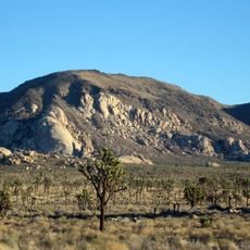
Quail Mountain, Mountain summit in Joshua Tree National Park, California, US.

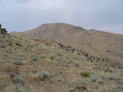
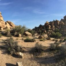
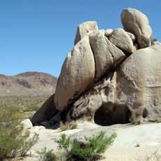
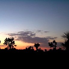
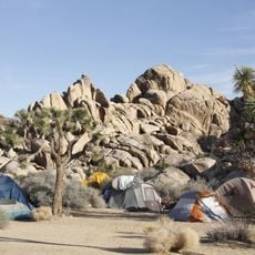
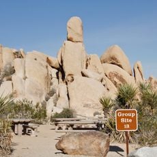
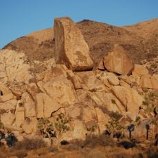
Quail Mountain is the highest summit in the Little San Bernardino Mountains, rising to 1773 meters above the southern Mojave Desert. The landscape features rocky terrain and desert vegetation that spans across the surrounding region.

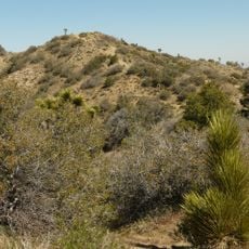
The mountain experienced severe damage from two consecutive wildfires in 1999 and 2001, resulting in major changes to its vegetation structure. These fires permanently shaped the landscape appearance and affected the ecosystem for years afterward.

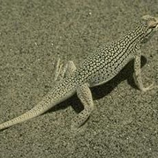
The mountain serves as a natural laboratory for scientists studying desert ecology, geological formations, and the regeneration patterns of native California plants.

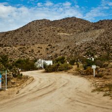
Visitors should carry plenty of water since there is little shade on the way up and the sun is intense throughout the route. The ascent follows unmarked paths through desert terrain and requires roughly 7.2 kilometers of walking.

Wreckage from two T-28 aircraft that collided in 1999 and crashed into the western slope remains visible on the mountainside. This debris serves as a quiet reminder of the accident that occurred during low visibility conditions.

The community of curious travelers

AroundUs brings together thousands of curated places, local tips, and hidden gems, enriched daily by 60,000 contributors worldwide.

Start exploring
Location
Elevation above the sea
1,772 m
GPS coordinates
34.00723,-116.24140
Latest update
December 13, 2025 11:47
Around this place
Rancho De La Luna
United States of America

Rancho De La Luna

16.6 km
Cabot's Pueblo Museum
United States of America

Cabot's Pueblo Museum

22.9 km
Hidden Valley
United States of America

Hidden Valley

6.6 km
Coachella Valley National Wildlife Refuge
United States of America

Coachella Valley National Wildlife Refuge

24.3 km
Keys Desert Queen Ranch
United States of America

Keys Desert Queen Ranch

8 km
Desert Queen Mine
United States of America

Desert Queen Mine

15.8 km
Ryan Mountain
United States of America

Ryan Mountain

10.1 km
Desert Christ Park
United States of America

Desert Christ Park

22.8 km
Malapai Hill
United States of America

Malapai Hill

16 km
United States of America

Eureka Peak

10.4 km
Ryan House and Lost Horse Well
United States of America

Ryan House and Lost Horse Well

8.9 km
World Famous Crochet Museum
United States of America

World Famous Crochet Museum

15.7 km
Hi-Desert Nature Museum
United States of America

Hi-Desert Nature Museum

20.9 km
Joshua Tree National Park Visitor Center
United States of America

Joshua Tree National Park Visitor Center

22.2 km
Classic Club
United States of America

Classic Club

26.5 km
Joshua Tree Visitor Center
United States of America

Joshua Tree Visitor Center

15.7 km
Black Rock Nature Center
United States of America

Black Rock Nature Center

15.6 km
Beauty Bubble Salon and Museum
United States of America

Beauty Bubble Salon and Museum

15.7 km
Hidden Valley Campground
United States of America

Hidden Valley Campground

7.4 km
Jumbo Rocks Campground
United States of America

Jumbo Rocks Campground

16.6 km
White Tank Campground
United States of America

White Tank Campground

20.9 km
Black Rock Campground
United States of America

Black Rock Campground

15.5 km
Sheep Pass Campground
United States of America

Sheep Pass Campground

11.2 km
Belle Campground
United States of America

Belle Campground

20.4 km
Jumbo Rocks Campground Amphitheater
United States of America

Jumbo Rocks Campground Amphitheater

16.6 km
Indian Cove Campground
United States of America

Indian Cove Campground

12.3 km
Ryan Campground
United States of America

Ryan Campground

8.4 km
Indian Cove Campground Amphitheater
United States of America

Indian Cove Campground Amphitheater

12.5 km
Show the full map
« Quail Mountain - Mountain summit in Joshua Tree National Park, California, US » is provided by Around Us (aroundus.com). Images and texts are derived from Wikimedia project under a Creative Commons license. You are allowed to copy, distribute, and modify copies of this page, under the conditions set by the license, as long as this note is clearly visible.

Discover hidden gems everywhere you go!

From secret cafés to breathtaking viewpoints, skip the crowded tourist spots and find places that match your style. Our app makes it easy with voice search, smart filtering, route optimization, and insider tips from travelers worldwide. Download now for the complete mobile experience.

Around Us App Screenshot

A unique approach to discovering new places

Le Figaro

All the places worth exploring

France Info

A tailor-made excursion in just a few clicks

20 Minutes

Around Us
Travel Guide & Maps
Download

Send to your phone

QR Code
1

Open the camera app on your mobile.

2

Point at the QR code with your camera. A notification will appear.

3

Tap the notification to open the link.