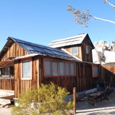
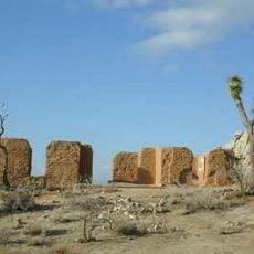
Enable Location

We need your location to show you interesting places around you

Discover nearby places

Find interesting locations and hidden gems around you

Precise directions

Get accurate directions and distances to places

Your location is never shared with other users. It's only used when you tap the location button.

Wall Street Mill

Log in to your account

Start exploring — it's free

Trusted by 62,625 travelers worldwide

Continue with Google
Continue with Apple
or

We will send you a code to connect

By continuing, you accept our Terms and Conditions and our Privacy Policy

Check your inbox

We've sent a pincode in your inbox. Please enter the code below.

Wall Street Mill

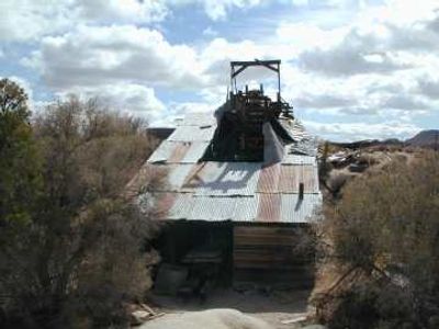
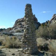
Wall Street Mill is a former factory in San Bernardino County that was specifically built to crush and process gold ore from nearby mines. The structure is made of wood and stone and still retains most of its original machinery, including a stamp mill with two heavy stamps that broke apart rock.

The stamp mill was built in 1931 and belonged to a later phase of California gold mining, long after the major gold rush of the 1800s. It was repaired and updated several times over the decades until operations stopped, and it was eventually added to the National Register of Historic Places.

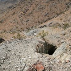
The mill takes its name from Wall Street in New York, reflecting how even small desert mining communities in California connected to larger economic trends. The site shows how local workers depended on extracting resources and how this work shaped their daily lives and the surrounding area.

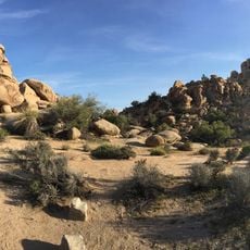
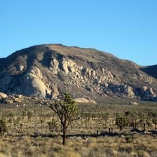
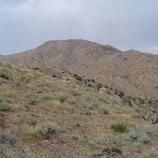
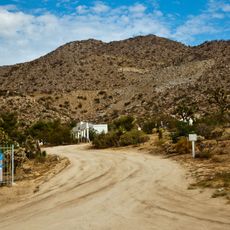
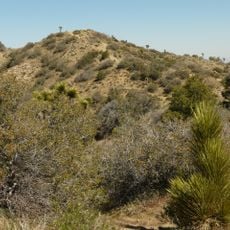
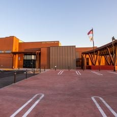
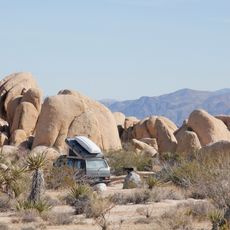
The site is accessible by car and located near Twentynine Palms in desert terrain, not far from Joshua Tree National Park. Visitors should wear sturdy footwear and stick to marked paths, as the old structure is fragile and the surroundings feature rough desert ground.

The stamp mill is the only functioning preserved mill of its kind in the area and retains nearly all of its original machinery and parts. This completeness allows visitors to understand how the equipment actually worked and imagine how workers daily extracted gold from stone.

The community of curious travelers

AroundUs brings together thousands of curated places, local tips, and hidden gems, enriched daily by 60,000 contributors worldwide.

Start exploring
Inception
1933
Architects
William F. Keys
GPS coordinates
34.03651,-116.13402
Latest update
February 9, 2026 08:22
Around this place
Rancho De La Luna
United States of America

Rancho De La Luna

21 km
Cabot's Pueblo Museum
United States of America

Cabot's Pueblo Museum

33.3 km
Hidden Valley
United States of America

Hidden Valley

4.2 km
Coachella Valley National Wildlife Refuge
United States of America

Coachella Valley National Wildlife Refuge

31.5 km
Keys Desert Queen Ranch
United States of America

Keys Desert Queen Ranch

3.4 km
Desert Queen Mine
United States of America

Desert Queen Mine

5.9 km
Ryan Mountain
United States of America

Ryan Mountain

5.6 km
Quail Mountain
United States of America

Quail Mountain

10.4 km
Desert Christ Park
United States of America

Desert Christ Park

30 km
Malapai Hill
United States of America

Malapai Hill

11.6 km
Cow Camp
United States of America

Cow Camp

3.1 km
United States of America

Eureka Peak

20 km
Ryan House and Lost Horse Well
United States of America

Ryan House and Lost Horse Well

6 km
World Famous Crochet Museum
United States of America

World Famous Crochet Museum

19.8 km
Hi-Desert Nature Museum
United States of America

Hi-Desert Nature Museum

27.9 km
Joshua Tree National Park Visitor Center
United States of America

Joshua Tree National Park Visitor Center

13.1 km
Joshua Tree Visitor Center
United States of America

Joshua Tree Visitor Center

19.9 km
Black Rock Nature Center
United States of America

Black Rock Nature Center

24 km
Beauty Bubble Salon and Museum
United States of America

Beauty Bubble Salon and Museum

19.9 km
Hidden Valley Campground
United States of America

Hidden Valley Campground

3.3 km
White Tank Campground
United States of America

White Tank Campground

12.3 km
Jumbo Rocks Campground
United States of America

Jumbo Rocks Campground

8.3 km
Black Rock Campground
United States of America

Black Rock Campground

23.9 km
Sheep Pass Campground
United States of America

Sheep Pass Campground

4.3 km
Belle Campground
United States of America

Belle Campground

11.2 km
Jumbo Rocks Campground Amphitheater
United States of America

Jumbo Rocks Campground Amphitheater

8.2 km
Ryan Campground
United States of America

Ryan Campground

6.3 km
Indian Cove Campground Amphitheater
United States of America

Indian Cove Campground Amphitheater

7 km
Show the full map
« Wall Street Mill » is provided by Around Us (aroundus.com). Images and texts are derived from Wikimedia project under a Creative Commons license. You are allowed to copy, distribute, and modify copies of this page, under the conditions set by the license, as long as this note is clearly visible.

Discover hidden gems everywhere you go!

From secret cafés to breathtaking viewpoints, skip the crowded tourist spots and find places that match your style. Our app makes it easy with voice search, smart filtering, route optimization, and insider tips from travelers worldwide. Download now for the complete mobile experience.

Around Us App Screenshot

A unique approach to discovering new places

Le Figaro

All the places worth exploring

France Info

A tailor-made excursion in just a few clicks

20 Minutes

Around Us
Travel Guide & Maps
Download

Send to your phone

QR Code
1

Open the camera app on your mobile.

2

Point at the QR code with your camera. A notification will appear.

3

Tap the notification to open the link.