Janos Municipality

Log in to your account

AroundUs is a community-driven map of interesting places, built by curious explorers like you. It grows with every review, story, and photo you share.
Connect to save your favorite spots, contribute locations, and create personalized routes.
By continuing, you accept our Terms and Conditions and our Privacy Policy
Add to collection
Map
Suggest a change
Share

Janos Municipality, Administrative municipality in Chihuahua, Mexico.

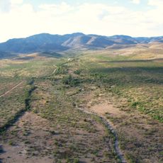
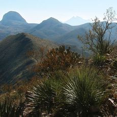
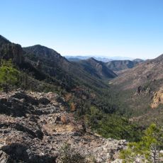
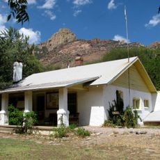
Janos Municipality is an administrative area in Chihuahua that spans desert and mountainous terrain in the northwest, bordering the United States and Sonora state. The territory contains many smaller settlements connected by highways.

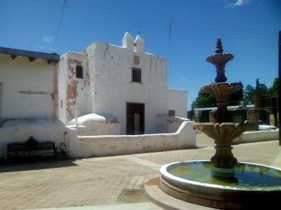
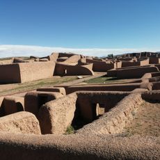
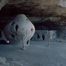
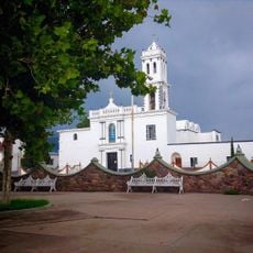
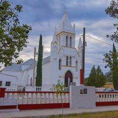
Spanish missionaries established the Soledad de Janos mission in 1640, naming it after the indigenous Janos people who lived in the region. This founding marked the beginning of Spanish presence in the area.

The town preserves traditions through annual festivals that showcase regional music and local food specialties. These celebrations reflect how people in this northern Mexican region live and gather together.

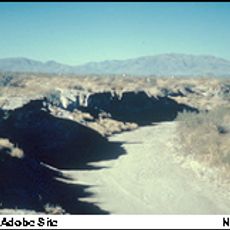
The area is best explored by car since the municipality is large and crossed by highways. The seasons strongly affect travel conditions, especially during hot periods.

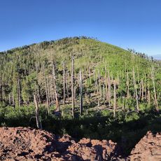
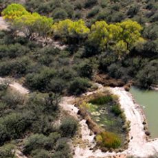
The area is home to a major biosphere reserve established in 2009 that protects rare wildlife species. This protected land is one of the largest natural areas in northern Mexico.

Location: Janos

Address: 31840 Janos, Chihuahua, Mexico

Website: http://janos.gob.mx

GPS coordinates: 30.75653,-108.44170

Latest update: December 6, 2025 17:43

Photos
Hidden gems of Chihuahua: canyons, waterfalls, colonial churches

The Mexican state of Chihuahua extends from desert plains to pine forests in the Sierra Madre Occidental, reaching elevations above 2000 meters. The region preserves a rich cultural and natural heritage that includes pre-Columbian rock art, colonial-era mining facilities, and religious buildings...

Around this place
Show the full map
Casas Grandes
Mexico

Casas Grandes

63 km
Cuarenta Casas
Mexico

Cuarenta Casas

136.5 km
Skeleton Canyon
United States of America

Skeleton Canyon

108.7 km
Gadsden Hotel
United States of America

Gadsden Hotel

124.7 km
Chiricahua Peak
United States of America

Chiricahua Peak

145.7 km
Cueva de la Olla
Mexico

Cueva de la Olla

67.1 km
San Bernardino Ranch
United States of America

San Bernardino Ranch

102.7 km
Village of Columbus and Camp Furlong
United States of America

Village of Columbus and Camp Furlong

142 km
Colonia Juárez Chihuahua México Temple
Mexico

Colonia Juárez Chihuahua México Temple

60.9 km
San Bernardino National Wildlife Refuge
United States of America

San Bernardino National Wildlife Refuge

102.1 km
Leslie Canyon National Wildlife Refuge
United States of America

Leslie Canyon National Wildlife Refuge

137.7 km
Canyon de Guadalupe
Mexico

Canyon de Guadalupe

97.6 km
Big Hatchet Peak
United States of America

Big Hatchet Peak

97.9 km
Rucker Canyon
United States of America

Rucker Canyon

145.4 km
Grand Theatre
United States of America

Grand Theatre

125.2 km
Double Adobe Site
United States of America

Double Adobe Site

123.3 km
Plaza Azueta
Mexico

Plaza Azueta

124.4 km
Portal Ranger Station
United States of America

Portal Ranger Station

144.4 km
Our Lady of Loreto Church
Mexico

Our Lady of Loreto Church

125.3 km
Douglas Historic District
United States of America

Douglas Historic District

124.7 km
El Paso and Southwestern Railroad YMCA
United States of America

El Paso and Southwestern Railroad YMCA

124.9 km
United States Post Office and Customs House–Douglas Main
United States of America

United States Post Office and Customs House–Douglas Main

124.6 km
Temple of Our Lady of Assumption of Mary
Mexico

Temple of Our Lady of Assumption of Mary

64.7 km
Temple of Saint Michael the Archangel
Mexico

Temple of Saint Michael the Archangel

56.8 km
Douglas Residential Historic District
United States of America

Douglas Residential Historic District

124.1 km
Chiricahua Desert Museum
United States of America

Chiricahua Desert Museum

136.2 km
Silver Peak Lookout Complex
United States of America

Silver Peak Lookout Complex

146.8 km
Monte Vista Lookout Cabin
United States of America

Monte Vista Lookout Cabin

145.1 km
Show the full map
Reviews

Visited this place? Tap the stars to rate it and share your experience / photos with the community! Try now! You can cancel it anytime.

« Janos Municipality - Administrative municipality in Chihuahua, Mexico » is provided by Around Us (aroundus.com). Images and texts are derived from Wikimedia project under a Creative Commons license. You are allowed to copy, distribute, and modify copies of this page, under the conditions set by the license, as long as this note is clearly visible.

Discover hidden gems everywhere you go!

From secret cafés to breathtaking viewpoints, skip the crowded tourist spots and find places that match your style. Our app makes it easy with voice search, smart filtering, route optimization, and insider tips from travelers worldwide. Download now for the complete mobile experience.

Around Us App Screenshot

A unique approach to discovering new places

Le Figaro

All the places worth exploring

France Info

A tailor-made excursion in just a few clicks

20 Minutes