Enable Location

We need your location to show you interesting places around you

Discover nearby places

Find interesting locations and hidden gems around you

Precise directions

Get accurate directions and distances to places

Your location is never shared with other users. It's only used when you tap the location button.

Log in to your account

Start exploring — it's free

Trusted by 67,546 travelers worldwide

Continue with Google
Continue with Apple
or

We will send you a code to connect

By continuing, you accept our Terms and Conditions and our Privacy Policy

Check your inbox

We've sent a pincode in your inbox. Please enter the code below.

Fresnal Canyon
Discussion Reviews Photo
1.3k Popularity

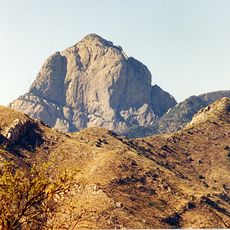
Fresnal Canyon, Canyon in Baboquivari Mountains, Pima County, Arizona, United States

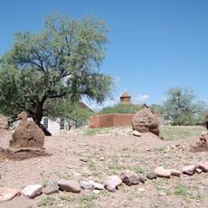
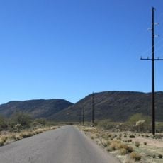
Fresnal Canyon is a narrow ravine in the Baboquivari Mountains of southern Arizona that cuts through limestone rock formations creating steep canyon walls. The passage runs through the Sonoran Desert landscape and forms a natural corridor bounded by tall cliffs on either side.

Archaeological work in the canyon has revealed evidence of early Native American settlements dating to the pre-ceramic period, showing that people lived in this region long ago. These discoveries provide clues about how ancient inhabitants adapted to desert life.

The canyon sits within Tohono O'odham Nation territory, where indigenous communities maintain their relationship with the land through traditional knowledge and practices passed down over generations. Visitors walking through this landscape are walking through a place of cultural significance that remains part of daily life.

A visit requires good preparation for desert conditions with plenty of water and navigation tools, as trails through the area can be difficult to follow and easy to lose. The location is remote, so planning your route and letting others know where you are going is important for safety.

The canyon is home to the elephant tree, a plant species perfectly adapted to survive in its specific microclimate within the desert landscape. This uncommon tree species thrives here and is not found everywhere in the surrounding region.

The community of curious travelers

AroundUs brings together thousands of curated places, local tips, and hidden gems, enriched daily by 60,000 contributors worldwide.

Start exploring
Location
GPS coordinates
31.82730,-111.64000
Latest update
December 9, 2025 20:24
Around this place
Titan Missile Museum
United States of America

Titan Missile Museum

61.2 km
Kitt Peak National Observatory
United States of America

Kitt Peak National Observatory

15.2 km
Tumacácori National Historical Park
United States of America

Tumacácori National Historical Park

62.8 km
Baboquivari Peak Wilderness
United States of America

Baboquivari Peak Wilderness

7.3 km
Dark Energy Spectroscopic Instrument
United States of America

Dark Energy Spectroscopic Instrument

15.1 km
Kitt Peak
United States of America

Kitt Peak

15.8 km
McMath–Pierce Solar Telescope
United States of America

McMath–Pierce Solar Telescope

15.2 km
Tumacácori Mission
United States of America

Tumacácori Mission

62.8 km
Buenos Aires National Wildlife Refuge
United States of America

Buenos Aires National Wildlife Refuge

27.2 km
Nicholas U. Mayall Telescope
United States of America

Nicholas U. Mayall Telescope

15.6 km
Tubac Presidio State Historic Park
United States of America

Tubac Presidio State Historic Park

61.1 km
Tucson ring meteorite
United States of America

Tucson ring meteorite

63.7 km
Tubac Presidio
United States of America

Tubac Presidio

61.1 km
WIYN Telescope
United States of America

WIYN Telescope

15 km
ARO 12m Radio Telescope
United States of America

ARO 12m Radio Telescope

14.2 km
Michigan-Dartmouth-MIT Observatory
United States of America

Michigan-Dartmouth-MIT Observatory

14 km
Black Mountain
United States of America

Black Mountain

62.1 km
Bok Telescope
United States of America

Bok Telescope

15.6 km
United States of America

Gu Achi Peak

62.1 km
Arivaca Schoolhouse
United States of America

Arivaca Schoolhouse

40.5 km
Old Tubac Schoolhouse
United States of America

Old Tubac Schoolhouse

61.1 km
San Ignacio Golf Club
United States of America

San Ignacio Golf Club

58.9 km
Tubac Presidio State Historic Park
United States of America

Tubac Presidio State Historic Park

61.1 km
Tumacácori Museum
United States of America

Tumacácori Museum

62.8 km
McGraw-Hill Telescope
United States of America

McGraw-Hill Telescope

13.8 km
Hiltner 2.4m Telescope
United States of America

Hiltner 2.4m Telescope

14 km
Red Hills Visitor Center
United States of America

Red Hills Visitor Center

63.3 km
Otero Hall
United States of America

Otero Hall

61.1 km
Show the full map
Reviews
Share your experience

No review yet

Discussions
Start a discussion...

No discussion yet

« Fresnal Canyon - Canyon in Baboquivari Mountains, Pima County, Arizona, United States » is provided by Around Us (aroundus.com). Images and texts are derived from Wikimedia project under a Creative Commons license. You are allowed to copy, distribute, and modify copies of this page, under the conditions set by the license, as long as this note is clearly visible.

Discover hidden gems everywhere you go!

From secret cafés to breathtaking viewpoints, skip the crowded tourist spots and find places that match your style. Our app makes it easy with voice search, smart filtering, route optimization, and insider tips from travelers worldwide. Download now for the complete mobile experience.

Around Us App Screenshot

A unique approach to discovering new places

Le Figaro

All the places worth exploring

France Info

A tailor-made excursion in just a few clicks

20 Minutes

Around Us
Travel Guide & Maps
Download

Send to your phone

QR Code
1

Open the camera app on your mobile.

2

Point at the QR code with your camera. A notification will appear.

3

Tap the notification to open the link.