Refugio de Vida Silvestre Manglares Estuario Río Esmeraldas, Schutzgebiet an der Pazifikküste von Ecuador
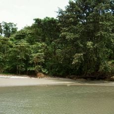
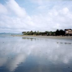
Refugio de Vida Silvestre Manglares Estuario Rio Esmeraldas is a protected conservation area where a major river meets the Pacific coast. The landscape is dominated by dense mangrove stands mixed with areas of dry scrub vegetation along the waterfront.
The refuge was established in 2008 to protect the remaining mangrove forests from further destruction. This action came after decades of habitat loss caused by urban expansion and the spread of shrimp farming operations.
Local fishing communities have practiced their trade in these mangroves for generations, using traditional methods to harvest fish and shellfish. The estuary remains central to how residents make their living and sustain their families.
Access the area through the city of Esmeraldas, where Puerto Pesquero Artesanal serves as the entry point for exploring the mangroves. The rainy season brings more birds and activity, making it the better time for visits.
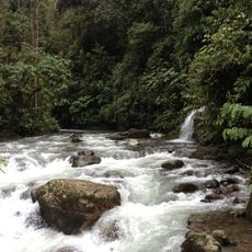
White mangrove trees form the dominant vegetation while black mangrove species occupy deeper interior zones. This arrangement reveals how plants have adapted to different water levels and soil conditions across the reserve.
The community of curious travelers
AroundUs brings together thousands of curated places, local tips, and hidden gems, enriched daily by 60,000 contributors worldwide.