Río Mayo, River tributary in southwestern Colombia.
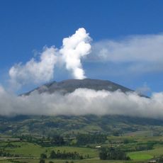
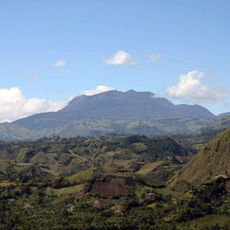
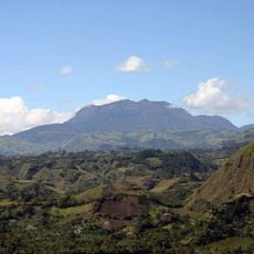
The Rio Mayo flows westward from the Doña Juana Volcanic Complex across a large watershed. The river forms a boundary between Cauca and Nariño departments and passes through ten municipalities on its course.
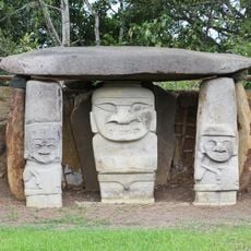
Archaeological evidence suggests the river may correspond to the ancient Ancasmayo, which once marked the northern boundary of the Inca Empire. This historical geography makes the region significant for understanding pre-Columbian times.
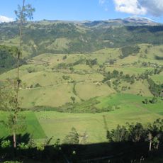
People living along the river grow coffee, sugar cane, plantains, and corn on their land. These crops shape how the landscape looks and how communities use the water in their daily life.
The river basin includes flat areas and hilly sections, so access and walkability vary depending on the season and location. It helps to check conditions beforehand and wear suitable footwear for exploring the landscape.
As the river flows downward from the volcano, the surrounding plants change from high mountain grasslands to drier valley vegetation. This shift shows how much the landscape can change along a single river's path.
The community of curious travelers
AroundUs brings together thousands of curated places, local tips, and hidden gems, enriched daily by 60,000 contributors worldwide.