Guaviare Department, Administrative department in southern Colombia
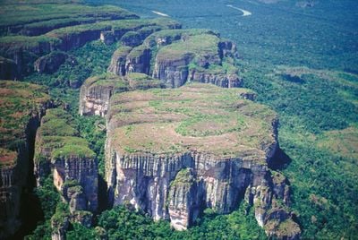
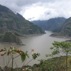
Guaviare Department is an administrative division in southern Colombia that covers a broad area of rainforest and open plains. The region sits in a transition zone between the eastern Andes and the Amazon basin, where tropical vegetation meets savanna landscapes.
The department was created in 1991 through the new Colombian constitution, breaking away from earlier administrative structures. The shift to independent status marked a turning point for the political organization of this remote region.
Multiple indigenous communities, including the Carijona, Guahibo, Guayabero, and Nukak, maintain their traditional languages and customs throughout the department.
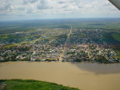
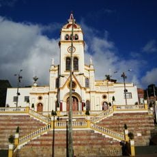
The department consists of four municipalities, with San José del Guaviare serving as the administrative center that houses most public facilities. The other three municipalities are spread across the territory and connected by roads and waterways.
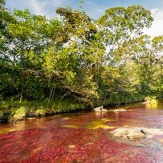
The red rock formations and pre-Columbian rock paintings near San José attract visitors interested in the early inhabitants of the region. These artworks on natural stone walls show motifs of animals, human figures, and geometric patterns.
Location: Colombia
Inception: 1991
Capital city: San José del Guaviare
Elevation above the sea: 300 m
Reference: GUV
Shares border with: Caquetá Department, Meta Department, Vichada Department, Guainía Department, Vaupés Department
Website: http://guaviare.gov.co
GPS coordinates: 1.98333,-71.93333
Latest update: December 14, 2025 17:33
Caño Cristales
209.4 km
Monserrate
375.2 km
Serranía de la Macarena
215.1 km
Sumapaz Paramo
362.4 km
Chingaza National Natural Park
346.7 km
Estadio Bello Horizonte - Rey Pelé
304.5 km
Chiribiquete National Park
172.7 km
Monserrate Sanctuary
375.2 km
Guadalupe Hill
374 km
Sumapaz Natural Park
362.4 km
Guavio Reservoir
348.9 km
Embalse de Chivor
364.7 km
Bioparque Los Ocarros
307.8 km
Teleférico de Monserrate
375.4 kmReserva nacional natural Nukak
47.7 km
Yaigojé-Apaporis National Park
325.3 kmCahuinarí National Natural Park
389.9 km
Chiribiquete's rock shelters
117.6 kmPuinawai Natural Reserve
308.8 km
Cordillera de los Picachos National Natural Park
314.5 km
Tinigua National Natural Park
253.1 km
La Media Torta
375.5 km
Our Lady of Mount Carmel Cathedral, Villavicencio
306.9 km
Iglesia de Nuestra Señora de Egipto
375.2 kmEmbalse El Hato
365.1 km
Archeological Museum of Pasca
369 km
Fundación Gilberto Alzate Avendaño
375.6 km
La Esmeralda Dam
358.4 kmVisited this place? Tap the stars to rate it and share your experience / photos with the community! Try now! You can cancel it anytime.
Discover hidden gems everywhere you go!
From secret cafés to breathtaking viewpoints, skip the crowded tourist spots and find places that match your style. Our app makes it easy with voice search, smart filtering, route optimization, and insider tips from travelers worldwide. Download now for the complete mobile experience.
A unique approach to discovering new places❞
— Le Figaro
All the places worth exploring❞
— France Info
A tailor-made excursion in just a few clicks❞
— 20 Minutes