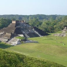
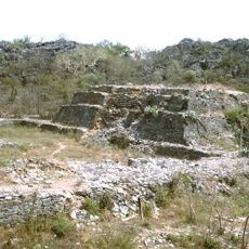
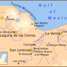
San Lorenzo Tenochtitlán, Olmec archaeological site in Texistepec, Mexico.
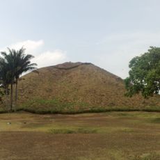
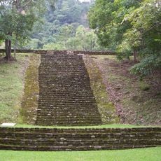
San Lorenzo Tenochtitlán is an Olmec archaeological site in Texistepec, Mexico, built on an artificial platform rising fifty meters above the savanna. The terrain is bordered by ravines between elevated hills along the Coatzacoalcos River and holds remains of ancient residential terraces and plazas.
The site developed as the first Olmec regional center between 1500 and 900 BCE, reaching its height around 1200 BCE. The place was later abandoned systematically, with sculptures buried and monuments ritually destroyed.
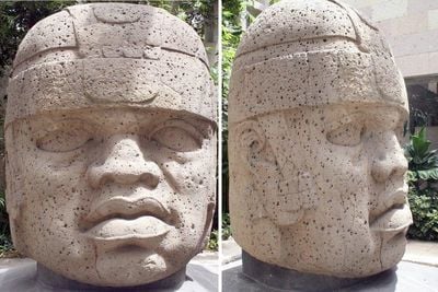
The stone carvings depict rulers and mythological figures shaped with careful toolwork from volcanic rock brought from distant mountains. Visitors today see replica heads and smaller objects placed around the grounds, while original colossal heads rest in museums far from the site.
The archaeological zone opens Tuesday through Sunday from 9:00 to 17:00 and lies 79 kilometers (49 miles) from Coatzacoalcos along the Acayucan-Cosoleacaque Federal Highway. The paths are paved but can become slippery during rainy periods.
The builders installed a drainage system of basalt channels beneath the platform to divert rainwater, and it still functions today. This underground network prevents erosion and has kept the artificial mound stable for thousands of years.
The community of curious travelers
AroundUs brings together thousands of curated places, local tips, and hidden gems, enriched daily by 60,000 contributors worldwide.