Enable Location

We need your location to show you interesting places around you

Discover nearby places

Find interesting locations and hidden gems around you

Precise directions

Get accurate directions and distances to places

Your location is never shared with other users. It's only used when you tap the location button.

Cenote Azul

Log in to your account

Start exploring — it's free

Trusted by 61,684 travelers worldwide

Continue with Google
Continue with Apple
or

We will send you a code to connect

By continuing, you accept our Terms and Conditions and our Privacy Policy

Check your inbox

We've sent a pincode in your inbox. Please enter the code below.

Cenote Azul

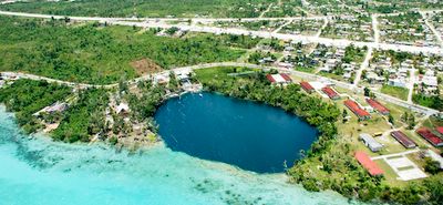
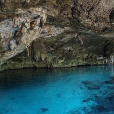
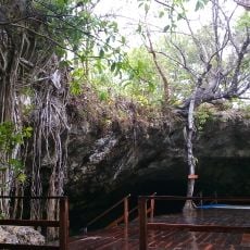
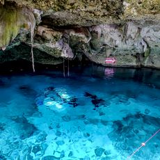
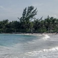
Cenote Azul, Natural sinkhole in Quintana Roo, Mexico.

Description

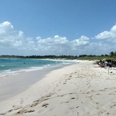
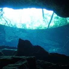
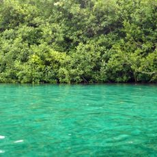
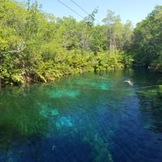
Cenote Azul is a natural sinkhole in Quintana Roo with a deep limestone basin filled with clear freshwater suitable for swimming and diving. The water reaches considerable depths and allows exploration both at the surface and beneath.

History

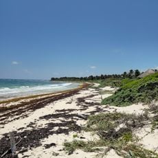
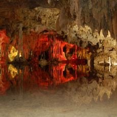
Formation of the cenote dates back millions of years when acidified rainwater dissolved the limestone bedrock, creating an extensive system of underground caves. This geological process shaped the Yucatán Peninsula and created the many water sources that define the region.

Culture

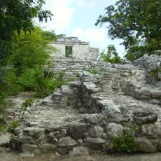
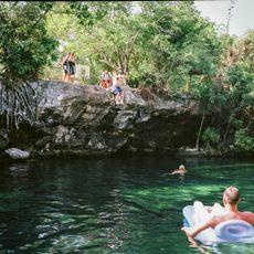
The Maya held this sinkhole as sacred, using it for ceremonies and water collection. Local communities today still connect the cenote to spiritual meanings that remain woven into regional conversations and customs.

Practical

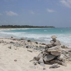
Water access is through constructed staircases, with changing rooms and basic facilities near the main entrance. The site is relatively easy to access, though visitors should be aware that walkways can be slippery, especially when wet.

Did you know?

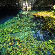
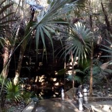
The cenote connects to the Ponderosa cave system, which contains distinctive geological formations where fresh and salt water create visible separation lines. This boundary zone between two different water bodies creates a striking phenomenon that divers can observe during exploration.

Location
GPS coordinates
19.87056,-87.85611
Latest update
December 6, 2025 19:08

AroundUs brings together thousands of curated places, local tips, and hidden gems, enriched daily by 60,000 contributors worldwide. Discover all places nearby (Quintana Roo).

Alternative destinations in Quintana Roo Mexico

Quintana Roo is a coastal region where remote beaches, Mayan archaeological sites, and natural wonders come together. The area is known for its cenotes – natural freshwater sinkholes, some with underwater caves and clear water for swimming and diving. You will find ancient ruins hidden in the...

Hiddem gems of Quintana Roo

Southern Quintana Roo is a region filled with nature reserves, cenotes, lagoons, and archaeological sites. You'll find traditional Maya villages, coral reefs, and mangrove forests throughout the area. Visitors swim in the waters, observe wildlife in nature reserves, and walk among Maya ruins...

« Cenote Azul - Natural sinkhole in Quintana Roo, Mexico » is provided by Around Us (aroundus.com). Images and texts are derived from Wikimedia project under a Creative Commons license. You are allowed to copy, distribute, and modify copies of this page, under the conditions set by the license, as long as this note is clearly visible.

Discover hidden gems everywhere you go!

From secret cafés to breathtaking viewpoints, skip the crowded tourist spots and find places that match your style. Our app makes it easy with voice search, smart filtering, route optimization, and insider tips from travelers worldwide. Download now for the complete mobile experience.

Around Us App Screenshot

A unique approach to discovering new places

Le Figaro

All the places worth exploring

France Info

A tailor-made excursion in just a few clicks

20 Minutes

Around Us
Travel Guide & Maps
Download

Send to your phone

QR Code
1

Open the camera app on your mobile.

2

Point at the QR code with your camera. A notification will appear.

3

Tap the notification to open the link.