Enable Location

We need your location to show you interesting places around you

Discover nearby places

Find interesting locations and hidden gems around you

Precise directions

Get accurate directions and distances to places

Your location is never shared with other users. It's only used when you tap the location button.

Brazoria County

Log in to your account

Start exploring — it's free

Trusted by 62,163 travelers worldwide

Continue with Google
Continue with Apple
or

We will send you a code to connect

By continuing, you accept our Terms and Conditions and our Privacy Policy

Check your inbox

We've sent a pincode in your inbox. Please enter the code below.

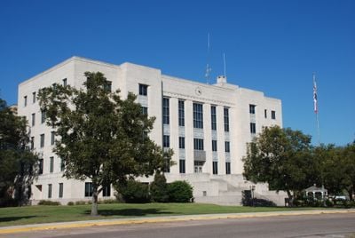
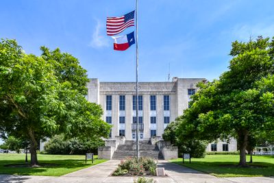
Brazoria County, Administrative division in southeastern Texas, United States

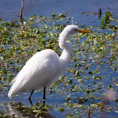
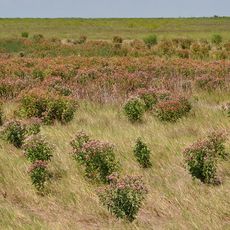
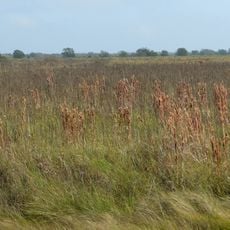
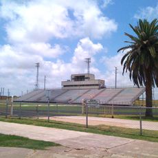
Brazoria County is an administrative division in southeastern Texas stretching from the Gulf of Mexico coast inland, covering plains, wetlands, and forested zones. The geography shifts from flat coastal strips with waterways to wooded areas farther inland, crossed by several river branches.

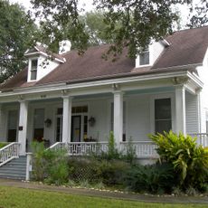
The territory was settled in 1821 by colonists led by Stephen F. Austin, among the first European settlers in the region. Following Texas independence, it became an administrative division in 1836 as the young republic took shape.

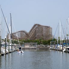
The name derives from the Brazos River, which flows through the territory and shapes much of its character. Coastal communities show the influence of oil and petrochemical industries alongside cattle ranching and farming traditions that remain part of daily life.

Coastal zones can experience storms during hurricane season from June to November, so checking weather forecasts before visiting is wise. Several colleges in the area offer public events and facilities open to visitors.

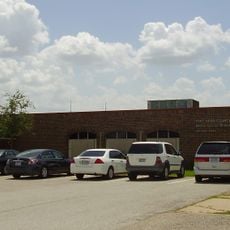
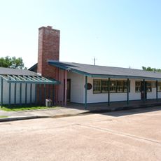
The local law enforcement agency was the first of its kind in what became Texas, beginning operations in March 1836. This detail shows how early organized structures formed in this frontier region, even before many other institutions were established.

The community of curious travelers

AroundUs brings together thousands of curated places, local tips, and hidden gems, enriched daily by 60,000 contributors worldwide.

Start exploring
Location
Inception
1836
Capital city
Angleton
Shares border with
Harris County, Galveston County, Matagorda County, Wharton County, Fort Bend County
GPS coordinates
29.17000,-95.44000
Latest update
December 14, 2025 17:22
Around this place
Christopher C. Kraft Jr. Mission Control Center
United States of America

Christopher C. Kraft Jr. Mission Control Center

55.1 km
Space Center Houston
United States of America

Space Center Houston

53.9 km
Kemah Boardwalk
United States of America

Kemah Boardwalk

58.7 km
Brazos Bend State Park
United States of America

Brazos Bend State Park

27.7 km
United States of America

Senior Road Tower

45.8 km
Boardwalk Bullet
United States of America

Boardwalk Bullet

58.6 km
Varner–Hogg Plantation State Historical Site
United States of America

Varner–Hogg Plantation State Historical Site

19.4 km
Brazoria National Wildlife Refuge
United States of America

Brazoria National Wildlife Refuge

20.8 km
United States of America

Challenger Columbia Stadium

48.7 km
United States of America

Sri Meenakshi Temple

41.6 km
Levi Jordan Plantation
United States of America

Levi Jordan Plantation

27.7 km
United States of America

Armand Bayou Nature Center

57.8 km
NASA Mission Control Center
United States of America

NASA Mission Control Center

55 km
United States of America

MSR Houston

12.2 km
United States of America

Telfair, Sugar Land

51.5 km
San Bernard National Wildlife Refuge
United States of America

San Bernard National Wildlife Refuge

35 km
Space Environment Simulation Laboratory
United States of America

Space Environment Simulation Laboratory

55.3 km
Fort Bend County Libraries
United States of America

Fort Bend County Libraries

53.5 km
United States of America

Big Boggy National Wildlife Refuge

58.5 km
Pine Gully Park, Seabrook, Texas
United States of America

Pine Gully Park, Seabrook, Texas

60.1 km
Durazno Plantation
United States of America

Durazno Plantation

23.8 km
John M. and Lottie D. Moore House
United States of America

John M. and Lottie D. Moore House

55.4 km
United States of America

Rosenberg Railroad Museum

56.2 km
Hopper Field
United States of America

Hopper Field

24.3 km
George W. S. Abbey Rocket Park at Space Center Houston
United States of America

George W. S. Abbey Rocket Park at Space Center Houston

54.3 km
United States of America

George Observatory

29.1 km
Lamar–Calder House
United States of America

Lamar–Calder House

55 km
Alden B. Dow Office and Lake Jackson City Hall
United States of America

Alden B. Dow Office and Lake Jackson City Hall

14.3 km
Show the full map
« Brazoria County - Administrative division in southeastern Texas, United States » is provided by Around Us (aroundus.com). Images and texts are derived from Wikimedia project under a Creative Commons license. You are allowed to copy, distribute, and modify copies of this page, under the conditions set by the license, as long as this note is clearly visible.

Discover hidden gems everywhere you go!

From secret cafés to breathtaking viewpoints, skip the crowded tourist spots and find places that match your style. Our app makes it easy with voice search, smart filtering, route optimization, and insider tips from travelers worldwide. Download now for the complete mobile experience.

Around Us App Screenshot

A unique approach to discovering new places

Le Figaro

All the places worth exploring

France Info

A tailor-made excursion in just a few clicks

20 Minutes

Around Us
Travel Guide & Maps
Download

Send to your phone

QR Code
1

Open the camera app on your mobile.

2

Point at the QR code with your camera. A notification will appear.

3

Tap the notification to open the link.