Chest opened
+${chestReward.xp} XP
Explorer
NOUVEAU ×${chestReward.collectible.quantity}
tapez pour fermer
Chest locked

Open chests in the app

Around Us is built for your phone — chests unlock when you walk, explore and capture nearby places.

Enable Location

We need your location to show you interesting places around you

Discover nearby places

Find interesting locations and hidden gems around you

Precise directions

Get accurate directions and distances to places

Your location is never shared with other users. It's only used when you tap the location button.

Log in to your account

Start exploring — it's free

Trusted by 72,874 travelers worldwide

Continue with Google
Continue with Apple
or

We will send you a code to connect

By continuing, you accept our Terms and Conditions and our Privacy Policy

Check your inbox

We've sent a pincode in your inbox. Please enter the code below.

Stack Island
Discussion Reviews Photo
3.1k Popularity

Stack Island, River island in Mississippi River, United States

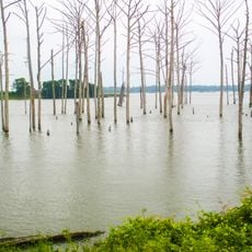
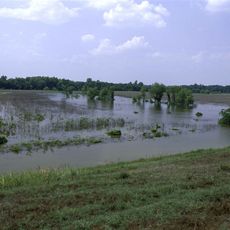
Stack Island is a river island sitting in the middle of the Mississippi River, close to the town of Lake Providence near the border of Mississippi and Louisiana. The island sits entirely within the river channel, with no bridge or road connection to either bank.

In the late 1700s, the island was known as a base for river pirates who preyed on cargo boats traveling the Mississippi. A series of powerful earthquakes in the early 1800s, part of the New Madrid seismic events, reshaped it so dramatically that its outline and position changed.

The name Stack Island appears in old river navigation records, linking it to the era when the Mississippi was the main highway of the interior. Today the island has no permanent human use and is left almost entirely to wildlife.

The island can only be reached by boat, and there are no facilities or marked paths once ashore. Water levels on the Mississippi vary greatly by season, so conditions for approaching the island change throughout the year.

Because the earthquakes shifted the island so far from its original position, the states of Mississippi and Louisiana ended up disputing which of them actually owned it, and the case reached the US Supreme Court in 1995. It is one of the very few times a geological event directly triggered a boundary dispute decided at that level.

The community of curious travelers

AroundUs brings together thousands of curated places, local tips, and hidden gems, enriched daily by 60,000 contributors worldwide.

Start exploring
Location
GPS coordinates
32.82920,-91.13360
Latest update
March 3, 2026 13:53
Around this place
Poverty Point
United States of America

Poverty Point

33.7 km
Greenville Bridge
United States of America

Greenville Bridge

51 km
Lakeport Plantation
United States of America

Lakeport Plantation

47.6 km
Benjamin G. Humphreys Bridge
United States of America

Benjamin G. Humphreys Bridge

51.8 km
Holly Bluff Site
United States of America

Holly Bluff Site

42.2 km
Mount Holly
United States of America

Mount Holly

30.9 km
Poverty Point Reservoir State Park
United States of America

Poverty Point Reservoir State Park

51.3 km
Belmont Plantation
United States of America

Belmont Plantation

49.9 km
Delta National Forest
United States of America

Delta National Forest

35.8 km
Panther Swamp National Wildlife Refuge
United States of America

Panther Swamp National Wildlife Refuge

53.4 km
Leroy Percy State Park
United States of America

Leroy Percy State Park

41.4 km
High Delta Safari Park
United States of America

High Delta Safari Park

46.3 km
Crescent Plantation
United States of America

Crescent Plantation

51.4 km
Junius R. Ward House
United States of America

Junius R. Ward House

31.6 km
Hermione
United States of America

Hermione

47 km
Scottland Plantation House
United States of America

Scottland Plantation House

47.9 km
Montrose Plantation House
United States of America

Montrose Plantation House

56.3 km
Fiske Theatre
United States of America

Fiske Theatre

24 km
First Baptist Church
United States of America

First Baptist Church

31.7 km
Louisiana State Cotton Museum
United States of America

Louisiana State Cotton Museum

7.2 km
Raffman Site
United States of America

Raffman Site

44.4 km
Madison Parish Courthouse
United States of America

Madison Parish Courthouse

47.2 km
American Legion Post No. 127 Building
United States of America

American Legion Post No. 127 Building

33.6 km
Parkdale Methodist Church
United States of America

Parkdale Methodist Church

50.6 km
Parkdale Baptist Church-AS0051
United States of America

Parkdale Baptist Church-AS0051

50.7 km
Dr. M.C. Hawkins House
United States of America

Dr. M.C. Hawkins House

50.5 km
Eudora City Hall
United States of America

Eudora City Hall

33.5 km
Dr. A.G. Anderson House
United States of America

Dr. A.G. Anderson House

33.4 km
Show the full map
Reviews
Share your experience

No review yet

Discussions
Start a discussion...

No discussion yet

« Stack Island - River island in Mississippi River, United States » is provided by Around Us (aroundus.com). Images and texts are derived from Wikimedia project under a Creative Commons license. You are allowed to copy, distribute, and modify copies of this page, under the conditions set by the license, as long as this note is clearly visible.

Discover hidden gems everywhere you go!

From secret cafés to breathtaking viewpoints, skip the crowded tourist spots and find places that match your style. Our app makes it easy with voice search, smart filtering, route optimization, and insider tips from travelers worldwide. Download now for the complete mobile experience.

Around Us App Screenshot

A unique approach to discovering new places

Le Figaro

All the places worth exploring

France Info

A tailor-made excursion in just a few clicks

20 Minutes

Around Us
Travel Guide & Maps
Download

Send to your phone

QR Code
1

Open the camera app on your mobile.

2

Point at the QR code with your camera. A notification will appear.

3

Tap the notification to open the link.