Chest opened
+${chestReward.xp} XP
Explorer
NOUVEAU ×${chestReward.collectible.quantity}
tapez pour fermer
Chest locked

Open chests in the app

Around Us is built for your phone — chests unlock when you walk, explore and capture nearby places.

Enable Location

We need your location to show you interesting places around you

Discover nearby places

Find interesting locations and hidden gems around you

Precise directions

Get accurate directions and distances to places

Your location is never shared with other users. It's only used when you tap the location button.

Natchez Trace Parkway

Log in to your account

Start exploring — it's free

Trusted by 72,933 travelers worldwide

Continue with Google
Continue with Apple
or

We will send you a code to connect

By continuing, you accept our Terms and Conditions and our Privacy Policy

Check your inbox

We've sent a pincode in your inbox. Please enter the code below.

Natchez Trace Parkway
Discussion Reviews 2 Photos
64.9k Popularity

Natchez Trace Parkway, National Parkway and All-American Road in Mississippi, US

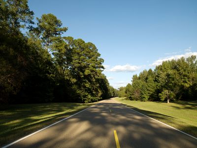
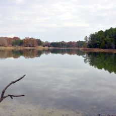
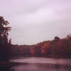
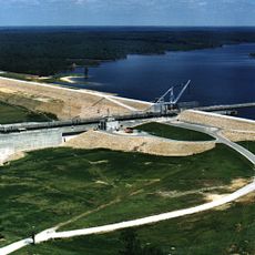
Natchez Trace Parkway is a two-lane road stretching more than seven hundred kilometers through Mississippi, Alabama and Tennessee, linking Natchez to Nashville. The route follows old paths and passes through open meadows, dense forests and rolling hills.

Indigenous groups used this connection for over ten thousand years as a travel corridor between settlements and hunting grounds. European settlers began expanding the route as a trade road between the Gulf and the northern river valleys in the late eighteenth century.

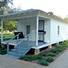
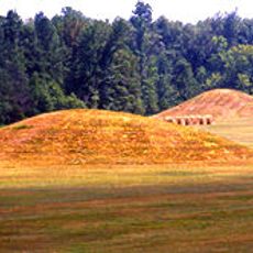
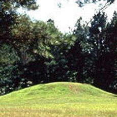
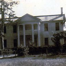
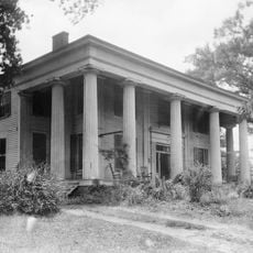
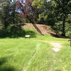
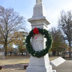
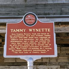
The name recalls an old trading path used by the Natchez people and early merchants moving between river ports. Along the route, visitors see reconstructed inns, burial mounds and markers that show how travelers once paused and traded goods.

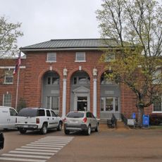
A visitor center near Tupelo provides maps, guides and information about hiking trails and rest stops along the route. The entire road has no traffic lights or intersections with other vehicles, allowing for calm driving.

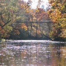
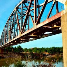
Cyclists and hikers share certain sections without motorized traffic, allowing undisturbed encounters with deer, wild turkeys and other animals. At some points, narrow bridges cross streams that still follow the same width as the old merchant paths.

The community of curious travelers

AroundUs brings together thousands of curated places, local tips, and hidden gems, enriched daily by 60,000 contributors worldwide.

Start exploring
Location
Location
Location
Inception
May 18, 1938
GPS coordinates
34.32997,-88.71181
Latest update
December 13, 2025 18:30
Around this place
Elvis Presley Birthplace
United States of America

Elvis Presley Birthplace

8.3 km
Tishomingo State Park
United States of America

Tishomingo State Park

56.8 km
Tupelo Automobile Museum
United States of America

Tupelo Automobile Museum

8 km
Pharr Mounds
United States of America

Pharr Mounds

31.1 km
Bay Springs Lake
United States of America

Bay Springs Lake

45.2 km
United States of America

Lyceum

57.5 km
Bynum Mound and Village Site
United States of America

Bynum Mound and Village Site

52.7 km
Lochinvar
United States of America

Lochinvar

29.9 km
Trace State Park
United States of America

Trace State Park

19.1 km
Tombigbee State Park
United States of America

Tombigbee State Park

13.3 km
Jamie Whitten Lock and Dam
United States of America

Jamie Whitten Lock and Dam

41.5 km
Reuben Davis House
United States of America

Reuben Davis House

58 km
Owl Creek Mounds
United States of America

Owl Creek Mounds

36.2 km
Fairpark
United States of America

Fairpark

8.2 km
Fulton Lock
United States of America

Fulton Lock

27.6 km
Judge Bates House
United States of America

Judge Bates House

55.2 km
G. V. Montgomery Lock
United States of America

G. V. Montgomery Lock

35.1 km
Ripley Historic District
United States of America

Ripley Historic District

48.1 km
Houston Carnegie Library
United States of America

Houston Carnegie Library

55.1 km
North Broadway Historic District
United States of America

North Broadway Historic District

7.8 km
First Methodist Church
United States of America

First Methodist Church

8 km
Downtown Booneville Historic District
United States of America

Downtown Booneville Historic District

38.7 km
Amory's Tribute to the Heroes of 1861–1865
United States of America

Amory's Tribute to the Heroes of 1861–1865

43.5 km
Stewart-Anderson House
United States of America

Stewart-Anderson House

7.5 km
Old U.S. Post Office
United States of America

Old U.S. Post Office

49.7 km
Tammy Wynette Legacy Center
United States of America

Tammy Wynette Legacy Center

42.6 km
Amory Railway Bridge
United States of America

Amory Railway Bridge

41.6 km
Tishomingo State Park Historic District
United States of America

Tishomingo State Park Historic District

57.3 km
Show the full map
Reviews
Share your experience

No review yet

Discussions
Start a discussion...

No discussion yet

« Natchez Trace Parkway - National Parkway and All-American Road in Mississippi, US » is provided by Around Us (aroundus.com). Images and texts are derived from Wikimedia project under a Creative Commons license. You are allowed to copy, distribute, and modify copies of this page, under the conditions set by the license, as long as this note is clearly visible.

Discover hidden gems everywhere you go!

From secret cafés to breathtaking viewpoints, skip the crowded tourist spots and find places that match your style. Our app makes it easy with voice search, smart filtering, route optimization, and insider tips from travelers worldwide. Download now for the complete mobile experience.

Around Us App Screenshot

A unique approach to discovering new places

Le Figaro

All the places worth exploring

France Info

A tailor-made excursion in just a few clicks

20 Minutes

Around Us
Travel Guide & Maps
Download

Send to your phone

QR Code
1

Open the camera app on your mobile.

2

Point at the QR code with your camera. A notification will appear.

3

Tap the notification to open the link.