Chest opened
+${chestReward.xp} XP
Explorer
NOUVEAU ×${chestReward.collectible.quantity}
tapez pour fermer
Chest locked

Open chests in the app

Around Us is built for your phone — chests unlock when you walk, explore and capture nearby places.

Enable Location

We need your location to show you interesting places around you

Discover nearby places

Find interesting locations and hidden gems around you

Precise directions

Get accurate directions and distances to places

Your location is never shared with other users. It's only used when you tap the location button.

Coosa River

Log in to your account

Start exploring — it's free

Trusted by 72,891 travelers worldwide

Continue with Google
Continue with Apple
or

We will send you a code to connect

By continuing, you accept our Terms and Conditions and our Privacy Policy

Check your inbox

We've sent a pincode in your inbox. Please enter the code below.

Coosa River
Discussion Reviews 1 Photos
28.1k Popularity

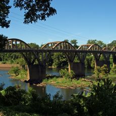
Coosa River, River system in northeastern Alabama, United States

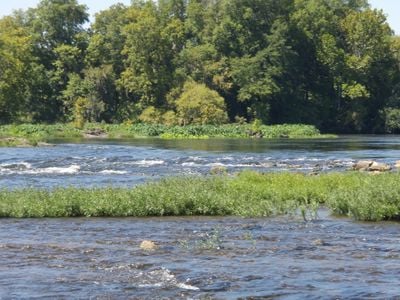
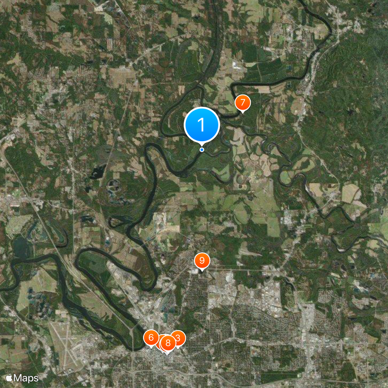
The Coosa River is a watercourse system in northeastern Alabama that flows for hundreds of kilometers before joining the Tallapoosa River. Seven dams along its course create reservoirs that serve recreation, power generation, and flood control.

Before European settlement, Native American tribes established villages along the banks and used the waters for travel and food. The arrival of settlers brought significant changes to the region.

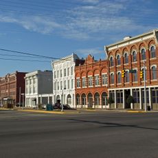
The name Coosa comes from the Muskogee language and refers to the Abihka people who once lived along its banks. Local communities today connect with the river through recreation and daily life.

The best time to visit is during mild weather when water conditions are safe and shorelines are easy to access. Check local conditions before arriving, as water levels and access points vary depending on seasonal changes and dam operations.

The river system is home to the Coosa Walleye, a fish species found naturally only in these waters. This rare fish makes the area particularly special for anglers and nature enthusiasts who visit.

The community of curious travelers

AroundUs brings together thousands of curated places, local tips, and hidden gems, enriched daily by 60,000 contributors worldwide.

Start exploring
Location
Location
Location
Location
Location
Location
Location
Location
Location
Location
Location
Location
Elevation above the sea
42 m
GPS coordinates
32.48625,-86.27775
Latest update
December 20, 2025 12:53
Around this place
Alabama State Capitol
United States of America

Alabama State Capitol

12.3 km
Cramton Bowl
United States of America

Cramton Bowl

12 km
Dexter Avenue Baptist Church
United States of America

Dexter Avenue Baptist Church

12.4 km
First White House of the Confederacy
United States of America

First White House of the Confederacy

12.4 km
The Legacy Museum
United States of America

The Legacy Museum

12.2 km
Fort Toulouse
United States of America

Fort Toulouse

3.3 km
Alabama State House
United States of America

Alabama State House

12.3 km
Montgomery Zoo
United States of America

Montgomery Zoo

7.2 km
Alabama Judicial Building
United States of America

Alabama Judicial Building

12.4 km
Fort Jackson
United States of America

Fort Jackson

2.8 km
Union Station
United States of America

Union Station

12.3 km
Confederate Memorial Monument
United States of America

Confederate Memorial Monument

12.2 km
Wetumpka State Penitentiary
United States of America

Wetumpka State Penitentiary

10.8 km
Old Alabama Town
United States of America

Old Alabama Town

11.9 km
St. John's Episcopal Church
United States of America

St. John's Episcopal Church

12.2 km
The Murphy House
United States of America

The Murphy House

12.2 km
Bibb Graves Bridge
United States of America

Bibb Graves Bridge

8.8 km
Statue of Jefferson Davis
United States of America

Statue of Jefferson Davis

12.3 km
First Baptist Church of Wetumpka
United States of America

First Baptist Church of Wetumpka

8.6 km
First Presbyterian Church of Wetumpka
United States of America

First Presbyterian Church of Wetumpka

8.8 km
Lower Commerce Street Historic District
United States of America

Lower Commerce Street Historic District

12.2 km
Robinson Springs United Methodist Church
United States of America

Robinson Springs United Methodist Church

9.6 km
Patrick Henry Brittan House
United States of America

Patrick Henry Brittan House

11.8 km
Cassimus House
United States of America

Cassimus House

12.1 km
First United Methodist Church
United States of America

First United Methodist Church

9.2 km
Town of Spectre
United States of America

Town of Spectre

6.5 km
Rice-Semple-Haardt House
United States of America

Rice-Semple-Haardt House

12.1 km
Alabama State Capitol Grounds
United States of America

Alabama State Capitol Grounds

12.3 km
Show the full map
Reviews
Share your experience

No review yet

Discussions
Start a discussion...

No discussion yet

« Coosa River - River system in northeastern Alabama, United States » is provided by Around Us (aroundus.com). Images and texts are derived from Wikimedia project under a Creative Commons license. You are allowed to copy, distribute, and modify copies of this page, under the conditions set by the license, as long as this note is clearly visible.

Discover hidden gems everywhere you go!

From secret cafés to breathtaking viewpoints, skip the crowded tourist spots and find places that match your style. Our app makes it easy with voice search, smart filtering, route optimization, and insider tips from travelers worldwide. Download now for the complete mobile experience.

Around Us App Screenshot

A unique approach to discovering new places

Le Figaro

All the places worth exploring

France Info

A tailor-made excursion in just a few clicks

20 Minutes

Around Us
Travel Guide & Maps
Download

Send to your phone

QR Code
1

Open the camera app on your mobile.

2

Point at the QR code with your camera. A notification will appear.

3

Tap the notification to open the link.