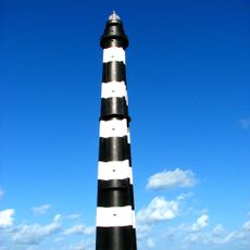
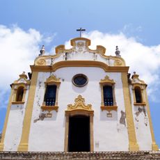
Atol das Rocas Lighthouse, Lighthouse on Rocas Atoll, Rio Grande do Norte, Brazil.
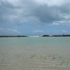
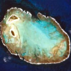
Leuchtturm Rocas is a lighthouse tower standing on a circular coral atoll off the coast of Rio Grande do Norte, Brazil. The structure sits on a reef formation approximately 2 kilometers in diameter and serves as a navigation marker for ships traveling in Atlantic waters.
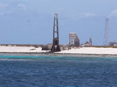
Following numerous shipwrecks around the atoll, authorities established the first light signal in 1883 to warn vessels of the reef's presence. This beacon transformed navigation in the area and significantly reduced maritime incidents in subsequent years.
This lighthouse represents Brazil's commitment to safe ocean passage and maritime responsibility in one of the Atlantic's most remote locations. It serves as a symbol of human effort to navigate and protect vessels in challenging waters far from the mainland.
The lighthouse operates entirely on solar power through panels and batteries, requiring no external energy supply regardless of season. Access to this remote atoll is challenging and limited, so advance planning and local guidance are essential for any visit.
The atoll's waters account for eighteen documented shipwrecks spanning different periods of maritime history. Despite this troubled past, the reef has become a vital reference point that guides modern vessels safely through Atlantic waters.
The community of curious travelers
AroundUs brings together thousands of curated places, local tips, and hidden gems, enriched daily by 60,000 contributors worldwide.