Chimanimani Mountains

Log in to your account

AroundUs is a community-driven map of interesting places, built by curious explorers like you. It grows with every review, story, and photo you share.
Connect to save your favorite spots, contribute locations, and create personalized routes.
Continue with Google
Continue with Apple
Continue with X
Continue with Facebook
Continue with email
By continuing, you accept our Terms and Conditions and our Privacy Policy
Create an account

Chimanimani Mountains

Add to collection
Map
Suggest a change
Share

Chimanimani Mountains, Mountain range in Eastern Highlands, Zimbabwe and Mozambique

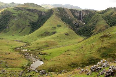
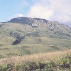
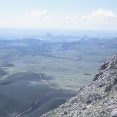
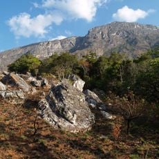
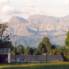
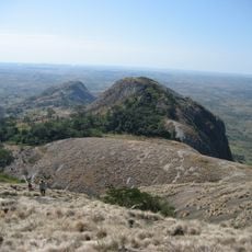
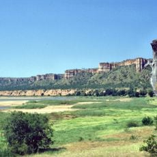
The Chimanimani Mountains form a ridge-like range along the Zimbabwe-Mozambique border with distinctive quartzite rock formations that rise steeply from surrounding valleys. The peaks create a dramatic natural boundary while connecting protected areas on both sides of the international frontier.

The Ndau people lived in the surrounding valleys for centuries before European colonial forces arrived in the region during the 1890s. The border drawn between Zimbabwe and Mozambique split communities that had always moved freely across the landscape.

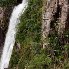
The mountains hold deep meaning for the communities living in the valleys below, shaping how people move and settle across the border region. Local traditions and pathways have developed around the natural features and water sources found throughout the range.

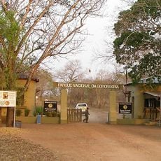
You can reach the mountains from Zimbabwe's side through the national park or from Mozambique through the reserve, both offering marked trails and camping facilities. The dry season provides the most comfortable conditions for hiking and exploring the ridge walks.

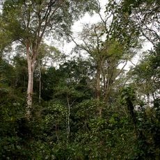
The highest areas of the mountains are home to plant and animal species found nowhere else on Earth, thriving in the cool conditions above 1,000 meters. These rare species are the reason the mountains were protected as conservation areas on both sides of the border.

Location: Mozambique

Location: Manicaland

Elevation above the sea: 1,413 m

GPS coordinates: -19.86667,33.10000

Latest update: December 6, 2025 17:41

Photos
Photo spots in Mozambique

Mozambique stretches along the Indian Ocean coast for 1,500 miles (2,400 kilometers) and presents photographers with diverse subjects. The coastal region includes archipelagos such as Bazaruto and Quirimbas with white sand beaches and coral reefs. Along the shore sit historic structures like Macuti...

Reviews

Visited this place? Tap the stars to rate it and share your experience / photos with the community! Try now! You can cancel it anytime.

« Chimanimani Mountains - Mountain range in Eastern Highlands, Zimbabwe and Mozambique » is provided by Around Us (aroundus.com). Images and texts are derived from Wikimedia project under a Creative Commons license. You are allowed to copy, distribute, and modify copies of this page, under the conditions set by the license, as long as this note is clearly visible.

Discover hidden gems everywhere you go!

From secret cafés to breathtaking viewpoints, skip the crowded tourist spots and find places that match your style. Our app makes it easy with voice search, smart filtering, route optimization, and insider tips from travelers worldwide. Download now for the complete mobile experience.

Around Us App Screenshot

A unique approach to discovering new places

Le Figaro

All the places worth exploring

France Info

A tailor-made excursion in just a few clicks

20 Minutes