
Ramanuju, subdistrict in Cilegon City, Banten, Indonesia
Location: Purwakarta
Elevation above the sea: 24 m
GPS coordinates: -6.00528,106.03167
Latest update: June 13, 2025 16:40

Great Mosque of Banten
14.1 km
Gunung Karang
29.9 km
Rakata
67.1 km
Pantai Carita
38.7 km
Pulosari
37.9 km
Siger Tower
34.9 km
Pantai Marina
24.8 km
Gunung Rajabasa
50.9 km
Pusat Rekreasi Amsterdam
63.5 km
Fun Park
63.3 km
Benteng Heritage Museum
69 km
Kali Pasir Mosque
68.9 km
Pantai Karangsari
38.8 km
Tanjung Lesung Beach
67.1 km
Rawa Danau Nature Reserve
18.3 km
Cikoneng Lighthouse
17.8 km
Kasunyatan Mosque
14.8 km
Masjid Carita
40.5 km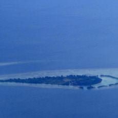
Payung Besar Island
61.4 km
Wisata Pantai
66.2 km
Pantai PAsir Perawan
67.5 km
Aryana Aquaplay
66.4 km
Masjid Caringin
45.2 km
Pantai Pasir Panjang
20.9 km
Pulau Anak Krakatau natural reserve
67.8 km
Pantai Matahari
35 km
Pantai Bulakan
29.8 km
Pantai Badur
67 kmReviews
Visited this place? Tap the stars to rate it and share your experience / photos with the community! Try now! You can cancel it anytime.
Discover hidden gems everywhere you go!
From secret cafés to breathtaking viewpoints, skip the crowded tourist spots and find places that match your style. Our app makes it easy with voice search, smart filtering, route optimization, and insider tips from travelers worldwide. Download now for the complete mobile experience.

A unique approach to discovering new places❞
— Le Figaro
All the places worth exploring❞
— France Info
A tailor-made excursion in just a few clicks❞
— 20 Minutes