Point of Pines Sites

Log in to your account

AroundUs is a community-driven map of interesting places, built by curious explorers like you. It grows with every review, story, and photo you share.
Connect to save your favorite spots, contribute locations, and create personalized routes.
By continuing, you accept our Terms and Conditions and our Privacy Policy
Add to collection
Map
Suggest a change
Share

Point of Pines Sites, Archaeological site in San Carlos Apache Reservation, Arizona.

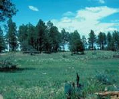
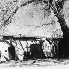
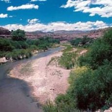
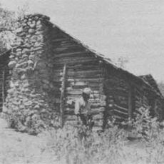
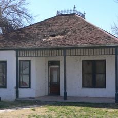
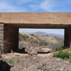
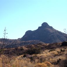
Point of Pines Sites are multiple archaeological locations in the eastern portion of San Carlos Apache Reservation containing remains of prehistoric settlements. The sites near Nantack Ridge hold building structures and numerous artifacts that show how people lived in this area long ago.

The site was established in 1946 as a field school led by Dr. Emil Haury, where systematic excavations took place over several years. The research provided important findings about how settlements developed and changed over time in this region during prehistoric periods.

The sites show evidence of people who lived here centuries ago and practiced different crafts visible through pottery styles and building methods. Found objects and structures tell stories of contact between groups from different regions who shared knowledge and goods.

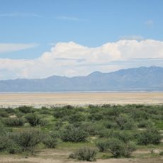
The location sits on tribal land and access is limited; visiting requires proper permission and is often guided. It is important to arrange access ahead of time and follow all rules since the area is protected and reserved for research purposes.

Among the discoveries were items with patterns from distant groups showing that people here traded with neighbors hundreds of miles away. These objects suggest that trading networks existed even then, connecting distant communities.

Location: Arizona

GPS coordinates: 32.83333,-109.71667

Latest update: December 13, 2025 12:42

Photos
Around this place
Large Binocular Telescope
United States of America

Large Binocular Telescope

21.8 km
Vatican Advanced Technology Telescope
United States of America

Vatican Advanced Technology Telescope

22 km
Mount Graham
United States of America

Mount Graham

20.6 km
Morenci Mine
United States of America

Morenci Mine

43.5 km
Mount Graham International Observatory
United States of America

Mount Graham International Observatory

22 km
Sierra Bonita Ranch
United States of America

Sierra Bonita Ranch

47 km
Willcox Playa
United States of America

Willcox Playa

78.1 km
Roper Lake State Park
United States of America

Roper Lake State Park

8.7 km
Heinrich Hertz Submillimeter Telescope
United States of America

Heinrich Hertz Submillimeter Telescope

22 km
Gila Box Riparian National Conservation Area
United States of America

Gila Box Riparian National Conservation Area

23.9 km
Galiuro Wilderness
United States of America

Galiuro Wilderness

63.7 km
Rex Allen Arizona Cowboy Museum and Willcox Cowboy Hall of Fame
United States of America

Rex Allen Arizona Cowboy Museum and Willcox Cowboy Hall of Fame

65.5 km
Park Avenue Bridge
United States of America

Park Avenue Bridge

46.2 km
Clifton Townsite Historic District
United States of America

Clifton Townsite Historic District

46.3 km
William Talley House
United States of America

William Talley House

956 m
Benjamin F. Billingsley House
United States of America

Benjamin F. Billingsley House

58.5 km
Gila River Bridge
United States of America

Gila River Bridge

40.8 km
Graham County Courthouse
United States of America

Graham County Courthouse

68 m
Columbine Work Station
United States of America

Columbine Work Station

23.4 km
Black Gap Bridge
United States of America

Black Gap Bridge

39.2 km
Johnson-Tillotson House
United States of America

Johnson-Tillotson House

65.5 km
John Gung'l House
United States of America

John Gung'l House

65.6 km
James R. Welker House
United States of America

James R. Welker House

922 m
Benjamin E. Briscoe House
United States of America

Benjamin E. Briscoe House

65.1 km
Woman's Club
United States of America

Woman's Club

644 m
Fort Bowie National Historic Site
United States of America

Fort Bowie National Historic Site

80.1 km
Bowie School District No. 14
United States of America

Bowie School District No. 14

60.4 km
Chase Creek Railroad Bridge
United States of America

Chase Creek Railroad Bridge

46.2 km
Show the full map
Reviews

Visited this place? Tap the stars to rate it and share your experience / photos with the community! Try now! You can cancel it anytime.

« Point of Pines Sites - Archaeological site in San Carlos Apache Reservation, Arizona » is provided by Around Us (aroundus.com). Images and texts are derived from Wikimedia project under a Creative Commons license. You are allowed to copy, distribute, and modify copies of this page, under the conditions set by the license, as long as this note is clearly visible.

Discover hidden gems everywhere you go!

From secret cafés to breathtaking viewpoints, skip the crowded tourist spots and find places that match your style. Our app makes it easy with voice search, smart filtering, route optimization, and insider tips from travelers worldwide. Download now for the complete mobile experience.

Around Us App Screenshot

A unique approach to discovering new places

Le Figaro

All the places worth exploring

France Info

A tailor-made excursion in just a few clicks

20 Minutes