Enable Location

We need your location to show you interesting places around you

Discover nearby places

Find interesting locations and hidden gems around you

Precise directions

Get accurate directions and distances to places

Your location is never shared with other users. It's only used when you tap the location button.

Roper Lake State Park

Log in to your account

Start exploring — it's free

Trusted by 61,977 travelers worldwide

Continue with Google
Continue with Apple
or

We will send you a code to connect

By continuing, you accept our Terms and Conditions and our Privacy Policy

Check your inbox

We've sent a pincode in your inbox. Please enter the code below.

Roper Lake State Park

Roper Lake State Park, State park in Safford, Arizona.

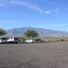
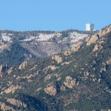
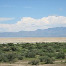
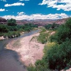
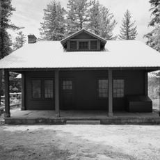
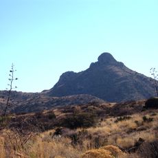
Roper Lake State Park is a recreation area in southeastern Arizona at the base of Mount Graham, featuring a lake for swimming and boating, multiple campgrounds, and hiking trails through the surrounding landscape. The park combines water activities with woodland trails and natural scenery.

The park was established in 1972 as part of Arizona's effort to develop recreational areas in the Madrean Archipelago region. This development brought organized outdoor facilities to a previously undeveloped corner of southeastern Arizona.

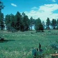
The lake and surrounding woodlands draw bird watchers who observe native species like Gambel's quail and great horned owls in their natural habitat. The shoreline and trees create natural viewing spots for visitors interested in local wildlife.

The park offers multiple campgrounds with varying facilities, from sites with water and electric hookups to simpler tent camping areas. Visitors should plan visits around seasonal weather, as the lake and trails remain accessible year-round.

Natural thermal springs feed a dedicated warm-water swimming area that stays heated year-round without artificial warming. This geothermal feature offers an unusual contrast to the cool alpine lake.

The community of curious travelers

AroundUs brings together thousands of curated places, local tips, and hidden gems, enriched daily by 60,000 contributors worldwide.

Start exploring
Location
Inception
1972
GPS coordinates
32.75580,-109.70500
Latest update
December 8, 2025 20:03
Around this place
Large Binocular Telescope
United States of America

Large Binocular Telescope

18.3 km
Vatican Advanced Technology Telescope
United States of America

Vatican Advanced Technology Telescope

18.5 km
Mount Graham
United States of America

Mount Graham

16.7 km
Morenci Mine
United States of America

Morenci Mine

48.9 km
Mount Graham International Observatory
United States of America

Mount Graham International Observatory

18.5 km
Sierra Bonita Ranch
United States of America

Sierra Bonita Ranch

41.6 km
Willcox Playa
United States of America

Willcox Playa

69.7 km
Heinrich Hertz Submillimeter Telescope
United States of America

Heinrich Hertz Submillimeter Telescope

18.5 km
Gila Box Riparian National Conservation Area
United States of America

Gila Box Riparian National Conservation Area

27.7 km
Galiuro Wilderness
United States of America

Galiuro Wilderness

61.5 km
Point of Pines Sites
United States of America

Point of Pines Sites

8.7 km
Rex Allen Arizona Cowboy Museum and Willcox Cowboy Hall of Fame
United States of America

Rex Allen Arizona Cowboy Museum and Willcox Cowboy Hall of Fame

57.2 km
Park Avenue Bridge
United States of America

Park Avenue Bridge

50.6 km
Clifton Townsite Historic District
United States of America

Clifton Townsite Historic District

50.6 km
William Talley House
United States of America

William Talley House

8 km
Benjamin F. Billingsley House
United States of America

Benjamin F. Billingsley House

56.2 km
Gila River Bridge
United States of America

Gila River Bridge

43.8 km
Graham County Courthouse
United States of America

Graham County Courthouse

8.7 km
Columbine Work Station
United States of America

Columbine Work Station

20.3 km
Black Gap Bridge
United States of America

Black Gap Bridge

41.8 km
Johnson-Tillotson House
United States of America

Johnson-Tillotson House

57.2 km
John Gung'l House
United States of America

John Gung'l House

57.4 km
James R. Welker House
United States of America

James R. Welker House

7.9 km
Benjamin E. Briscoe House
United States of America

Benjamin E. Briscoe House

56.9 km
Woman's Club
United States of America

Woman's Club

8.6 km
Fort Bowie National Historic Site
United States of America

Fort Bowie National Historic Site

71.6 km
Bowie School District No. 14
United States of America

Bowie School District No. 14

52 km
Chase Creek Railroad Bridge
United States of America

Chase Creek Railroad Bridge

50.6 km
Show the full map
« Roper Lake State Park - State park in Safford, Arizona » is provided by Around Us (aroundus.com). Images and texts are derived from Wikimedia project under a Creative Commons license. You are allowed to copy, distribute, and modify copies of this page, under the conditions set by the license, as long as this note is clearly visible.

Discover hidden gems everywhere you go!

From secret cafés to breathtaking viewpoints, skip the crowded tourist spots and find places that match your style. Our app makes it easy with voice search, smart filtering, route optimization, and insider tips from travelers worldwide. Download now for the complete mobile experience.

Around Us App Screenshot

A unique approach to discovering new places

Le Figaro

All the places worth exploring

France Info

A tailor-made excursion in just a few clicks

20 Minutes

Around Us
Travel Guide & Maps
Download

Send to your phone

QR Code
1

Open the camera app on your mobile.

2

Point at the QR code with your camera. A notification will appear.

3

Tap the notification to open the link.