Chest opened
+${chestReward.xp} XP
Explorer
NOUVEAU ×${chestReward.collectible.quantity}
tapez pour fermer
Chest locked

Open chests in the app

Around Us is built for your phone — chests unlock when you walk, explore and capture nearby places.

Enable Location

We need your location to show you interesting places around you

Discover nearby places

Find interesting locations and hidden gems around you

Precise directions

Get accurate directions and distances to places

Your location is never shared with other users. It's only used when you tap the location button.

Lugoff

Log in to your account

Start exploring — it's free

Trusted by 72,878 travelers worldwide

Continue with Google
Continue with Apple
or

We will send you a code to connect

By continuing, you accept our Terms and Conditions and our Privacy Policy

Check your inbox

We've sent a pincode in your inbox. Please enter the code below.

Discussion Reviews 1 Photos
14.7k Popularity

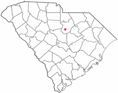
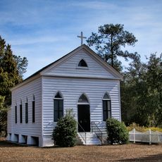
Lugoff, Census-designated place in Kershaw County, South Carolina.

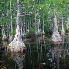
Lugoff is a census-designated place in Kershaw County, situated southwest of Camden with the Wateree River marking its eastern edge. This residential community sits at a crossroads with major transportation routes connecting to larger cities.

The settlement was named after Count Lugoff, a Russian engineer who oversaw railway construction in 1899 that influenced the area's early development. This rail connection shaped how the community grew and connected to the broader region.

The Christmas parade draws families and locals who gather in December to celebrate together through the community streets with festive decorations and lights.

Interstate 20 and US Routes 1 and 601 intersect here, providing direct connections to Columbia and other major South Carolina cities. This crossroads location makes it easy to explore the area and reach nearby destinations.

The community experienced substantial population growth between 2010 and 2020, indicating it became an attractive place for families to settle. This expansion shows how the area transformed from a traditional rural settlement into a modern residential community.

The community of curious travelers

AroundUs brings together thousands of curated places, local tips, and hidden gems, enriched daily by 60,000 contributors worldwide.

Start exploring
Location
Elevation above the sea
80 m
GPS coordinates
34.22056,-80.69194
Latest update
December 7, 2025 20:20
Around this place
Sesquicentennial State Park
United States of America

Sesquicentennial State Park

24.5 km
Mulberry Plantation
United States of America

Mulberry Plantation

9.3 km
Camden Battlefield
United States of America

Camden Battlefield

16 km
Strom Thurmond Federal Building and United States Courthouse
United States of America

Strom Thurmond Federal Building and United States Courthouse

32.1 km
Goodale State Park
United States of America

Goodale State Park

17.3 km
Cool Springs
United States of America

Cool Springs

11.1 km
Bethesda Presbyterian Church
United States of America

Bethesda Presbyterian Church

8.5 km
Boykin Mill Complex
United States of America

Boykin Mill Complex

15.1 km
St. Philip's Episcopal Church
United States of America

St. Philip's Episcopal Church

27.8 km
Stateburg Historic District
United States of America

Stateburg Historic District

32.3 km
Good Hope Baptist Church
United States of America

Good Hope Baptist Church

31.3 km
Orange Grove
United States of America

Orange Grove

30.6 km
City of Camden Historic District
United States of America

City of Camden Historic District

8.3 km
George P. Hoffman House
United States of America

George P. Hoffman House

25.8 km
Kendall Mill Historic District
United States of America

Kendall Mill Historic District

10.2 km
Valencia
United States of America

Valencia

29.3 km
Lenoir Store
United States of America

Lenoir Store

24.9 km
Magnolia Hall
United States of America

Magnolia Hall

21.8 km
Liberty Hill Historic District
United States of America

Liberty Hill Historic District

29.8 km
Zachariah Cantey House
United States of America

Zachariah Cantey House

14.3 km
High Hills of Santee Baptist Church
United States of America

High Hills of Santee Baptist Church

30 km
Century House
United States of America

Century House

26.2 km
Blink Bonnie
United States of America

Blink Bonnie

17.6 km
Thomas English House
United States of America

Thomas English House

15 km
Ridgeway Historic District
United States of America

Ridgeway Historic District

26.5 km
Ruff's Chapel
United States of America

Ruff's Chapel

26.1 km
Monroe Wilson House
United States of America

Monroe Wilson House

27 km
Historic Camden Revolutionary War
United States of America

Historic Camden Revolutionary War

8.2 km
Show the full map
Reviews
Share your experience

No review yet

Discussions
Start a discussion...

No discussion yet

« Lugoff - Census-designated place in Kershaw County, South Carolina » is provided by Around Us (aroundus.com). Images and texts are derived from Wikimedia project under a Creative Commons license. You are allowed to copy, distribute, and modify copies of this page, under the conditions set by the license, as long as this note is clearly visible.

Discover hidden gems everywhere you go!

From secret cafés to breathtaking viewpoints, skip the crowded tourist spots and find places that match your style. Our app makes it easy with voice search, smart filtering, route optimization, and insider tips from travelers worldwide. Download now for the complete mobile experience.

Around Us App Screenshot

A unique approach to discovering new places

Le Figaro

All the places worth exploring

France Info

A tailor-made excursion in just a few clicks

20 Minutes

Around Us
Travel Guide & Maps
Download

Send to your phone

QR Code
1

Open the camera app on your mobile.

2

Point at the QR code with your camera. A notification will appear.

3

Tap the notification to open the link.