Chest opened
+${chestReward.xp} XP
Explorer
NOUVEAU ×${chestReward.collectible.quantity}
tapez pour fermer
Chest locked

Open chests in the app

Around Us is built for your phone — chests unlock when you walk, explore and capture nearby places.

Enable Location

We need your location to show you interesting places around you

Discover nearby places

Find interesting locations and hidden gems around you

Precise directions

Get accurate directions and distances to places

Your location is never shared with other users. It's only used when you tap the location button.

Diablo Range

Log in to your account

Start exploring — it's free

Trusted by 72,889 travelers worldwide

Continue with Google
Continue with Apple
or

We will send you a code to connect

By continuing, you accept our Terms and Conditions and our Privacy Policy

Check your inbox

We've sent a pincode in your inbox. Please enter the code below.

Diablo Range
Discussion Reviews 2 Photos
26.4k Popularity

Diablo Range, Mountain range in eastern San Francisco Bay Area, California

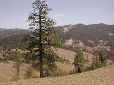
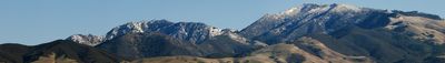
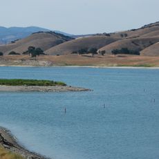
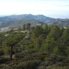
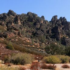
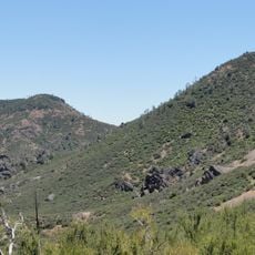
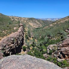
The Diablo Range is a mountain chain east of San Francisco Bay made of sedimentary rock layers that rise up to 3,849 feet. The range displays a distinctive shape when viewed from different directions and covers a substantial area.

The range served as a key reference point for surveying operations during the 1850s across California. These surveys shaped boundary lines that extended into neighboring states to the east.

The mountain held deep meaning for the Ohlone people, who wove it into their creation stories and spiritual traditions. This place remained central to how local communities understood their relationship with the land.

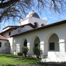
The surrounding Mount Diablo State Park offers hiking trails, picnic areas, and a visitor center with geological displays. Plan to explore different routes depending on your interests and physical ability.

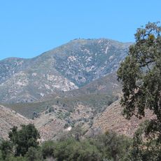
The rocks here formed during the Jurassic period in ocean depths and were pushed upward by tectonic forces over millions of years. You can see layers of stone that tell this dramatic story of earth movement.

The community of curious travelers

AroundUs brings together thousands of curated places, local tips, and hidden gems, enriched daily by 60,000 contributors worldwide.

Start exploring
Location
Elevation above the sea
1,597 m
Made from material
sedimentary rock
GPS coordinates
36.36970,-120.64430
Latest update
December 20, 2025 15:10
Around this place
Mission San Antonio de Padua
United States of America

Mission San Antonio de Padua

67.2 km
Avenal State Prison
United States of America

Avenal State Prison

64.4 km
Mission San Miguel Arcángel
United States of America

Mission San Miguel Arcángel

69.8 km
Lake Nacimiento
United States of America

Lake Nacimiento

75.3 km
Mission Nuestra Señora de la Soledad
United States of America

Mission Nuestra Señora de la Soledad

63.9 km
Lake San Antonio
United States of America

Lake San Antonio

64.7 km
The Hacienda
United States of America

The Hacienda

67 km
Junipero Serra Peak
United States of America

Junipero Serra Peak

73.9 km
Randall Fawcett House
United States of America

Randall Fawcett House

69.7 km
Kettleman Hills Hazardous Waste Facility
United States of America

Kettleman Hills Hazardous Waste Facility

72.8 km
San Benito mountain
United States of America

San Benito mountain

4 m
Kearney Park
United States of America

Kearney Park

76 km
Laguna Mountain Recreation Area
United States of America

Laguna Mountain Recreation Area

18.7 km
Hernandez Reservoir
United States of America

Hernandez Reservoir

16.1 km
Rios-Caledonia Adobe
United States of America

Rios-Caledonia Adobe

70.5 km
King City High School Auditorium
United States of America

King City High School Auditorium

47.2 km
M. Young Botanic Garden
United States of America

M. Young Botanic Garden

65.4 km
Estrella Adobe Church
United States of America

Estrella Adobe Church

76.7 km
Pinnacles National Forest
United States of America

Pinnacles National Forest

51.8 km
Odd Fellows Hall
United States of America

Odd Fellows Hall

73.1 km
Mission Soledad Museum
United States of America

Mission Soledad Museum

63.9 km
Bear Gulch Reservoir
United States of America

Bear Gulch Reservoir

50.1 km
Juniper Canyon Trail
United States of America

Juniper Canyon Trail

51.5 km
Fort Hunter Liggett
United States of America

Fort Hunter Liggett

70.3 km
Balconies Trail
United States of America

Balconies Trail

52.1 km
Bear Valley School
United States of America

Bear Valley School

48.6 km
Chalone Peak Lookout
United States of America

Chalone Peak Lookout

50.2 km
Moses Spring Trailhead
United States of America

Moses Spring Trailhead

49.8 km
Show the full map
Reviews
Share your experience

No review yet

Discussions
Start a discussion...

No discussion yet

« Diablo Range - Mountain range in eastern San Francisco Bay Area, California » is provided by Around Us (aroundus.com). Images and texts are derived from Wikimedia project under a Creative Commons license. You are allowed to copy, distribute, and modify copies of this page, under the conditions set by the license, as long as this note is clearly visible.

Discover hidden gems everywhere you go!

From secret cafés to breathtaking viewpoints, skip the crowded tourist spots and find places that match your style. Our app makes it easy with voice search, smart filtering, route optimization, and insider tips from travelers worldwide. Download now for the complete mobile experience.

Around Us App Screenshot

A unique approach to discovering new places

Le Figaro

All the places worth exploring

France Info

A tailor-made excursion in just a few clicks

20 Minutes

Around Us
Travel Guide & Maps
Download

Send to your phone

QR Code
1

Open the camera app on your mobile.

2

Point at the QR code with your camera. A notification will appear.

3

Tap the notification to open the link.