Enable Location

We need your location to show you interesting places around you

Discover nearby places

Find interesting locations and hidden gems around you

Precise directions

Get accurate directions and distances to places

Your location is never shared with other users. It's only used when you tap the location button.

California State Route 238

Log in to your account

Start exploring — it's free

Trusted by 61,902 travelers worldwide

Continue with Google
Continue with Apple
or

We will send you a code to connect

By continuing, you accept our Terms and Conditions and our Privacy Policy

Check your inbox

We've sent a pincode in your inbox. Please enter the code below.

California State Route 238

California State Route 238, Transportation corridor in Alameda County, US

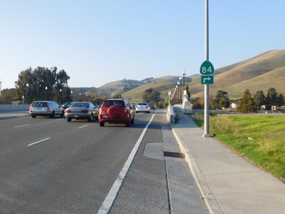
California State Route 238 is a north-south highway in Alameda County that connects Interstate 680 in Fremont to Interstate 580 in Castro Valley. The road consists of a mix of surface streets and faster sections that pass through several East Bay communities.

The route received its current designation in 1964, replacing the former State Route 9. Later sections were integrated into Interstate 238, reflecting the region's evolving transportation infrastructure.

A section called Mission Boulevard runs past Mission San José, a location important to the area's early Spanish colonial period and settlement history.

The route facilitates travel between several East Bay communities and alternates between regular city streets and faster roadways. Drivers should expect varying speed limits depending on the time of day and section.

The roadway alignment follows the Hayward Fault, a major geological feature running through the eastern San Francisco Bay Area. This alignment with an active fault line subtly shapes the region's physical infrastructure.

The community of curious travelers

AroundUs brings together thousands of curated places, local tips, and hidden gems, enriched daily by 60,000 contributors worldwide.

Start exploring
Location
Inception
July 1, 1964
GPS coordinates
37.61376,-122.00998
Latest update
December 10, 2025 15:55
Around this place
Show the full map
« California State Route 238 - Transportation corridor in Alameda County, US » is provided by Around Us (aroundus.com). Images and texts are derived from Wikimedia project under a Creative Commons license. You are allowed to copy, distribute, and modify copies of this page, under the conditions set by the license, as long as this note is clearly visible.

Discover hidden gems everywhere you go!

From secret cafés to breathtaking viewpoints, skip the crowded tourist spots and find places that match your style. Our app makes it easy with voice search, smart filtering, route optimization, and insider tips from travelers worldwide. Download now for the complete mobile experience.

Around Us App Screenshot

A unique approach to discovering new places

Le Figaro

All the places worth exploring

France Info

A tailor-made excursion in just a few clicks

20 Minutes

Around Us
Travel Guide & Maps
Download

Send to your phone

QR Code
1

Open the camera app on your mobile.

2

Point at the QR code with your camera. A notification will appear.

3

Tap the notification to open the link.