Chest opened
+${chestReward.xp} XP
Explorer
NOUVEAU ×${chestReward.collectible.quantity}
tapez pour fermer
Chest locked

Open chests in the app

Around Us is built for your phone — chests unlock when you walk, explore and capture nearby places.

Enable Location

We need your location to show you interesting places around you

Discover nearby places

Find interesting locations and hidden gems around you

Precise directions

Get accurate directions and distances to places

Your location is never shared with other users. It's only used when you tap the location button.

Log in to your account

Start exploring — it's free

Trusted by 73,045 travelers worldwide

Continue with Google
Continue with Apple
or

We will send you a code to connect

By continuing, you accept our Terms and Conditions and our Privacy Policy

Check your inbox

We've sent a pincode in your inbox. Please enter the code below.

Oakland Air Route Traffic Control Center
Discussion Reviews Photo
4.1k Popularity

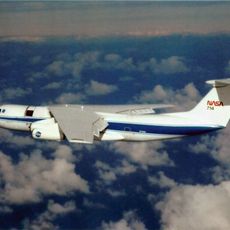
Oakland Air Route Traffic Control Center, Air traffic control center in Fremont, California, United States.

The Oakland Air Route Traffic Control Center in Fremont directs flight operations across a large region of California and Nevada airspace. The facility employs specialized controllers who continuously monitor aircraft movements and manage communication between pilots and ground personnel.

The center was established as one of the original air traffic control facilities created to improve aviation safety across the United States. Its founding represented a major shift toward centralized management of aircraft movements in the region.

Controllers at Oakland Center maintain strict communication protocols and precise coordination methods to ensure safe passage of aircraft through their jurisdiction.

The facility operates continuously with rotating teams to maintain constant monitoring. Visitors should know that most areas are restricted from public access for security reasons.

The center monitors airspace over the Pacific Ocean and covers one of the world's busiest international flight corridors. This oceanic responsibility makes it crucial for long-distance flights traveling to and from Asia.

The community of curious travelers

AroundUs brings together thousands of curated places, local tips, and hidden gems, enriched daily by 60,000 contributors worldwide.

Start exploring
GPS coordinates
37.54300,-122.01600
Latest update
December 11, 2025 11:08
Around this place
Shoreline Amphitheatre
United States of America

Shoreline Amphitheatre

14.2 km
Mission San José
United States of America

Mission San José

8.6 km
Mission Peak
United States of America

Mission Peak

12.4 km
Dumbarton Bridge
United States of America

Dumbarton Bridge

9.8 km
Kuiper Airborne Observatory
United States of America

Kuiper Airborne Observatory

14.4 km
Niles Canyon
United States of America

Niles Canyon

6.1 km
Don Edwards San Francisco Bay National Wildlife Refuge
United States of America

Don Edwards San Francisco Bay National Wildlife Refuge

6.6 km
Ardenwood Historic Farm
United States of America

Ardenwood Historic Farm

3.4 km
Shoreline Park, Mountain View
United States of America

Shoreline Park, Mountain View

14.3 km
Sunol Water Temple
United States of America

Sunol Water Temple

12.5 km
Dumbarton Rail Bridge
United States of America

Dumbarton Rail Bridge

10.5 km
Coyote Hills Regional Park
United States of America

Coyote Hills Regional Park

5.8 km
Rengstorff House
United States of America

Rengstorff House

13.9 km
Eden Landing Ecological Reserve
United States of America

Eden Landing Ecological Reserve

10.7 km
Quarry Lakes Regional Recreation Area
United States of America

Quarry Lakes Regional Recreation Area

3.9 km
Mount Allison
United States of America

Mount Allison

13.7 km
Golden Gate Railroad Museum
United States of America

Golden Gate Railroad Museum

10.6 km
Niles Essanay Silent Film Museum
United States of America

Niles Essanay Silent Film Museum

4.9 km
Pioneer Stadium
United States of America

Pioneer Stadium

13.3 km
Warren Hall
United States of America

Warren Hall

13 km
Vallejo Flour Mill
United States of America

Vallejo Flour Mill

5.7 km
Pioneer Amphitheatre
United States of America

Pioneer Amphitheatre

13.4 km
Golden Gate Biosphere Reserve
United States of America

Golden Gate Biosphere Reserve

5 km
Ohlone Wilderness
United States of America

Ohlone Wilderness

13.7 km
Holy Cross Orthodox Monastery
United States of America

Holy Cross Orthodox Monastery

11.6 km
Niles Depot Museum
United States of America

Niles Depot Museum

5.1 km
Sunol
United States of America

Sunol

12.6 km
Meta Headquarters
United States of America

Meta Headquarters

13.3 km
Show the full map
Reviews
Share your experience

No review yet

Discussions
Start a discussion...

No discussion yet

« Oakland Air Route Traffic Control Center - Air traffic control center in Fremont, California, United States » is provided by Around Us (aroundus.com). Images and texts are derived from Wikimedia project under a Creative Commons license. You are allowed to copy, distribute, and modify copies of this page, under the conditions set by the license, as long as this note is clearly visible.

Discover hidden gems everywhere you go!

From secret cafés to breathtaking viewpoints, skip the crowded tourist spots and find places that match your style. Our app makes it easy with voice search, smart filtering, route optimization, and insider tips from travelers worldwide. Download now for the complete mobile experience.

Around Us App Screenshot

A unique approach to discovering new places

Le Figaro

All the places worth exploring

France Info

A tailor-made excursion in just a few clicks

20 Minutes

Around Us
Travel Guide & Maps
Download

Send to your phone

QR Code
1

Open the camera app on your mobile.

2

Point at the QR code with your camera. A notification will appear.

3

Tap the notification to open the link.