Chest opened
+${chestReward.xp} XP
Explorer
NOUVEAU ×${chestReward.collectible.quantity}
tapez pour fermer
Chest locked

Open chests in the app

Around Us is built for your phone — chests unlock when you walk, explore and capture nearby places.

Enable Location

We need your location to show you interesting places around you

Discover nearby places

Find interesting locations and hidden gems around you

Precise directions

Get accurate directions and distances to places

Your location is never shared with other users. It's only used when you tap the location button.

Sacramento-San Joaquin River Delta

Log in to your account

Start exploring — it's free

Trusted by 73,068 travelers worldwide

Continue with Google
Continue with Apple
or

We will send you a code to connect

By continuing, you accept our Terms and Conditions and our Privacy Policy

Check your inbox

We've sent a pincode in your inbox. Please enter the code below.

Sacramento-San Joaquin River Delta
Discussion Reviews 2 Photos
70.5k Popularity

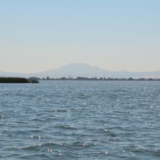
Sacramento-San Joaquin River Delta, River delta in Northern California, United States

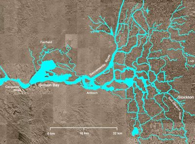
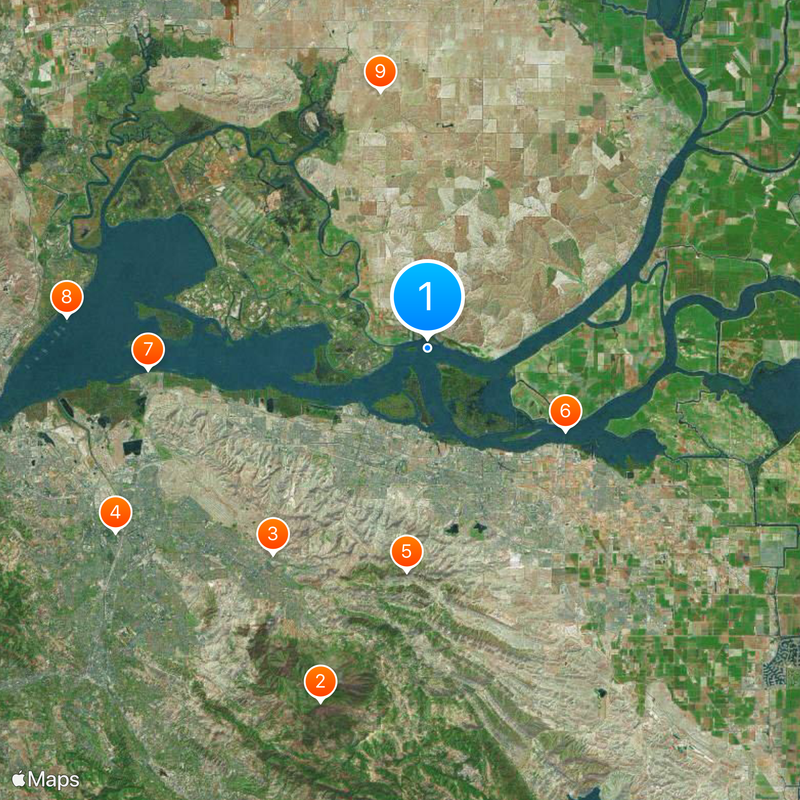
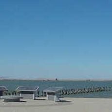
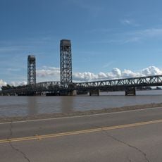
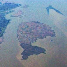
The Sacramento-San Joaquin River Delta is a river delta in Northern California where two major rivers merge east of Suisun Bay to form a web of waterways. The landscape shows flat islands, narrow channels, and levees that crisscross the region.

Marshlands were reshaped in the 1800s when workers built levees to reclaim land for farming. These changes redirected water flow and altered the natural wetland pattern across the region.

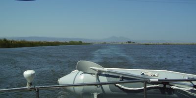
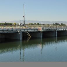
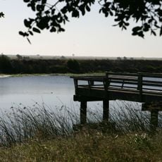
Local communities still travel by boat through narrow channels to reach homes built along the waterbanks. Small piers and wooden docks line the water routes, showing how people live and work on this watery landscape.

Visitors need a boat or kayak to explore the waterways since many areas can only be reached by water. Early morning hours offer calmer conditions and better chances to spot birds and other wildlife.

Some channels run below sea level and rely on tall levees to hold back water. This unusual layout makes the area vulnerable to flooding if the levees fail or break.

The community of curious travelers

AroundUs brings together thousands of curated places, local tips, and hidden gems, enriched daily by 60,000 contributors worldwide.

Start exploring
Location
GPS coordinates
38.06797,-121.84274
Latest update
December 13, 2025 17:44
Around this place
Mount Diablo
United States of America

Mount Diablo

21.7 km
Sleep Train Pavilion
United States of America

Sleep Train Pavilion

15.1 km
Six Flags Hurricane Harbor Concord
United States of America

Six Flags Hurricane Harbor Concord

21.3 km
Black Diamond Mines Regional Preserve
United States of America

Black Diamond Mines Regional Preserve

13.2 km
Antioch Bridge
United States of America

Antioch Bridge

9.4 km
Port Chicago Naval Magazine National Memorial
United States of America

Port Chicago Naval Magazine National Memorial

16.5 km
USCGC Storis
United States of America

USCGC Storis

21.3 km
Western Railway Museum
United States of America

Western Railway Museum

15.3 km
Rio Vista Bridge
United States of America

Rio Vista Bridge

17.2 km
Franks Tract State Recreation Area
United States of America

Franks Tract State Recreation Area

18.1 km
Antioch Dunes National Wildlife Refuge
United States of America

Antioch Dunes National Wildlife Refuge

7.3 km
Contra Costa Canal
United States of America

Contra Costa Canal

13.8 km
Marsh Creek State Park
United States of America

Marsh Creek State Park

21.8 km
Contra Loma Regional Park
United States of America

Contra Loma Regional Park

7.5 km
Don Francisco Galindo House
United States of America

Don Francisco Galindo House

19.9 km
Hastings Adobe
United States of America

Hastings Adobe

1.4 km
Don Salvio Pacheco Adobe
United States of America

Don Salvio Pacheco Adobe

19.9 km
Twitchell Island
United States of America

Twitchell Island

17.6 km
Ryer Island
United States of America

Ryer Island

15.1 km
Shannon-Williamson Ranch
United States of America

Shannon-Williamson Ranch

13.8 km
Roswell Butler Hard House
United States of America

Roswell Butler Hard House

6.1 km
Markham Regional Arboretum
United States of America

Markham Regional Arboretum

18.3 km
Don Fernando Pacheco Adobe
United States of America

Don Fernando Pacheco Adobe

19.3 km
Riverview Union High School Building
United States of America

Riverview Union High School Building

5.9 km
Rainforest Flora
United States of America

Rainforest Flora

18.3 km
Bird and Dinkelspiel Store
United States of America

Bird and Dinkelspiel Store

7.6 km
Pixieland Amusement Park
United States of America

Pixieland Amusement Park

18 km
William T. Hendrick House
United States of America

William T. Hendrick House

22 km
Show the full map
Reviews
Share your experience

No review yet

Discussions
Start a discussion...

No discussion yet

« Sacramento-San Joaquin River Delta - River delta in Northern California, United States » is provided by Around Us (aroundus.com). Images and texts are derived from Wikimedia project under a Creative Commons license. You are allowed to copy, distribute, and modify copies of this page, under the conditions set by the license, as long as this note is clearly visible.

Discover hidden gems everywhere you go!

From secret cafés to breathtaking viewpoints, skip the crowded tourist spots and find places that match your style. Our app makes it easy with voice search, smart filtering, route optimization, and insider tips from travelers worldwide. Download now for the complete mobile experience.

Around Us App Screenshot

A unique approach to discovering new places

Le Figaro

All the places worth exploring

France Info

A tailor-made excursion in just a few clicks

20 Minutes

Around Us
Travel Guide & Maps
Download

Send to your phone

QR Code
1

Open the camera app on your mobile.

2

Point at the QR code with your camera. A notification will appear.

3

Tap the notification to open the link.