Enable Location

We need your location to show you interesting places around you

Discover nearby places

Find interesting locations and hidden gems around you

Precise directions

Get accurate directions and distances to places

Your location is never shared with other users. It's only used when you tap the location button.

Log in to your account

Start exploring — it's free

Trusted by 62,495 travelers worldwide

Continue with Google
Continue with Apple
or

We will send you a code to connect

By continuing, you accept our Terms and Conditions and our Privacy Policy

Check your inbox

We've sent a pincode in your inbox. Please enter the code below.

California State Fairgrounds Race Track

California State Fairgrounds Race Track, tor wyścigowy (Stany Zjednoczone)

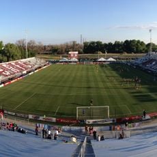
The California State Fairgrounds Race Track was a racing facility in Sacramento with an oval dirt surface, approximately one mile long and featuring nine turns. It hosted various racing series including USAC races starting in 1949 and NASCAR events beginning in 1956, with operations continuing until 1970.

The track opened in 1906 as a horse racing venue and switched to motorsport in 1907 with midget car racing. After a wartime interruption, racing resumed and made the facility a key motorsport center for California until its closure in 1970.

For many years, this was a place where racing fans gathered to watch competitions and cheer for their favorite drivers together. The races became local traditions, especially the Golden State 100, which drew top drivers from across the country and brought people together as a social event.

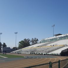
The original location is no longer active, but visitors can still explore the historic site to see what remains from the racing era. It is helpful to arrive with some knowledge about the track's history to better appreciate the landscape and understand what once happened there.

The racing surface was made from a unique blend of dirt and rice hulls, which gave the cars a distinctive track to compete on. Additionally, between the mid-1950s and late 1960s, a separate asphalt road course about two miles long was laid out in the surrounding parking areas for sports car racing.

The community of curious travelers

AroundUs brings together thousands of curated places, local tips, and hidden gems, enriched daily by 60,000 contributors worldwide.

Start exploring
Location
GPS coordinates
38.55000,-121.45000
Latest update
February 7, 2026 11:00
Around this place
Heart Health Park
United States of America

Heart Health Park

4.7 km
Hornet Stadium
United States of America

Hornet Stadium

2.4 km
Sacramento Convention Center Complex
United States of America

Sacramento Convention Center Complex

4.6 km
Sacramento Historic City Cemetery
United States of America

Sacramento Historic City Cemetery

4.7 km
William Land Park
United States of America

William Land Park

4.4 km
California State Indian Museum
United States of America

California State Indian Museum

3.1 km
Julia Morgan House
United States of America

Julia Morgan House

1.4 km
Guy West Bridge
United States of America

Guy West Bridge

2.9 km
Wells Fargo Pavilion
United States of America

Wells Fargo Pavilion

4.7 km
Sacramento State University Library
United States of America

Sacramento State University Library

2.5 km
Libby, McNeil and Libby Cannery
United States of America

Libby, McNeil and Libby Cannery

2.1 km
University Arboretum at California State University, Sacramento
United States of America

University Arboretum at California State University, Sacramento

2.6 km
Old Tavern
United States of America

Old Tavern

2.8 km
California State Capitol Park
United States of America

California State Capitol Park

4.6 km
IHOP
United States of America

IHOP

2.6 km
SMUD Headquarters Building
United States of America

SMUD Headquarters Building

1.5 km
Eastern Star Hall
United States of America

Eastern Star Hall

3.2 km
McKinley Park
United States of America

McKinley Park

3 km
Winters House
United States of America

Winters House

3.7 km
Statue of Thomas Starr King
United States of America

Statue of Thomas Starr King

4.7 km
Sacramento Memorial Auditorium
United States of America

Sacramento Memorial Auditorium

4.5 km
Funderland
United States of America

Funderland

4.7 km
Theodore Judah School
United States of America

Theodore Judah School

3 km
J. C. Carly House
United States of America

J. C. Carly House

2.3 km
Cranston-Geary House
United States of America

Cranston-Geary House

4 km
Raging Waters Sacramento
United States of America

Raging Waters Sacramento

4.7 km
St. Paul's Church of Sacramento
United States of America

St. Paul's Church of Sacramento

4.5 km
H Street Bridge
United States of America

H Street Bridge

3.2 km
Show the full map
« California State Fairgrounds Race Track - tor wyścigowy (Stany Zjednoczone) » is provided by Around Us (aroundus.com). Images and texts are derived from Wikimedia project under a Creative Commons license. You are allowed to copy, distribute, and modify copies of this page, under the conditions set by the license, as long as this note is clearly visible.

Discover hidden gems everywhere you go!

From secret cafés to breathtaking viewpoints, skip the crowded tourist spots and find places that match your style. Our app makes it easy with voice search, smart filtering, route optimization, and insider tips from travelers worldwide. Download now for the complete mobile experience.

Around Us App Screenshot

A unique approach to discovering new places

Le Figaro

All the places worth exploring

France Info

A tailor-made excursion in just a few clicks

20 Minutes

Around Us
Travel Guide & Maps
Download

Send to your phone

QR Code
1

Open the camera app on your mobile.

2

Point at the QR code with your camera. A notification will appear.

3

Tap the notification to open the link.