Chest opened
+${chestReward.xp} XP
Explorer
NOUVEAU ×${chestReward.collectible.quantity}
tapez pour fermer
Chest locked

Open chests in the app

Around Us is built for your phone — chests unlock when you walk, explore and capture nearby places.

Enable Location

We need your location to show you interesting places around you

Discover nearby places

Find interesting locations and hidden gems around you

Precise directions

Get accurate directions and distances to places

Your location is never shared with other users. It's only used when you tap the location button.

Log in to your account

Start exploring — it's free

Trusted by 72,880 travelers worldwide

Continue with Google
Continue with Apple
or

We will send you a code to connect

By continuing, you accept our Terms and Conditions and our Privacy Policy

Check your inbox

We've sent a pincode in your inbox. Please enter the code below.

Sutter Hock Farm
Discussion Reviews Photo
2.9k Popularity

Sutter Hock Farm, Historical agricultural settlement in Sutter County, California.

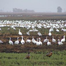
Sutter Hock Farm was an agricultural settlement located along the Feather River valley, featuring vineyards, grain fields, orchards, and pasture lands for livestock. The property operated as a diversified farming operation during the 19th century in what is now Yuba City.

John Augustus Sutter founded this settlement in 1841 as part of early European-American agricultural expansion in northern California. The farm became a significant productive operation during the territorial period before California statehood.

The site memorial incorporates original iron pieces from the farm's fort, preserving physical connections to Northern California's agricultural heritage.

A historical marker stands at the intersection of Garden Highway and Messick Road in Yuba City, making the location easy to find along major roads. The site is accessible during daylight hours and fits well into a driving tour of the region.

A former soldier deliberately burned the main house in 1865 as retaliation for discipline, destroying valuable pioneer records and historical documents in the process. This single act of destruction ended an important chapter in the site's history.

The community of curious travelers

AroundUs brings together thousands of curated places, local tips, and hidden gems, enriched daily by 60,000 contributors worldwide.

Start exploring
GPS coordinates
39.04890,-121.63300
Latest update
December 12, 2025 14:27
Around this place
Woodland Opera House
United States of America

Woodland Opera House

43 km
Bok Kai Temple
United States of America

Bok Kai Temple

10.4 km
Englebright Lake
United States of America

Englebright Lake

37.9 km
Camp Far West Reservoir
United States of America

Camp Far West Reservoir

27.5 km
Colusa National Wildlife Refuge
United States of America

Colusa National Wildlife Refuge

37.4 km
Sutter National Wildlife Refuge
United States of America

Sutter National Wildlife Refuge

11.3 km
Ellis Lake
United States of America

Ellis Lake

11.7 km
Fremont Weir Wildlife Area
United States of America

Fremont Weir Wildlife Area

33.3 km
Englebright Dam
United States of America

Englebright Dam

37.9 km
Woodland Public Library
United States of America

Woodland Public Library

42.9 km
Yolo County Courthouse
United States of America

Yolo County Courthouse

42.8 km
Community Memorial Museum of Sutter County
United States of America

Community Memorial Museum of Sutter County

10.9 km
Downtown Woodland Historic District
United States of America

Downtown Woodland Historic District

43 km
Yolo Branch Library
United States of America

Yolo Branch Library

38.3 km
Live Oak Historic Commercial District
United States of America

Live Oak Historic Commercial District

25.3 km
Griffith Mansion
United States of America

Griffith Mansion

38.5 km
Yuba City Astronomical Observatory
United States of America

Yuba City Astronomical Observatory

7.3 km
Grand Island Shrine
United States of America

Grand Island Shrine

27.2 km
Porter Building
United States of America

Porter Building

43.1 km
Hart Building
United States of America

Hart Building

10.8 km
R. H. Beamer House
United States of America

R. H. Beamer House

42.3 km
Wake Island Water Park
United States of America

Wake Island Water Park

35.5 km
Packard Library
United States of America

Packard Library

10.8 km
I.O.O.F. Building
United States of America

I.O.O.F. Building

43 km
Colusa County Courthouse
United States of America

Colusa County Courthouse

37.3 km
Wheatland Masonic Temple
United States of America

Wheatland Masonic Temple

18.7 km
Marysville Historic Commercial District
United States of America

Marysville Historic Commercial District

10.7 km
West Butte Schoolhouse
United States of America

West Butte Schoolhouse

26.2 km
Show the full map
Reviews
Share your experience

No review yet

Discussions
Start a discussion...

No discussion yet

« Sutter Hock Farm - Historical agricultural settlement in Sutter County, California » is provided by Around Us (aroundus.com). Images and texts are derived from Wikimedia project under a Creative Commons license. You are allowed to copy, distribute, and modify copies of this page, under the conditions set by the license, as long as this note is clearly visible.

Discover hidden gems everywhere you go!

From secret cafés to breathtaking viewpoints, skip the crowded tourist spots and find places that match your style. Our app makes it easy with voice search, smart filtering, route optimization, and insider tips from travelers worldwide. Download now for the complete mobile experience.

Around Us App Screenshot

A unique approach to discovering new places

Le Figaro

All the places worth exploring

France Info

A tailor-made excursion in just a few clicks

20 Minutes

Around Us
Travel Guide & Maps
Download

Send to your phone

QR Code
1

Open the camera app on your mobile.

2

Point at the QR code with your camera. A notification will appear.

3

Tap the notification to open the link.