Chest opened
+${chestReward.xp} XP
Explorer
NOUVEAU ×${chestReward.collectible.quantity}
tapez pour fermer
Chest locked

Open chests in the app

Around Us is built for your phone — chests unlock when you walk, explore and capture nearby places.

Enable Location

We need your location to show you interesting places around you

Discover nearby places

Find interesting locations and hidden gems around you

Precise directions

Get accurate directions and distances to places

Your location is never shared with other users. It's only used when you tap the location button.

Log in to your account

Start exploring — it's free

Trusted by 72,955 travelers worldwide

Continue with Google
Continue with Apple
or

We will send you a code to connect

By continuing, you accept our Terms and Conditions and our Privacy Policy

Check your inbox

We've sent a pincode in your inbox. Please enter the code below.

Quail Ridge Reserve
Discussion Reviews Photo
3.6k Popularity

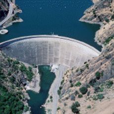
Quail Ridge Reserve, Nature reserve near Lake Berryessa, US

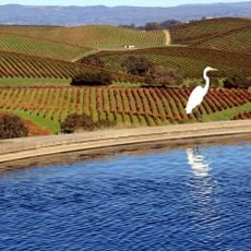
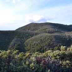
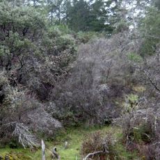
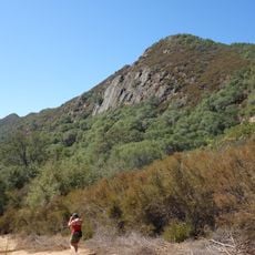
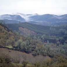
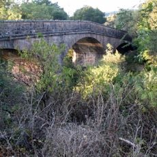
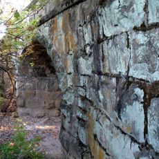
Quail Ridge Reserve is a nature preserve spanning about 2,500 acres of California chaparral and oak woodlands situated on a peninsula. The landscape features native grasses, trees, and dense shrubland across rolling hills above the water.

The reserve was established by the UC Natural Reserve System to protect native grasslands and forest types in Napa County. It developed into a research facility for scientific study of these endangered ecosystems.

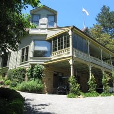
The reserve serves as a learning place where UC Davis students conduct field studies in ecology and conservation. Visitors can observe how scientific work happens on-site and understand the role of hands-on research in protecting these habitats.

Access requires prior permission from the management, and overnight accommodations are available for researchers and students. The site is designed primarily for scientific work rather than casual visits.

The reserve uses QuRiNet, a wireless mesh network system for tracking wildlife and gathering data on animal movements. This technology allows researchers to monitor ecosystems in real time without disrupting natural animal behavior.

The community of curious travelers

AroundUs brings together thousands of curated places, local tips, and hidden gems, enriched daily by 60,000 contributors worldwide.

Start exploring
GPS coordinates
38.81780,-122.24100
Latest update
December 12, 2025 07:53
Around this place
Monticello Dam
United States of America

Monticello Dam

35.9 km
Valle de Napa
United States of America

Valle de Napa

36 km
Culinary Institute of America at Greystone
United States of America

Culinary Institute of America at Greystone

39.8 km
Berryessa Snow Mountain National Monument
United States of America

Berryessa Snow Mountain National Monument

40.1 km
Robert Louis Stevenson State Park
United States of America

Robert Louis Stevenson State Park

36.4 km
Bothe-Napa Valley State Park
United States of America

Bothe-Napa Valley State Park

38.1 km
Schramsberg Vineyards
United States of America

Schramsberg Vineyards

39.5 km
St. Helena High School
United States of America

St. Helena High School

40.4 km
Anderson Marsh State Historic Park
United States of America

Anderson Marsh State Historic Park

36.6 km
Boggs Mountain Demonstration State Forest
United States of America

Boggs Mountain Demonstration State Forest

38.9 km
Stebbins Cold Canyon Reserve
United States of America

Stebbins Cold Canyon Reserve

36.6 km
Elmshaven
United States of America

Elmshaven

37.5 km
Blue Ridge Berryessa Natural Area
United States of America

Blue Ridge Berryessa Natural Area

15.7 km
Cache Creek Wilderness
United States of America

Cache Creek Wilderness

25.5 km
Pacific Union College Church
United States of America

Pacific Union College Church

32.6 km
Sacramento Valley Museum
United States of America

Sacramento Valley Museum

37.9 km
Zim Zim Falls
United States of America

Zim Zim Falls

7.9 km
Sam Brannan Cottage
United States of America

Sam Brannan Cottage

39.2 km
Pope Street Bridge
United States of America

Pope Street Bridge

38.9 km
Yolo Branch Library
United States of America

Yolo Branch Library

38.8 km
Griffith Mansion
United States of America

Griffith Mansion

38.9 km
Downtown Winters Historic District
United States of America

Downtown Winters Historic District

40.6 km
James H. Francis House
United States of America

James H. Francis House

39.9 km
Grace Episcopal Church
United States of America

Grace Episcopal Church

40.3 km
Chateau Pacheteau
United States of America

Chateau Pacheteau

40.8 km
Swartz Creek Bridge on Aetna Springs Road
United States of America

Swartz Creek Bridge on Aetna Springs Road

27.4 km
St. Helena Historic Commercial District
United States of America

St. Helena Historic Commercial District

40.1 km
Maxwell Creek Bridge on Hardin Road
United States of America

Maxwell Creek Bridge on Hardin Road

26.6 km
Show the full map
Reviews
Share your experience

No review yet

Discussions
Start a discussion...

No discussion yet

« Quail Ridge Reserve - Nature reserve near Lake Berryessa, US » is provided by Around Us (aroundus.com). Images and texts are derived from Wikimedia project under a Creative Commons license. You are allowed to copy, distribute, and modify copies of this page, under the conditions set by the license, as long as this note is clearly visible.

Discover hidden gems everywhere you go!

From secret cafés to breathtaking viewpoints, skip the crowded tourist spots and find places that match your style. Our app makes it easy with voice search, smart filtering, route optimization, and insider tips from travelers worldwide. Download now for the complete mobile experience.

Around Us App Screenshot

A unique approach to discovering new places

Le Figaro

All the places worth exploring

France Info

A tailor-made excursion in just a few clicks

20 Minutes

Around Us
Travel Guide & Maps
Download

Send to your phone

QR Code
1

Open the camera app on your mobile.

2

Point at the QR code with your camera. A notification will appear.

3

Tap the notification to open the link.