Chest opened
+${chestReward.xp} XP
Explorer
NOUVEAU ×${chestReward.collectible.quantity}
tapez pour fermer
Chest locked

Open chests in the app

Around Us is built for your phone — chests unlock when you walk, explore and capture nearby places.

Enable Location

We need your location to show you interesting places around you

Discover nearby places

Find interesting locations and hidden gems around you

Precise directions

Get accurate directions and distances to places

Your location is never shared with other users. It's only used when you tap the location button.

Log in to your account

Start exploring — it's free

Trusted by 72,890 travelers worldwide

Continue with Google
Continue with Apple
or

We will send you a code to connect

By continuing, you accept our Terms and Conditions and our Privacy Policy

Check your inbox

We've sent a pincode in your inbox. Please enter the code below.

Klamath Project
Discussion Reviews Photo
5.8k Popularity

Klamath Project, Water management system in Klamath Basin, United States

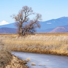
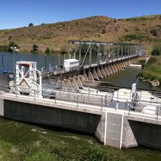
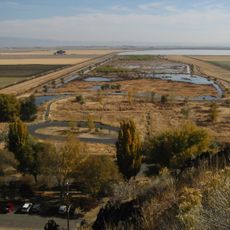
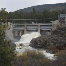
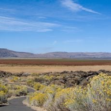
The Klamath Project is a water management system in the Klamath Basin that distributes water from lakes and rivers through dams and canals to farmland. The infrastructure includes multiple dams and hundreds of kilometers of irrigation channels that carry water to agricultural areas across the region.

Construction of the Klamath Project began in 1906 with the first canal. Additional dams were built in the following years, making it one of the earliest large-scale irrigation projects in the American West.

The irrigation system supports farmers in the region who grow grain, hay, and potatoes for local and regional markets. These crops shape how the land is used and the region's economy.

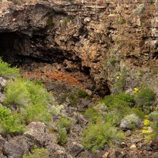
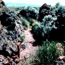
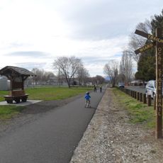
The project spans multiple counties and is vast, making it challenging to visit as a complete system. Visitors can view portions of the infrastructure from nearby roads or visit information centers that explain how the system operates.

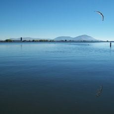
The system has been the subject of ongoing environmental debates regarding its effects on fish populations and native ecosystems. Despite these controversies, it remains essential infrastructure for the region's agricultural economy.

The community of curious travelers

AroundUs brings together thousands of curated places, local tips, and hidden gems, enriched daily by 60,000 contributors worldwide.

Start exploring
GPS coordinates
42.10000,-121.60000
Latest update
December 10, 2025 16:22
Around this place
Lava Beds National Monument
United States of America

Lava Beds National Monument

43.6 km
Captain Jack's Stronghold
United States of America

Captain Jack's Stronghold

32 km
Lower Klamath National Wildlife Refuge
United States of America

Lower Klamath National Wildlife Refuge

18.6 km
Link River Dam
United States of America

Link River Dam

22.4 km
Tule Lake National Wildlife Refuge
United States of America

Tule Lake National Wildlife Refuge

25.3 km
OC&E Woods Line State Trail
United States of America

OC&E Woods Line State Trail

17.3 km
Clear Lake National Wildlife Refuge
United States of America

Clear Lake National Wildlife Refuge

48.4 km
John C. Boyle Dam
United States of America

John C. Boyle Dam

37.1 km
Lake Ewauna
United States of America

Lake Ewauna

19.4 km
Mountain Lakes Wilderness
United States of America

Mountain Lakes Wilderness

49.7 km
Petroglyph Point Archaeological Site
United States of America

Petroglyph Point Archaeological Site

33.2 km
Bear Valley National Wildlife Refuge
United States of America

Bear Valley National Wildlife Refuge

25.5 km
Schonchin Butte
United States of America

Schonchin Butte

40.7 km
Klamath Basin National Wildlife Refuge Complex
United States of America

Klamath Basin National Wildlife Refuge Complex

17.3 km
Gerber Reservoir
United States of America

Gerber Reservoir

42.6 km
Canby's Cross
United States of America

Canby's Cross

31.6 km
Baldwin Hotel
United States of America

Baldwin Hotel

20.5 km
Bly Ranger Station
United States of America

Bly Ranger Station

56.6 km
Klamath Falls City Hall
United States of America

Klamath Falls City Hall

20.3 km
Blackburn Sanitarium
United States of America

Blackburn Sanitarium

20.5 km
Judge Henry L. Benson House
United States of America

Judge Henry L. Benson House

20.6 km
Richardson–Ulrich House
United States of America

Richardson–Ulrich House

21 km
Tule Lake National Monument
United States of America

Tule Lake National Monument

29.9 km
Schonchin Butte Lookout
United States of America

Schonchin Butte Lookout

40.7 km
Klamath County Museum
United States of America

Klamath County Museum

20.3 km
Skull Cave
United States of America

Skull Cave

41.7 km
Mushpot Cave
United States of America

Mushpot Cave

43.7 km
Hospital Rock Trail
United States of America

Hospital Rock Trail

31.6 km
Show the full map
Reviews
Share your experience

No review yet

Discussions
Start a discussion...

No discussion yet

« Klamath Project - Water management system in Klamath Basin, United States » is provided by Around Us (aroundus.com). Images and texts are derived from Wikimedia project under a Creative Commons license. You are allowed to copy, distribute, and modify copies of this page, under the conditions set by the license, as long as this note is clearly visible.

Discover hidden gems everywhere you go!

From secret cafés to breathtaking viewpoints, skip the crowded tourist spots and find places that match your style. Our app makes it easy with voice search, smart filtering, route optimization, and insider tips from travelers worldwide. Download now for the complete mobile experience.

Around Us App Screenshot

A unique approach to discovering new places

Le Figaro

All the places worth exploring

France Info

A tailor-made excursion in just a few clicks

20 Minutes

Around Us
Travel Guide & Maps
Download

Send to your phone

QR Code
1

Open the camera app on your mobile.

2

Point at the QR code with your camera. A notification will appear.

3

Tap the notification to open the link.