OC&E Woods Line State Trail

Log in to your account

AroundUs is a community-driven map of interesting places, built by curious explorers like you. It grows with every review, story, and photo you share.
Connect to save your favorite spots, contribute locations, and create personalized routes.
Continue with Google
Continue with Apple
Continue with X
Continue with Facebook
Continue with email
By continuing, you accept our Terms and Conditions and our Privacy Policy
Create an account
Add to collection
Map
Suggest a change
Share

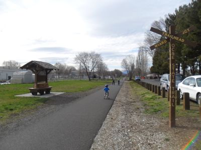
OC&E Woods Line State Trail, Rail trail in Klamath Falls, Oregon.

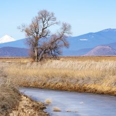
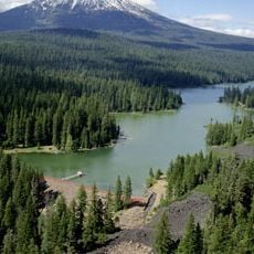
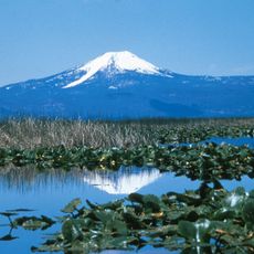
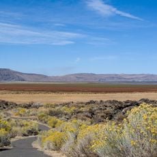
The OC&E Woods Line State Trail is a former railroad route that runs approximately 109 miles from Klamath Falls through ranch lands, forests, and valleys to Thompson Reservoir. The first 8 miles from town feature pavement suitable for all users, while the rest transitions to gravel surfaces.

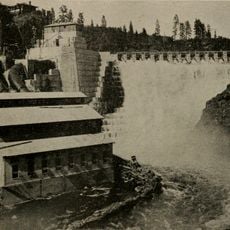
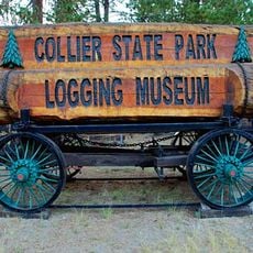
The route started in 1917 as the Klamath Municipal Railway, hauling timber products across the landscape for decades. In 1990 Weyerhaeuser donated the corridor to Oregon Parks, transforming it into a public recreation corridor.

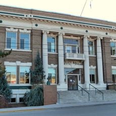
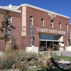
Communities along the route have built their identity around the timber trade that once defined the region. Local interpretive stations tell stories of how this work shaped settlement patterns and daily life for families living nearby.

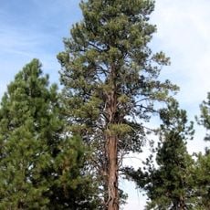
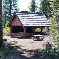
The trail starts smooth near town but becomes rougher as you progress outward, so choose footwear and equipment suited to changing conditions. Water sources and rest stops are scattered along the way rather than clustered together.

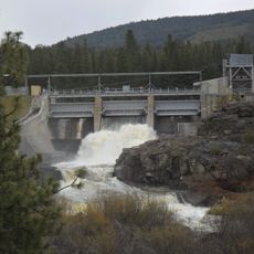
A steel trestle crosses Merritt Creek at mile 27, standing roughly 50 feet (15 meters) high and stretching about 400 feet (120 meters) long. This striking structure reveals the engineering effort needed to carry the old line over challenging waterways.

Location: Klamath County

Location: Lake County

Website: http://oregonstateparks.org/park_230.php

GPS coordinates: 42.20750,-121.75200

Latest update: December 11, 2025 11:07

Photos
Around this place
Lava Beds National Monument
United States of America

Lava Beds National Monument

58.5 km
Train Mountain Railroad
United States of America

Train Mountain Railroad

42.3 km
Captain Jack's Stronghold
United States of America

Captain Jack's Stronghold

47.6 km
Lower Klamath National Wildlife Refuge
United States of America

Lower Klamath National Wildlife Refuge

29.2 km
Copco Lake
United States of America

Copco Lake

52.2 km
Link River Dam
United States of America

Link River Dam

5.1 km
Tule Lake National Wildlife Refuge
United States of America

Tule Lake National Wildlife Refuge

41.6 km
Collier Memorial State Park
United States of America

Collier Memorial State Park

49.7 km
Fish Lake
United States of America

Fish Lake

52.6 km
John C. Boyle Dam
United States of America

John C. Boyle Dam

26.2 km
Lake Ewauna
United States of America

Lake Ewauna

2.3 km
Mountain Lakes Wilderness
United States of America

Mountain Lakes Wilderness

32.8 km
Howard Prairie Lake
United States of America

Howard Prairie Lake

51.5 km
Petroglyph Point Archaeological Site
United States of America

Petroglyph Point Archaeological Site

50.2 km
Bear Valley National Wildlife Refuge
United States of America

Bear Valley National Wildlife Refuge

21.4 km
Upper Klamath National Wildlife Refuge
United States of America

Upper Klamath National Wildlife Refuge

41.1 km
Fourmile Lake
United States of America

Fourmile Lake

50.3 km
Klamath Basin National Wildlife Refuge Complex
United States of America

Klamath Basin National Wildlife Refuge Complex

32.9 km
Canby's Cross
United States of America

Canby's Cross

46.6 km
Lake of the Woods Ranger Station
United States of America

Lake of the Woods Ranger Station

43.9 km
Klamath Falls City Hall
United States of America

Klamath Falls City Hall

3 km
Judge Henry L. Benson House
United States of America

Judge Henry L. Benson House

3.3 km
Richardson–Ulrich House
United States of America

Richardson–Ulrich House

3.8 km
Tule Lake National Monument
United States of America

Tule Lake National Monument

47.2 km
Klamath County Museum
United States of America

Klamath County Museum

3 km
Hospital Rock Trail
United States of America

Hospital Rock Trail

47.7 km
Ross Ragland Theatre
United States of America

Ross Ragland Theatre

3.3 km
Fish Lake Shelter
United States of America

Fish Lake Shelter

51 km
Show the full map
Reviews

Visited this place? Tap the stars to rate it and share your experience / photos with the community! Try now! You can cancel it anytime.

« OC&E Woods Line State Trail - Rail trail in Klamath Falls, Oregon » is provided by Around Us (aroundus.com). Images and texts are derived from Wikimedia project under a Creative Commons license. You are allowed to copy, distribute, and modify copies of this page, under the conditions set by the license, as long as this note is clearly visible.

Discover hidden gems everywhere you go!

From secret cafés to breathtaking viewpoints, skip the crowded tourist spots and find places that match your style. Our app makes it easy with voice search, smart filtering, route optimization, and insider tips from travelers worldwide. Download now for the complete mobile experience.

Around Us App Screenshot

A unique approach to discovering new places

Le Figaro

All the places worth exploring

France Info

A tailor-made excursion in just a few clicks

20 Minutes