Enable Location

We need your location to show you interesting places around you

Discover nearby places

Find interesting locations and hidden gems around you

Precise directions

Get accurate directions and distances to places

Your location is never shared with other users. It's only used when you tap the location button.

Fourmile Lake

Log in to your account

Start exploring — it's free

Trusted by 62,386 travelers worldwide

Continue with Google
Continue with Apple
or

We will send you a code to connect

By continuing, you accept our Terms and Conditions and our Privacy Policy

Check your inbox

We've sent a pincode in your inbox. Please enter the code below.

Fourmile Lake

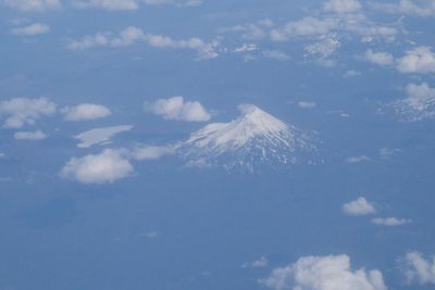
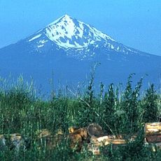
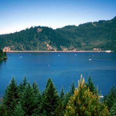
Fourmile Lake, reservoir located in Klamath County, Oregon, United States

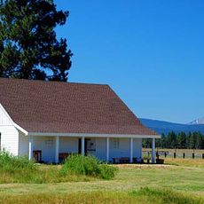
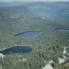
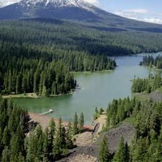
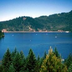
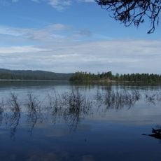
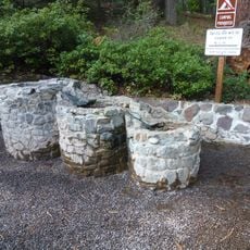
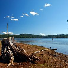
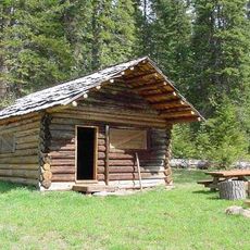
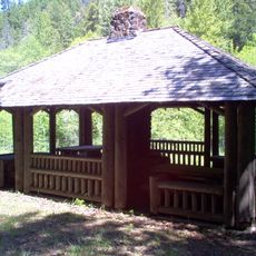
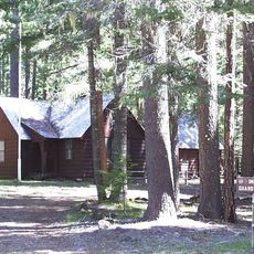
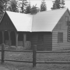
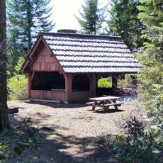
Fourmile Lake is a reservoir in the forest-covered mountains of Klamath County in southern Oregon, sitting at over 5700 feet elevation within Fremont-Winema National Forest. The lake is ringed by dense stands of mountain hemlock, Douglas fir, lodgepole pine, and other conifers, with a basic campground at the southern shore and a boat launch for small watercraft.

The lake sits in the traditional territory of Klamath tribes who hunted and gathered in this region. The modern campground and facilities were developed by the Forest Service to provide access to this remote wilderness area.

The best time to visit is summer through early fall when the gravel road access is in good condition for the high-elevation location. Klamath Falls is the nearest town about 40 kilometers away, and the final approach requires traveling on a dirt road.

The lake hosts a diverse bird population including woodpeckers, jays, and kinglets in its old conifer forests. Birdwatchers can encounter rare species like the Black-backed Woodpecker and various warblers that favor these remote forest habitats.

The community of curious travelers

AroundUs brings together thousands of curated places, local tips, and hidden gems, enriched daily by 60,000 contributors worldwide.

Start exploring
Location
Elevation above the sea
1,753 m
GPS coordinates
42.46580,-122.25400
Latest update
February 9, 2026 08:22
Around this place
Mount McLoughlin
United States of America

Mount McLoughlin

5.6 km
Train Mountain Railroad
United States of America

Train Mountain Railroad

31.4 km
Lost Creek Lake
United States of America

Lost Creek Lake

40.8 km
Fort Klamath
United States of America

Fort Klamath

34.1 km
Sky Lakes Wilderness
United States of America

Sky Lakes Wilderness

17.1 km
Prospect State Scenic Viewpoint
United States of America

Prospect State Scenic Viewpoint

36.2 km
Collier Memorial State Park
United States of America

Collier Memorial State Park

36.3 km
Fish Lake
United States of America

Fish Lake

12.5 km
John C. Boyle Dam
United States of America

John C. Boyle Dam

41.7 km
Jackson F. Kimball State Recreation Site
United States of America

Jackson F. Kimball State Recreation Site

37.8 km
Joseph H. Stewart State Recreation Area
United States of America

Joseph H. Stewart State Recreation Area

38.6 km
Mountain Lakes Wilderness
United States of America

Mountain Lakes Wilderness

18.1 km
Howard Prairie Lake
United States of America

Howard Prairie Lake

29.5 km
Upper Klamath National Wildlife Refuge
United States of America

Upper Klamath National Wildlife Refuge

18 km
Union Peak
United States of America

Union Peak

40.8 km
Casey State Recreation Site
United States of America

Casey State Recreation Site

42.1 km
Tub Springs State Wayside
United States of America

Tub Springs State Wayside

41.8 km
Hyatt Reservoir
United States of America

Hyatt Reservoir

35.2 km
Mill Creek Falls
United States of America

Mill Creek Falls

36.4 km
Lost Creek Bridge
United States of America

Lost Creek Bridge

28.4 km
Willow Prairie Cabin
United States of America

Willow Prairie Cabin

13.2 km
Dead Indian Soda Springs
United States of America

Dead Indian Soda Springs

21.8 km
Imnaha Guard Station
United States of America

Imnaha Guard Station

27.3 km
Lake of the Woods Ranger Station
United States of America

Lake of the Woods Ranger Station

9.1 km
Nils Ahlstrom House
United States of America

Nils Ahlstrom House

41.4 km
Honeymoon Creek Snow-Survey Cabin
United States of America

Honeymoon Creek Snow-Survey Cabin

23 km
Fish Lake Shelter
United States of America

Fish Lake Shelter

9.6 km
North Fork Rogue River Bridge
United States of America

North Fork Rogue River Bridge

36.9 km
Show the full map
« Fourmile Lake - reservoir located in Klamath County, Oregon, United States » is provided by Around Us (aroundus.com). Images and texts are derived from Wikimedia project under a Creative Commons license. You are allowed to copy, distribute, and modify copies of this page, under the conditions set by the license, as long as this note is clearly visible.

Discover hidden gems everywhere you go!

From secret cafés to breathtaking viewpoints, skip the crowded tourist spots and find places that match your style. Our app makes it easy with voice search, smart filtering, route optimization, and insider tips from travelers worldwide. Download now for the complete mobile experience.

Around Us App Screenshot

A unique approach to discovering new places

Le Figaro

All the places worth exploring

France Info

A tailor-made excursion in just a few clicks

20 Minutes

Around Us
Travel Guide & Maps
Download

Send to your phone

QR Code
1

Open the camera app on your mobile.

2

Point at the QR code with your camera. A notification will appear.

3

Tap the notification to open the link.