Lake County

Log in to your account

AroundUs is a community-driven map of interesting places, built by curious explorers like you. It grows with every review, story, and photo you share.
Connect to save your favorite spots, contribute locations, and create personalized routes.
Continue with Google
Continue with Apple
Continue with X
Continue with Facebook
Continue with email
By continuing, you accept our Terms and Conditions and our Privacy Policy
Create an account
Add to collection
Map
Suggest a change
Share

Lake County, County administration in Illinois, United States.

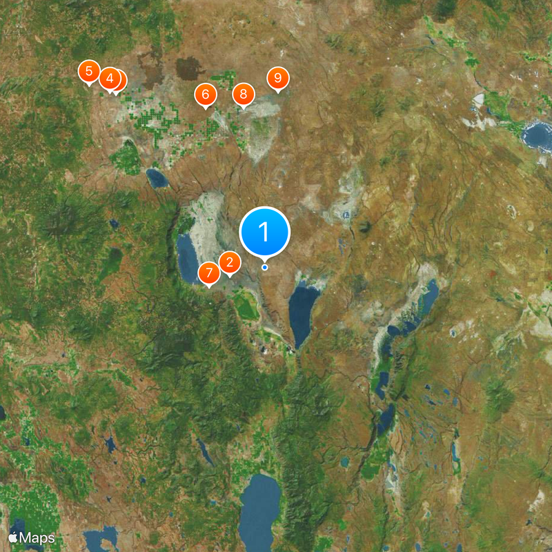
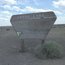
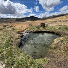
Lake County is an administrative division in northeastern Oregon encompassing urban and rural areas across multiple municipalities. The region includes parks, natural water bodies, and varied terrain that characterize its landscape.

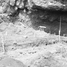
Lake County was established in 1876 as settlement expanded into the region. The county's development reflected growing needs for local administration and infrastructure in eastern Oregon.

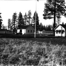
The county administration supports multiple educational institutions, including school districts and community colleges that serve the diverse population of the region.

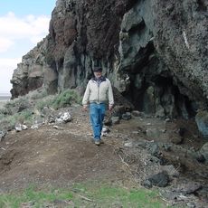
The county covers sparsely populated areas with significant distances between towns, making a personal vehicle essential for exploring the region. Most services and amenities are concentrated in town centers where visitors can find information and supplies.

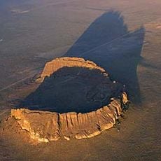
Lake County is one of Oregon's largest and most sparsely settled counties, with vast high desert regions and isolated towns. This remoteness has preserved a quietness uncommon in most American counties.

Location: Oregon

Inception: 1874

Capital city: Lakeview

Shares border with: Deschutes County, Harney County, Washoe County, Modoc County, Klamath County

Website: http://lakecountyor.org

GPS coordinates: 42.79000,-120.39000

Latest update: December 20, 2025 11:23

Photos
Around this place
Paisley Caves
United States of America

Paisley Caves

13.5 km
Fort Rock
United States of America

Fort Rock

85.4 km
Fort Rock Cave
United States of America

Fort Rock Cave

87.4 km
Hole-in-the-Ground
United States of America

Hole-in-the-Ground

94.7 km
Crack in the Ground
United States of America

Crack in the Ground

63.6 km
Summer Lake Hot Springs
United States of America

Summer Lake Hot Springs

22.2 km
Fossil Lake
United States of America

Fossil Lake

60.2 km
Lost Forest Research Natural Area
United States of America

Lost Forest Research Natural Area

65.9 km
Hart Mountain National Antelope Refuge
United States of America

Hart Mountain National Antelope Refuge

65.8 km
Summer Lake Wildlife Area
United States of America

Summer Lake Wildlife Area

35.4 km
Gearhart Mountain Wilderness
United States of America

Gearhart Mountain Wilderness

49.5 km
Abert Rim
United States of America

Abert Rim

46.5 km
David L. Shirk Ranch
United States of America

David L. Shirk Ranch

94.2 km
Picture Rock Pass Petroglyphs Site
United States of America

Picture Rock Pass Petroglyphs Site

43.9 km
Fort Rock Valley Historical Homestead Museum
United States of America

Fort Rock Valley Historical Homestead Museum

83.2 km
Greaser Petroglyph Site
United States of America

Greaser Petroglyph Site

82.8 km
Camp Warner
United States of America

Camp Warner

67.3 km
Goose Lake State Recreation Area
United States of America

Goose Lake State Recreation Area

88.7 km
Chandler State Wayside
United States of America

Chandler State Wayside

43.4 km
Hunter's Hot Springs
United States of America

Hunter's Hot Springs

63.4 km
Cabin Lake Guard Station
United States of America

Cabin Lake Guard Station

95.1 km
Stone Bridge and the Oregon Central Military Wagon Road
United States of America

Stone Bridge and the Oregon Central Military Wagon Road

66.2 km
United States of America

Burma Rim

39.1 km
Gerber Reservoir
United States of America

Gerber Reservoir

88 km
Booth State Scenic Corridor
United States of America

Booth State Scenic Corridor

68.8 km
Chickahominy Reservoir
United States of America

Chickahominy Reservoir

105 km
United States of America

Antelope Hot Springs

65.5 km
United States of America

Doherty Slide

112.2 km
Show the full map
Reviews

Visited this place? Tap the stars to rate it and share your experience / photos with the community! Try now! You can cancel it anytime.

Administrative divisions
« Lake County - County administration in Illinois, United States » is provided by Around Us (aroundus.com). Images and texts are derived from Wikimedia project under a Creative Commons license. You are allowed to copy, distribute, and modify copies of this page, under the conditions set by the license, as long as this note is clearly visible.

Discover hidden gems everywhere you go!

From secret cafés to breathtaking viewpoints, skip the crowded tourist spots and find places that match your style. Our app makes it easy with voice search, smart filtering, route optimization, and insider tips from travelers worldwide. Download now for the complete mobile experience.

Around Us App Screenshot

A unique approach to discovering new places

Le Figaro

All the places worth exploring

France Info

A tailor-made excursion in just a few clicks

20 Minutes