Fort Rock Cave

Log in to your account

AroundUs is a community-driven map of interesting places, built by curious explorers like you. It grows with every review, story, and photo you share.
Connect to save your favorite spots, contribute locations, and create personalized routes.
Continue with Google
Continue with Apple
Continue with X
Continue with Facebook
Continue with email
By continuing, you accept our Terms and Conditions and our Privacy Policy
Create an account
Add to collection
Map
Suggest a change
Share

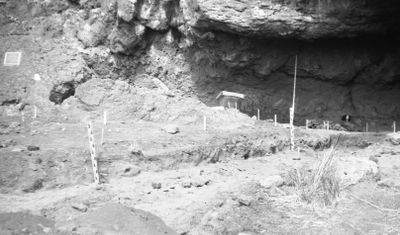
Fort Rock Cave, Archaeological cave in Lake County, Oregon

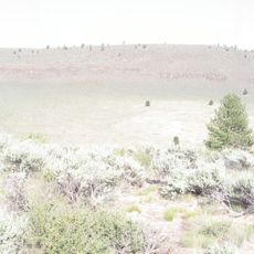
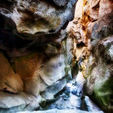
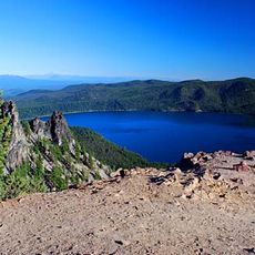
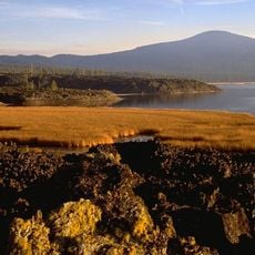
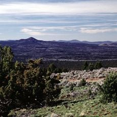
Fort Rock Cave is an archaeological site in Lake County, Oregon, extending roughly 70 feet across and reaching about 60 feet deep into a volcanic butte. The cave sits near a volcanic crater formation and contains layers of soil and ash that preserve evidence of ancient human activity.

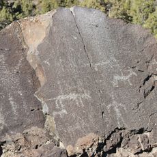
Excavations in 1938 uncovered many ancient sandals and tools buried beneath volcanic ash from Mount Mazama's eruption around 7,600 years ago. These discoveries allowed researchers to understand how people lived in this region during the early stone age.

The cave holds evidence of people who lived here long ago, visible through their sandals woven from sagebrush fibers, wooden tools, shell ornaments, and stone objects. These items show how inhabitants used this shelter and made things from materials they found nearby.

Visiting requires planning ahead, as access is controlled through the Oregon Parks and Recreation Department, which organizes guided tours of the site. Check current conditions and booking requirements before you go to ensure you can experience this protected archaeological location.

The sandals discovered here have distinctive flat soles with five rope warps and weft fibers arranged in a specific way that archaeologists use to identify similar finds across the broader region. This particular style became a reference point for dating and understanding ancient cultures throughout the Great Basin area.

Location: Lake County

GPS coordinates: 43.37853,-121.10156

Latest update: December 7, 2025 20:46

Photos
Around this place
Newberry Volcano
United States of America

Newberry Volcano

36.7 km
Newberry National Volcanic Monument
United States of America

Newberry National Volcanic Monument

37.2 km
Lava River Cave
United States of America

Lava River Cave

61.4 km
Lava Butte
United States of America

Lava Butte

63.4 km
Fort Rock
United States of America

Fort Rock

2.3 km
Hole-in-the-Ground
United States of America

Hole-in-the-Ground

8.3 km
Crack in the Ground
United States of America

Crack in the Ground

35.8 km
Wickiup Reservoir
United States of America

Wickiup Reservoir

59.4 km
Fossil Lake
United States of America

Fossil Lake

49.8 km
Lost Forest Research Natural Area
United States of America

Lost Forest Research Natural Area

62.4 km
Camp Abbot
United States of America

Camp Abbot

61.6 km
Summer Lake Wildlife Area
United States of America

Summer Lake Wildlife Area

54.9 km
Pine Mountain Observatory
United States of America

Pine Mountain Observatory

47.8 km
Picture Rock Pass Petroglyphs Site
United States of America

Picture Rock Pass Petroglyphs Site

44.4 km
La Pine State Park
United States of America

La Pine State Park

56.1 km
Fort Rock Valley Historical Homestead Museum
United States of America

Fort Rock Valley Historical Homestead Museum

4.3 km
Paulina Peak
United States of America

Paulina Peak

36.7 km
Klamath Marsh National Wildlife Refuge
United States of America

Klamath Marsh National Wildlife Refuge

63.4 km
Cabin Lake Guard Station
United States of America

Cabin Lake Guard Station

12.9 km
Paulina Falls
United States of America

Paulina Falls

39.9 km
Davis Lake volcanic field
United States of America

Davis Lake volcanic field

60.9 km
Sunriver Observatory
United States of America

Sunriver Observatory

62.9 km
Paulina Lake Guard Station
United States of America

Paulina Lake Guard Station

39.7 km
East Lava Field
United States of America

East Lava Field

29.7 km
Ed Eskelin Ranch
United States of America

Ed Eskelin Ranch

21 km
Odell Butte
United States of America

Odell Butte

62.5 km
Lava Butte Lookout
United States of America

Lava Butte Lookout

63.4 km
Newberry Crater
United States of America

Newberry Crater

39.7 km
Show the full map
Reviews

Visited this place? Tap the stars to rate it and share your experience / photos with the community! Try now! You can cancel it anytime.

« Fort Rock Cave - Archaeological cave in Lake County, Oregon » is provided by Around Us (aroundus.com). Images and texts are derived from Wikimedia project under a Creative Commons license. You are allowed to copy, distribute, and modify copies of this page, under the conditions set by the license, as long as this note is clearly visible.

Discover hidden gems everywhere you go!

From secret cafés to breathtaking viewpoints, skip the crowded tourist spots and find places that match your style. Our app makes it easy with voice search, smart filtering, route optimization, and insider tips from travelers worldwide. Download now for the complete mobile experience.

Around Us App Screenshot

A unique approach to discovering new places

Le Figaro

All the places worth exploring

France Info

A tailor-made excursion in just a few clicks

20 Minutes