Enable Location

We need your location to show you interesting places around you

Discover nearby places

Find interesting locations and hidden gems around you

Precise directions

Get accurate directions and distances to places

Your location is never shared with other users. It's only used when you tap the location button.

Davis Lake volcanic field

Log in to your account

Start exploring — it's free

Trusted by 63,065 travelers worldwide

Continue with Google
Continue with Apple
or

We will send you a code to connect

By continuing, you accept our Terms and Conditions and our Privacy Policy

Check your inbox

We've sent a pincode in your inbox. Please enter the code below.

Davis Lake volcanic field
Discussion Reviews 1 Photos
1.5k Popularity

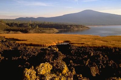
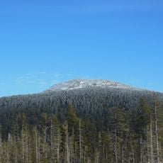
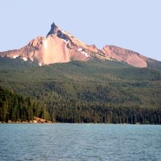
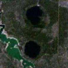
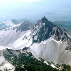
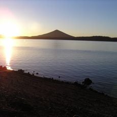
Davis Lake volcanic field, Cinder cone field in Oregon, US.

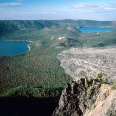
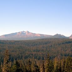
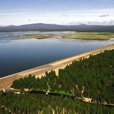
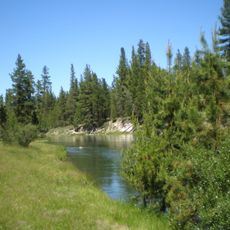
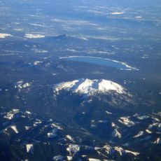
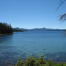
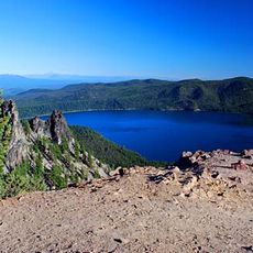
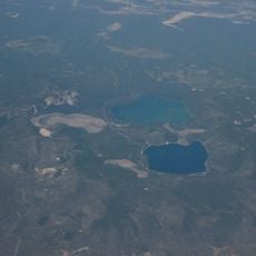
Davis Lake volcanic field is a region with three separate lava flows and scoria cones spread across the landscape. The northernmost lava flow acts as a natural dam that holds back the water forming Davis Lake.

The most recent volcanic eruptions in this field took place between 5,300 and 5,600 years ago, based on charcoal samples found beneath the cinder deposits. This period marks the final phase of volcanic activity across the region.

Scientists and geologists frequently study this volcanic field to understand the patterns of eruptions and formations within the Cascade Volcanic Arc system.

Access to this area is easiest through the nearby towns of Gilchrist and La Pine, where visitors can find information about the geology. The driest months offer the best conditions for exploring the volcanic landscape on foot.

The volcanic formations here stretch roughly 20 kilometers in a north-south alignment and show strikingly consistent chemical composition across all three lava flows. This uniform makeup across the formations is unusual and helps geologists understand the eruption patterns more clearly.

The community of curious travelers

AroundUs brings together thousands of curated places, local tips, and hidden gems, enriched daily by 60,000 contributors worldwide.

Start exploring
Location
GPS coordinates
43.55930,-121.81300
Latest update
December 14, 2025 14:21
Around this place
Show the full map
Reviews
Share your experience

No review yet

Discussions
Start a discussion...

No discussion yet

« Davis Lake volcanic field - Cinder cone field in Oregon, US » is provided by Around Us (aroundus.com). Images and texts are derived from Wikimedia project under a Creative Commons license. You are allowed to copy, distribute, and modify copies of this page, under the conditions set by the license, as long as this note is clearly visible.

Discover hidden gems everywhere you go!

From secret cafés to breathtaking viewpoints, skip the crowded tourist spots and find places that match your style. Our app makes it easy with voice search, smart filtering, route optimization, and insider tips from travelers worldwide. Download now for the complete mobile experience.

Around Us App Screenshot

A unique approach to discovering new places

Le Figaro

All the places worth exploring

France Info

A tailor-made excursion in just a few clicks

20 Minutes

Around Us
Travel Guide & Maps
Download

Send to your phone

QR Code
1

Open the camera app on your mobile.

2

Point at the QR code with your camera. A notification will appear.

3

Tap the notification to open the link.