Chest opened
+${chestReward.xp} XP
Explorer
NOUVEAU ×${chestReward.collectible.quantity}
tapez pour fermer

See the monuments around you in AR Open chests in the app

Around Us is built for your phone — point your camera at the streets and discover the monuments and places around you in augmented reality. Around Us is built for your phone — chests unlock when you walk, explore and capture nearby places.

•

Enable Location

We need your location to show you interesting places around you

Discover nearby places

Find interesting locations and hidden gems around you

Precise directions

Get accurate directions and distances to places

Your location is never shared with other users. It's only used when you tap the location button.

Mount Thielsen

Log in to your account

Start exploring — it's free

Trusted by 92,781 travelers worldwide

Continue with Google
Continue with Apple
or

We will send you a code to connect

By continuing, you accept our Terms and Conditions and our Privacy Policy

Check your inbox

We've sent a pincode in your inbox. Please enter the code below.

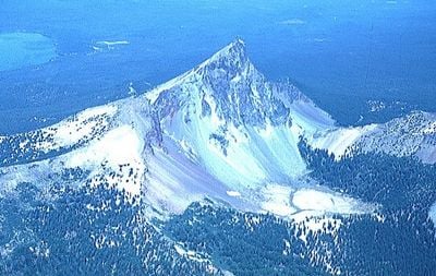
Mount Thielsen, Extinct shield volcano in southern Oregon, United States

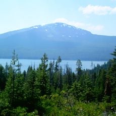
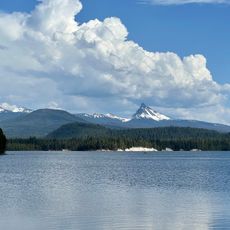
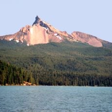
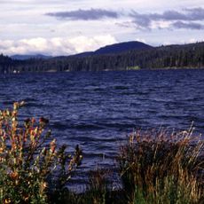
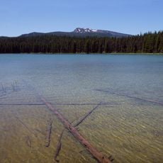
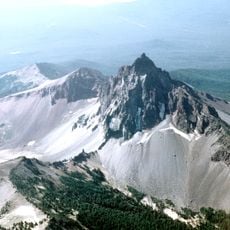
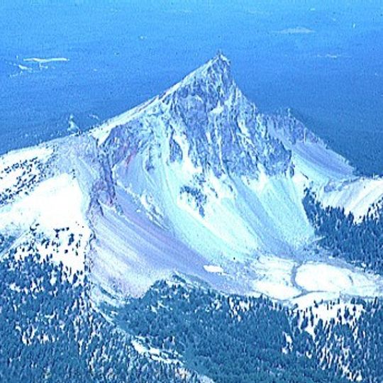
Mount Thielsen is an extinct shield volcano in the High Cascades of Oregon, reaching 9,182 feet (2,799 m). Glaciers eroded it after eruptions ceased 250,000 years ago, leaving a horn-like summit of pale, fractured rock with no crater. Broad slopes of loose material with vertical gullies fan out below, and dense forest covers the base.

Jon Hurlburt, an early explorer of the area, named the volcano after Hans Thielsen, a railroad engineer who helped build the California and Oregon Railroad. In 1884 a United States Geological Survey team led by J. S. Diller climbed the peak and sampled its fulgurite deposits. Eruptive activity had ceased about 250,000 years ago, and glaciers later carved the summit into a horn.

The Klamath people called this peak hisc'akwaleeʔas before settlers renamed it after railroad engineer Hans Thielsen. Hikers today follow trails through the wilderness area that carries the mountain's current name.

Hiking trails wind through 55,100 acres of wilderness around the peak and connect with the Pacific Crest Trail. Most routes require good fitness, especially for the steep summit climb over loose rock.

Lightning strikes hit the summit so often that they create fulgurite, a glass-like mineral formed from melted rock. These lightning tubes sometimes lie scattered across the upper slopes, showing the electrical activity of the area.

The community of curious travelers

AroundUs brings together thousands of curated places, local tips, and hidden gems, enriched daily by 92,781 contributors worldwide.
Start exploring
Location
Elevation above the sea
2,799 m
GPS coordinates
43.15287,-122.06656
Latest update
October 25, 2026 23:56
Reviews
Share your experience

No review yet

Discussions
Start a discussion...

No discussion yet

« Mount Thielsen - Extinct shield volcano in southern Oregon, United States » is provided by Around Us (aroundus.com). Images and texts are derived from Wikimedia project under a Creative Commons license. You are allowed to copy, distribute, and modify copies of this page, under the conditions set by the license, as long as this note is clearly visible.

Discover hidden gems everywhere you go!

From secret cafés to breathtaking viewpoints, skip the crowded tourist spots and find places that match your style. Our app makes it easy with voice search, smart filtering, route optimization, and insider tips from travelers worldwide. Download now for the complete mobile experience.

Around Us App Screenshot
❝

A unique approach to discovering new places❞

— Le Figaro

❝

All the places worth exploring❞

— France Info

❝

A tailor-made excursion in just a few clicks❞

— 20 Minutes

Around Us
Travel Guide & Maps
Download

Send to your phone

QR Code
1

Open the camera app on your mobile.

2

Point at the QR code with your camera. A notification will appear.

3

Tap the notification to open the link.